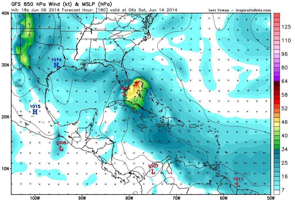
cycloneye wrote:12z GFS begins things in BOC in 90 hours.
At 180 hours it has a 997 pressure and lopsided.
Notice the low pressure in the Atlantic ocean
Moderator: S2k Moderators

cycloneye wrote:12z GFS begins things in BOC in 90 hours.
At 180 hours it has a 997 pressure and lopsided.


If the system in the eastern Pacific acquires a name and makes the track across southern Mexico without dissipating, it would then keep its eastern Pacific name in the Gulf of Mexico or northwestern Caribbean. However, storms from the eastern Pacific typically do not survive the trip across mountainous southern Mexico.
If the system dissipates over southern Mexico and only a piece of its energy fuels a new tropical storm in the Gulf of Mexico, the new system would acquire a name from the Atlantic Basin's list.
The first tropical storm of 2014 in the Atlantic would be named "Arthur."


Looking longer term, a weak
surface low still appears to form across Bay of Campeche or Nrn
Yucatan Peninsula around Wed bears watching as moisture heads
towards our area beginning on Sat.

Alyono wrote:Luis,
the EC actually shows TWO separate BOC systems in the next 10 days.

WeatherEmperor wrote:Dean4Storms wrote:#20 GEFS Member keeps it in the Yucatan Channel for several days then ENE across extreme southern Florida as a Hurricane @ 90kts, with Miami area getting hurricane winds. Lets hope that one is wrong!
Can you post a graphic of this model?
Sent from my HTC EVO 4G LTE


Users browsing this forum: No registered users and 79 guests