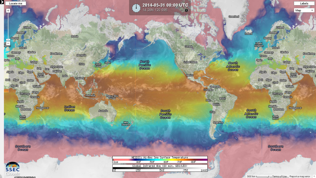
2014 WPAC Season

This is the general tropical discussion area. Anyone can take their shot at predicting a storms path.

Moderator: S2k Moderators

Forum rules

The posts in this forum are NOT official forecasts and should not be used as such. They are just the opinion of the poster and may or may not be backed by sound meteorological data. They are NOT endorsed by any professional institution or STORM2K. For official information, please refer to products from the National Hurricane Center and National Weather Service.

Help Support Storm2K
Message
Author
User avatar
mrbagyo
Category 5
Category 5
Posts: 3726
Age: 33
Joined: Thu Apr 12, 2012 9:18 am
Location: 14.13N 120.98E
Contact:

Re: 2014 WPAC Season

#261 Postby mrbagyo » Fri Jun 13, 2014 10:05 am

Another look at the current global sea surface temperature with infrared
June 13, 2014
Image


May 31, 2014
Image
0 likes   
The posts in this forum are NOT official forecast and should not be used as such. They are just the opinion of the poster and may or may not be backed by sound meteorological data. They are NOT endorsed by any professional institution or storm2k.org. For official information, please refer to RSMC, NHC and NWS products.

euro6208

Re: 2014 WPAC Season

#262 Postby euro6208 » Sat Jun 14, 2014 1:22 am

Image

Large area of above average rainfall due to MJO and kelvin wave during next weeks...

The updated outlook has some changes from that released earlier in the week. Starting in the western Pacific, the marginal threat for tropical development in the Meiyu Front region continues, but over a smaller region during the remainder of the previous Week-1 outlook. JTWC continues to monitor this region. It was removed during Week-2 as support for the area is less and decreased from the first portion of the updated outlook (Days 1-4). There is some evidence of an equatorial Rossby wave moving westward in the far western Pacific and model guidance appears to have adjusted some to this feature. Precipitation areas in the outlook for both below-median and above-median precipitation were modified accordingly for both periods. The two areas for above-median precipitation in the previous outlook were combined in the update for Days 5-11 (previous Week-2 outlook).


Also, tropical development is possible in a generally small region from just west of the northern Philippines northeastward to east of Taiwan during both Week-1 and Week-2. Any system may be subtropical in nature and likely short-lived.
0 likes   

euro6208

Re: 2014 WPAC Season

#263 Postby euro6208 » Sat Jun 14, 2014 9:42 am

Tropical Storm Hagibis has formed

:uarrow: Thread to our 7th Tropical Cyclone of the Season...
0 likes   

euro6208

Re: 2014 WPAC Season

#264 Postby euro6208 » Mon Jun 16, 2014 3:11 am

Image

90 Hours

Low pressure east of Philippines

Image

114 hours

TD/TS east of Luzon

Image

150 hours

Emerges in the South China Sea after making landfall over Luzon then tracks north and becomes a front and veers off to the northeast...
0 likes   

euro6208

Re: 2014 WPAC Season

#265 Postby euro6208 » Mon Jun 16, 2014 7:40 am

06Z GFS no longer showing any development near the philippines but it does show a developing tropical cyclone near the International dateline typical of an el nino year!

324 hours

Image

384 hours

Image
0 likes   

User avatar
Hurricane_Luis
Category 2
Category 2
Posts: 723
Age: 27
Joined: Sat Jun 23, 2012 3:14 pm
Location: Tiptree, Essex, United Kingdom
Contact:

Re: 2014 WPAC Season

#266 Postby Hurricane_Luis » Mon Jun 16, 2014 4:27 pm

euro6208 wrote:06Z GFS no longer showing any development near the philippines but it does show a developing tropical cyclone near the International dateline typical of an el nino year!

324 hours

http://i61.tinypic.com/10f10n4.png

384 hours

http://i58.tinypic.com/126bmz9.png


I noticed that low out in the open ocean earlier when I looked. But at 384 Hours out, That's in imaginary land for me, but hey something to watch out for.
0 likes   

euro6208

Re: 2014 WPAC Season

#267 Postby euro6208 » Tue Jun 17, 2014 7:11 am

Well this undecided el nino has caused quite a stir as the WPAC has not been able to become active.

EURO at 240 hours and GFS at 384 hours does not even develop anything!
0 likes   

euro6208

Re: 2014 WPAC Season

#268 Postby euro6208 » Tue Jun 17, 2014 7:41 am

Image

Looks like a big MJO pulse might get this basin active again...next month...
0 likes   

euro6208

Re: 2014 WPAC Season

#269 Postby euro6208 » Tue Jun 17, 2014 8:04 am

Image

Image

Image

Amazing! look at the WPAC!

Just waiting for the atmosphere to become ripe, then all hell's broke lose!
0 likes   

euro6208

Re: 2014 WPAC Season

#270 Postby euro6208 » Wed Jun 18, 2014 3:17 am

Image

The MJO is expected to continue to move slowly eastwards across the Maritime Continent, toward the western Pacific this week. Some models forecast the MJO signal to weaken as it moves east, while others indicate the signal will stay strong enough to influence tropical convection. The MJO is predicted to enter the western Pacific in the next six to ten days. If the MJO maintains its strength, the risk of tropical cyclone development over the west Pacific will increase towards the end of next week, but there is also an equal chance that the MJO will be too weak to have a significant impact on tropical weather. There is always a risk of tropical cyclone development when the monsoon trough is active, even if the MJO is not present.
0 likes   

euro6208

Re: 2014 WPAC Season

#271 Postby euro6208 » Wed Jun 18, 2014 7:27 am

Image

Starts off in the Central pacific...

Image

Crosses into the Western Pacific maybe a TD/TS

Image

End of run with no major change in strength...
0 likes   

User avatar
xtyphooncyclonex
Category 5
Category 5
Posts: 3861
Age: 23
Joined: Sat Dec 08, 2012 9:07 am
Location: Cebu City
Contact:

#272 Postby xtyphooncyclonex » Thu Jun 19, 2014 10:02 pm

I guess GFS dropped the system for now.
0 likes   
REMINDER: My opinions that I, or any other NON Pro-Met in this forum, are unofficial. Please do not take my opinions as an official forecast and warning. I am NOT a meteorologist. Following my forecasts blindly may lead to false alarm, danger and risk if official forecasts from agencies are ignored.

euro6208

Re: 2014 WPAC Season

#273 Postby euro6208 » Fri Jun 20, 2014 9:46 am

Yup GFS and EURO doesn't develop any storms within the next few days which is kinda bizarre given we are headed towards an el nino. SST is super favorable, Moisture is superb and spreading more northward towards Japan and intensifying over a large area but the atmosphere is only somewhat favorable with low to moderate shear dominating the basin...Plus instability is below average in the 3 main regions...also the MJO which is over the area is forecast to weaken back into the Indian Ocean...


Image

Image
0 likes   

User avatar
Macrocane
Category 5
Category 5
Posts: 4218
Age: 36
Joined: Sun May 24, 2009 5:35 pm
Location: El Salvador

Re: 2014 WPAC Season

#274 Postby Macrocane » Fri Jun 20, 2014 11:09 am

Could this year be the WPAC equivalent to the 2013 ATL hurricane season? ... a major bust after an anticipated above normal season?
Obviously is too early to tell but it's susrprisingly quiet out there.
0 likes   

User avatar
Hurricane_Luis
Category 2
Category 2
Posts: 723
Age: 27
Joined: Sat Jun 23, 2012 3:14 pm
Location: Tiptree, Essex, United Kingdom
Contact:

Re: 2014 WPAC Season

#275 Postby Hurricane_Luis » Fri Jun 20, 2014 2:46 pm

Macrocane wrote:Could this year be the WPAC equivalent to the 2013 ATL hurricane season? ... a major bust after an anticipated above normal season?
Obviously is too early to tell but it's susrprisingly quiet out there.


After Haiyan last year, I think the people of the Philippines would agree with you. I think it is going to be a big year for the EPAC and CPAC. Not as many intense storms in the WPAC will form. In my opinion anyway
0 likes   

hurricanes1234
Category 5
Category 5
Posts: 2907
Joined: Sat Jul 28, 2012 6:19 pm
Location: Trinidad and Tobago

#276 Postby hurricanes1234 » Fri Jun 20, 2014 7:43 pm

Does anyone think that the EPAC could be more active than the WPAC this year in terms of ACE and everything? I'm not saying it would, but just throwing the possibility out, in the event that this lack of activity continues for the next few months.
0 likes   
PLEASE NOTE: With the exception of information from weather agencies that I may copy and paste here, my posts will NEVER be official, since I am NOT a meteorologist. They are solely my amateur opinion, and may or may not be accurate. Therefore, please DO NOT use them as official details, particularly when making important decisions. Thank you.

User avatar
Steve820
Tropical Storm
Tropical Storm
Posts: 188
Age: 25
Joined: Sat May 17, 2014 8:04 pm
Location: Southern California
Contact:

Re:

#277 Postby Steve820 » Fri Jun 20, 2014 11:00 pm

hurricanes1234 wrote:Does anyone think that the EPAC could be more active than the WPAC this year in terms of ACE and everything? I'm not saying it would, but just throwing the possibility out, in the event that this lack of activity continues for the next few months.


Actually, I have a gut feeling the WPac will continue to be inactive until about the end of July, but in August the basin could possibly explode. The event you mentioned is very unusual, and I don't think it'll happen this year. There's still a tiny chance that'll happen though if the WPac surprisingly pulls a 2013 AHS on us (like, the intensity and number of storms ends up much less than originally predicted).
0 likes   
Hurricanes are an amazing natural phenomena. While many are spiraling pits of evil that kill people or cause devastation, some are tame and stay clear of land.

I wish for you to :Bcool:

User avatar
xtyphooncyclonex
Category 5
Category 5
Posts: 3861
Age: 23
Joined: Sat Dec 08, 2012 9:07 am
Location: Cebu City
Contact:

Re: Re:

#278 Postby xtyphooncyclonex » Fri Jun 20, 2014 11:25 pm

Steve820 wrote:
hurricanes1234 wrote:Does anyone think that the EPAC could be more active than the WPAC this year in terms of ACE and everything? I'm not saying it would, but just throwing the possibility out, in the event that this lack of activity continues for the next few months.


Actually, I have a gut feeling the WPac will continue to be inactive until about the end of July, but in August the basin could possibly explode. The event you mentioned is very unusual, and I don't think it'll happen this year. There's still a tiny chance that'll happen though if the WPac surprisingly pulls a 2013 AHS on us (like, the intensity and number of storms ends up much less than originally predicted).

I am thinking of a more intense repeat of last year's typhoon season, wherein, activity was low but there as a massive explosion of activity by SON. This year would be more activity than last year and thus more impressive, due to the more favorable conditions brought by the El Niño lingering. Less of those weak, unimpressive storms, but we may also have a few (less than last year tho) before the massive typhoon burst.
0 likes   
REMINDER: My opinions that I, or any other NON Pro-Met in this forum, are unofficial. Please do not take my opinions as an official forecast and warning. I am NOT a meteorologist. Following my forecasts blindly may lead to false alarm, danger and risk if official forecasts from agencies are ignored.

User avatar
Yellow Evan
Professional-Met
Professional-Met
Posts: 16143
Age: 27
Joined: Fri Jul 15, 2011 12:48 pm
Location: Henderson, Nevada/Honolulu, HI
Contact:

Re: Re:

#279 Postby Yellow Evan » Sat Jun 21, 2014 1:45 am

Steve820 wrote:
hurricanes1234 wrote:Does anyone think that the EPAC could be more active than the WPAC this year in terms of ACE and everything? I'm not saying it would, but just throwing the possibility out, in the event that this lack of activity continues for the next few months.


Actually, I have a gut feeling the WPac will continue to be inactive until about the end of July, but in August the basin could possibly explode. The event you mentioned is very unusual, and I don't think it'll happen this year. There's still a tiny chance that'll happen though if the WPac surprisingly pulls a 2013 AHS on us (like, the intensity and number of storms ends up much less than originally predicted).


I get that feeling as well. 1983 was close, but the EPAC has never been more active than the WPAC.
0 likes   

stormcruisin

#280 Postby stormcruisin » Sat Jun 21, 2014 2:13 am

Been following the Wespac for a few season's it only needs a strong wave and it has the potential to spawn multi TY,s also it not even peak time of the season there yet so don't be fooled Wespac will again kick butt and hopefully Guam is not the target this season. Its been suggested by the unofficial agency Guam is a 300% chance for a direct landfall this season.
0 likes   


Return to “Talkin' Tropics”

Who is online

Users browsing this forum: ElectricStorm, Lizzytiz1, Stratton23 and 44 guests