ATL: ARTHUR - Post-Tropical - Discussion
Moderator: S2k Moderators


Re: ATL: ARTHUR - Hurricane - Discussion
Recon found 82 knot SFMR and 977 mb. Arthur is deepening. Looks like the dry air is done slowing his intensification.
0 likes
-
Aric Dunn
- Category 5

- Posts: 21238
- Age: 43
- Joined: Sun Sep 19, 2004 9:58 pm
- Location: Ready for the Chase.
- Contact:
oh just as suspected it has wobbled back left again.. all these wobbles bring it closer to the wilmington area
0 likes
Note: If I make a post that is brief. Please refer back to previous posts for the analysis or reasoning. I do not re-write/qoute what my initial post said each time.
If there is nothing before... then just ask
Space & Atmospheric Physicist, Embry-Riddle Aeronautical University,
I believe the sky is falling...
If there is nothing before... then just ask
Space & Atmospheric Physicist, Embry-Riddle Aeronautical University,
I believe the sky is falling...
-
torrea40
Re: ATL: ARTHUR - Hurricane - Discussion
Pressure on the fall again in #Arthur. Latest recon pass ~2mb lower than the pass from 90 minutes ago.
0 likes
-
SunnyThoughts
- Category 5
- Posts: 2263
- Joined: Wed Jul 09, 2003 12:42 pm
- Location: Pensacola, Florida
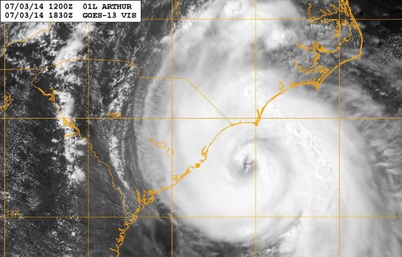
 [/img] Eye looking much better for sure.
-
Kingarabian

- S2K Supporter

- Posts: 16365
- Joined: Sat Aug 08, 2009 3:06 am
- Location: Honolulu, Hawaii
Re:
Aric Dunn wrote:oh just as suspected it has wobbled back left again.. all these wobbles bring it closer to the wilmington area
Hate to see this. Hope everyone stays safe!
0 likes
RIP Kobe Bryant
-
cycloneye

- Admin

- Posts: 149505
- Age: 69
- Joined: Thu Oct 10, 2002 10:54 am
- Location: San Juan, Puerto Rico
Re: ATL: ARTHUR - Hurricane - Discussion
There is the 977.2 pressure.

0 likes
Visit the Caribbean-Central America Weather Thread where you can find at first post web cams,radars
and observations from Caribbean basin members Click Here
and observations from Caribbean basin members Click Here

-
Aric Dunn
- Category 5
- Posts: 21238
- Age: 43
- Joined: Sun Sep 19, 2004 9:58 pm
- Location: Ready for the Chase.
- Contact:
Re: Re:
Kingarabian wrote:Aric Dunn wrote:oh just as suspected it has wobbled back left again.. all these wobbles bring it closer to the wilmington area
Hate to see this. Hope everyone stays safe!
they dont even have a hurricane warning...
0 likes
Note: If I make a post that is brief. Please refer back to previous posts for the analysis or reasoning. I do not re-write/qoute what my initial post said each time.
If there is nothing before... then just ask
Space & Atmospheric Physicist, Embry-Riddle Aeronautical University,
I believe the sky is falling...
If there is nothing before... then just ask
Space & Atmospheric Physicist, Embry-Riddle Aeronautical University,
I believe the sky is falling...
-
Kingarabian
- S2K Supporter
- Posts: 16365
- Joined: Sat Aug 08, 2009 3:06 am
- Location: Honolulu, Hawaii
-
Kingarabian
- S2K Supporter
- Posts: 16365
- Joined: Sat Aug 08, 2009 3:06 am
- Location: Honolulu, Hawaii
Re: Re:
Aric Dunn wrote:Kingarabian wrote:Aric Dunn wrote:oh just as suspected it has wobbled back left again.. all these wobbles bring it closer to the wilmington area
Hate to see this. Hope everyone stays safe!
they dont even have a hurricane warning...
What about watches? All my relatives living within Wilmington are telling me that not everyone is taking this seriously.
0 likes
RIP Kobe Bryant
-
TheAustinMan

- Category 5
- Posts: 1060
- Joined: Mon Jul 08, 2013 4:26 pm
- Location: Central TX / United States
Re:
Time_Zone wrote:eye clearing out.....dry air looks to be pretty much gone.
Expect this thing to intensify at a fast pace now unless it decides to ingest even more dry air...which wouldn't be surprising with this storm lol.
I wouldn't consider dry air to be completely gone, at least until Arthur moistens up that hole in its central convection that you can easily pick out in the radar loops out of Wilmington.

0 likes
Treat my opinions with a grain of salt. For official information see your local weather service.
“It's tough to make predictions, especially about the future.”
“It's tough to make predictions, especially about the future.”
-
Aric Dunn
- Category 5
- Posts: 21238
- Age: 43
- Joined: Sun Sep 19, 2004 9:58 pm
- Location: Ready for the Chase.
- Contact:
If this motion continues.. the heavy outer eywall convection will be rotating into .. south point, carolina beach then wilmington over the next couple hour..
0 likes
Note: If I make a post that is brief. Please refer back to previous posts for the analysis or reasoning. I do not re-write/qoute what my initial post said each time.
If there is nothing before... then just ask
Space & Atmospheric Physicist, Embry-Riddle Aeronautical University,
I believe the sky is falling...
If there is nothing before... then just ask
Space & Atmospheric Physicist, Embry-Riddle Aeronautical University,
I believe the sky is falling...

The highest winds they were finding an hour or so ago were only in the 80 mph range and now it's back to 90, and with pressure down as far as it is in short time, this may be the start of a faster rate of intensification. We can only hope that if this is the case that it will lead to a right shift in the track.
0 likes
The above post is not official and should not be used as such. It is the opinion of the poster and may or may not be backed by sound meteorological data. It is not endorsed by any professional institution or storm2k.org. For official information, please refer to the NHC and NWS products.
-
znel52
Re: ATL: ARTHUR - Hurricane - Discussion
Latest radar images show quite a bit of dry air in the northwest quadrant. Might keep this thing from intensifying much more.
0 likes
-
brunota2003

- S2K Supporter
- Posts: 9476
- Age: 35
- Joined: Sat Jul 30, 2005 9:56 pm
- Location: Stanton, KY...formerly Havelock, NC
- Contact:
Re: ATL: ARTHUR - Hurricane - Discussion
Talking about RI, here is one example of a storm that looks somewhat similar to Arthur that occurred in the EPac in 2011 (note the "cut" in the storm going from outside the storm into the center).
http://imageshack.com/a/img853/6365/0eyv.jpg
Kenneth at 13:30 UTC on Nov 21, 2011
This is Kenneth in the EPac in 2011, a few hours after the above image (about 12 hours, to be exact) on Nov 22, 2011 at 02:15 UTC.
http://imageshack.com/a/img850/7870/psuu.jpg
According to the BT, Kenneth was a 65 knot hurricane in the first image, and the second image is between the BT times of 00 UTC and 06 UTC (95 knots and 110 knots, respectively).
Will Arthur do the same? Doubtful, but it is something interesting to note.
0 likes
Just a small town southern boy helping other humans.
-
SunnyThoughts
- Category 5
- Posts: 2263
- Joined: Wed Jul 09, 2003 12:42 pm
- Location: Pensacola, Florida
-
supercane4867
- Category 5
- Posts: 4966
- Joined: Wed Nov 14, 2012 10:43 am

Who is online
Users browsing this forum: No registered users and 60 guests