

You can see how much energy halong was able to use to rapidly strengthen...
Conditions still quite favorable for another burst of strengthening...
Moderator: S2k Moderators


xtyphooncyclonex wrote:euro6208 wrote:How i wish halong was like this current state when it impacted Guam...Crazy...
Be careful what you wish for. When I got so excited and had adrenaline rush during typhokn Haiyan, it ended up in a MAJOR DISASTER. It is quite inconsiderate when you wish for a super typhoon to hit your place, think about those who are not weather enthusiasts and fearing of strong storms ( due to Paka or Pongsona).

euro6208 wrote:xtyphooncyclonex wrote:euro6208 wrote:How i wish halong was like this current state when it impacted Guam...Crazy...
Be careful what you wish for. When I got so excited and had adrenaline rush during typhokn Haiyan, it ended up in a MAJOR DISASTER. It is quite inconsiderate when you wish for a super typhoon to hit your place, think about those who are not weather enthusiasts and fearing of strong storms ( due to Paka or Pongsona).
Guam can withstand these kind of storms...Only major concern here is inland flooding especially low lying areas...

euro6208 wrote:xtyphooncyclonex wrote:euro6208 wrote:How i wish halong was like this current state when it impacted Guam...Crazy...
Be careful what you wish for. When I got so excited and had adrenaline rush during typhokn Haiyan, it ended up in a MAJOR DISASTER. It is quite inconsiderate when you wish for a super typhoon to hit your place, think about those who are not weather enthusiasts and fearing of strong storms ( due to Paka or Pongsona).
Guam can withstand these kind of storms...Only major concern here is inland flooding especially low lying areas...Typhoons are like thunderstorms here...


euro6208 wrote:So despite looking at it's best with a warmer eye, very cold cloud tops and increased outflow...The intensity increased by only 5 knots???
No way this is only a minor category 5...If recon were to go in, they would likely find winds of 150 knots and cp of 905...
The posts in this forum are NOT official forecast and should not be used as such. They are just the opinion of the poster and may or may not be backed by sound meteorological data. They are NOT endorsed by any professional institution or storm2k.org. For official information, please refer to the NHC and NWS products.
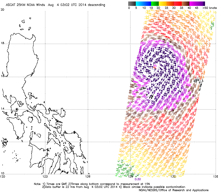
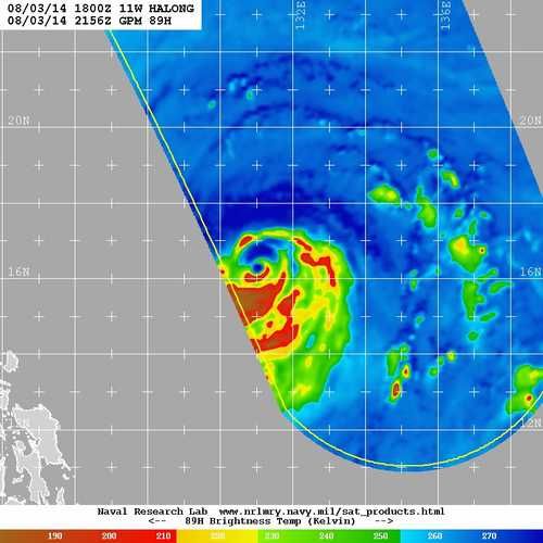
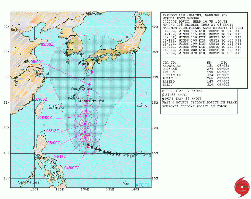
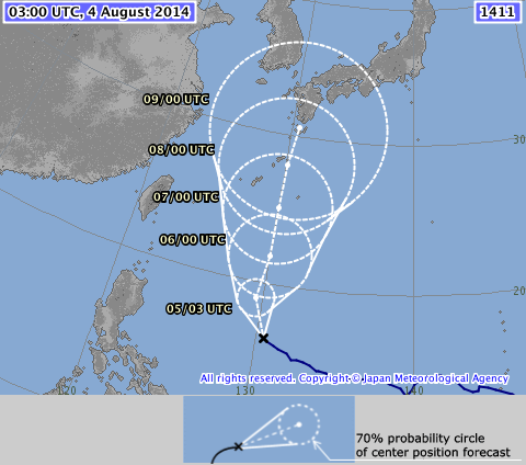
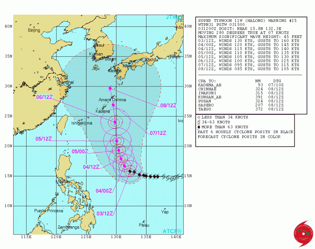
supercane wrote::uarrow: Old news. See above advisories posted earlier. If you need to see it graphically, JTWC at 115kt = 130mph, down from 130kt=150mph:
And other agencies coming down too, but more slowly. For example, JMA down to 95kt from 100kt:
And JTWC agreeing with SAB's sharply lower Dvorak classification:
TPPN11 PGTW 040337
A. TYPHOON 11W (HALONG)
B. 04/0232Z
C. 16.8N
D. 130.4E
E. THREE/MTSAT
F. T4.5/5.5/W2.0/24HRS STT: W0.5/03HRS
G. IR/EIR/VIS/MSI
H. REMARKS: 11A/PBO RAGGED EYE/ANMTN. DG EYE SURROUNDED BY MG
YIELDS A DT OF 4.5. PT AGREES; MET WAS 5.0. DBO DT.
I. ADDITIONAL POSITIONS:
03/2156Z 16.4N 131.1E GPMI
LONG
At least it now appears that system may pass east of Amami Oshima, but Kyushu and Shikoku in for a hit.
Equilibrium wrote:Btw ascat is only good upto 65 knots no point posting it.
Users browsing this forum: No registered users and 17 guests