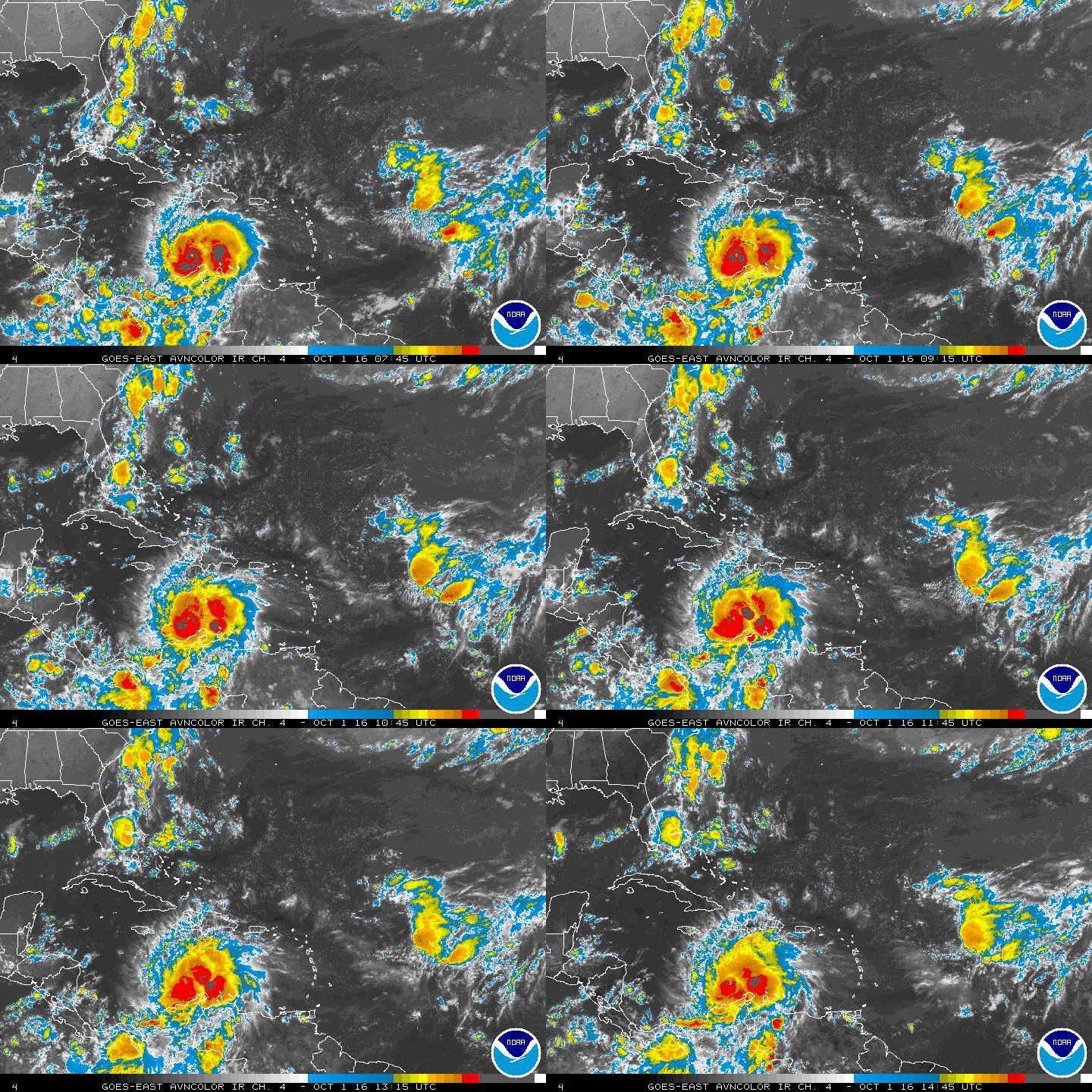
Tropical Wave east of Lesser Antilles (Is Invest 96L)
Moderator: S2k Moderators
Forum rules
The posts in this forum are NOT official forecasts and should not be used as such. They are just the opinion of the poster and may or may not be backed by sound meteorological data. They are NOT endorsed by any professional institution or STORM2K. For official information, please refer to products from the National Hurricane Center and National Weather Service.
- somethingfunny
- ChatStaff

- Posts: 3926
- Age: 37
- Joined: Thu May 31, 2007 10:30 pm
- Location: McKinney, Texas
Re:
Alyono wrote:I'll lose a lunch bet if the Canadian actually verifies
Someone was willing to bet you lunch on the GEM???
0 likes
I am not a meteorologist, and any posts made by me are not official forecasts or to be interpreted as being intelligent. These posts are just my opinions and are probably silly opinions.
Re: Re:
somethingfunny wrote:Alyono wrote:I'll lose a lunch bet if the Canadian actually verifies
Someone was willing to bet you lunch on the GEM???
nope... the bet was no TCs in the GOM through the remainder of August. I said none, the person I bet said there would be
0 likes
- cycloneye
- Admin

- Posts: 149426
- Age: 69
- Joined: Thu Oct 10, 2002 10:54 am
- Location: San Juan, Puerto Rico
Re: Tropical Wave WSW of CV Islands (Pouch 017L)
12z UKMET doesn't have a text for this pouch.
0 likes
Visit the Caribbean-Central America Weather Thread where you can find at first post web cams,radars
and observations from Caribbean basin members Click Here
and observations from Caribbean basin members Click Here
-
floridasun78
- Category 5

- Posts: 3755
- Joined: Sun May 17, 2009 10:16 pm
- Location: miami fl
Re: Tropical Wave WSW of CV Islands (Pouch 017L)
do look like pouch17 getting moisture into system as move west today
0 likes
- tropicwatch
- Category 5

- Posts: 3426
- Age: 62
- Joined: Sat Jun 02, 2007 10:01 am
- Location: The Villages, Florida
- Contact:
Re: Tropical Wave WSW of CV Islands (Pouch 017L)
Does appear to have showers building on the NW side of the circulation. That area has been devoid of showers the past several days.


0 likes
Tropicwatch
Agnes 72', Eloise 75, Elena 85', Kate 85', Charley 86', Florence 88', Beryl 94', Dean 95', Erin 95', Opal 95', Earl 98', Georges 98', Ivan 2004', Arlene 2005', Dennis 2005', Ida 2009' Debby 2012' Irma 2017' Michael 2018'
Agnes 72', Eloise 75, Elena 85', Kate 85', Charley 86', Florence 88', Beryl 94', Dean 95', Erin 95', Opal 95', Earl 98', Georges 98', Ivan 2004', Arlene 2005', Dennis 2005', Ida 2009' Debby 2012' Irma 2017' Michael 2018'
Re: Tropical Wave WSW of CV Islands (Pouch 017L)
Is this pouch #17
http://rammb.cira.colostate.edu/ramsdis ... 154500.gif
http://rammb.cira.colostate.edu/ramsdis ... 154500.gif
0 likes
The following post is NOT an official forecast and should not be used as such. It is just the opinion of the poster and may or may not be backed by sound meteorological data. It is NOT endorsed by any professional institution including storm2k.org For Official Information please refer to the NHC and NWS products.
- cycloneye
- Admin

- Posts: 149426
- Age: 69
- Joined: Thu Oct 10, 2002 10:54 am
- Location: San Juan, Puerto Rico
Re: Tropical Wave WSW of CV Islands (Pouch 017L)
I would not be surprised if this pouch gets tagged as invest sometime in the next day or two if it gets more convection as it has the EC and UKMET on it's side even thou GFS is flip-flopping.
0 likes
Visit the Caribbean-Central America Weather Thread where you can find at first post web cams,radars
and observations from Caribbean basin members Click Here
and observations from Caribbean basin members Click Here
Re: Tropical Wave WSW of CV Islands (Pouch 017L)
cycloneye wrote:I would not be surprised if this pouch gets tagged as invest sometime in the next day or two if it gets more convection as it has the EC and UKMET on it's side even thou GFS is flip-flopping.
I think you're absolutely right.
0 likes
-
TheStormExpert
-
floridasun78
- Category 5

- Posts: 3755
- Joined: Sun May 17, 2009 10:16 pm
- Location: miami fl
- cycloneye
- Admin

- Posts: 149426
- Age: 69
- Joined: Thu Oct 10, 2002 10:54 am
- Location: San Juan, Puerto Rico
Re: Tropical Wave WSW of CV Islands (Pouch 017L)
TROPICAL WEATHER OUTLOOK
NWS NATIONAL HURRICANE CENTER MIAMI FL
800 PM EDT SAT AUG 16 2014
For the North Atlantic...Caribbean Sea and the Gulf of Mexico:
Shower and thunderstorm activity has developed in association with
a broad area of low pressure located about 1000 miles west of the
Cape Verde Islands. Some gradual development of this system is
possible during the next few days while it begins to move slowly
westward across the central tropical Atlantic.
* Formation chance through 48 hours...low...10 percent.
* Formation chance through 5 days...low...20 percent.
$$
Forecaster Brennan

0 likes
Visit the Caribbean-Central America Weather Thread where you can find at first post web cams,radars
and observations from Caribbean basin members Click Here
and observations from Caribbean basin members Click Here
-
TheStormExpert
Re:
gatorcane wrote:So the question is when will this become and invest? You got to think it will be within the next day or so as we are seeing some convection and it has model support plus the Leewards are just beyond the 5-day track guidance.
It will probably be tagged an Invest within the next 48hrs.
0 likes
- SFLcane
- S2K Supporter

- Posts: 10281
- Age: 48
- Joined: Sat Jun 05, 2010 1:44 pm
- Location: Lake Worth Florida
Re: Tropical Wave West of CV Islands (Pouch 017L)
Its got some pretty good spin to it but may choke in sinking air near by.

http://rammb.cira.colostate.edu/ramsdis ... display=12

http://rammb.cira.colostate.edu/ramsdis ... display=12
0 likes
- cycloneye
- Admin

- Posts: 149426
- Age: 69
- Joined: Thu Oct 10, 2002 10:54 am
- Location: San Juan, Puerto Rico
Re: Tropical Wave West of CV Islands (Pouch 017L)
ASCAT pass made at 8:18 PM EDT.


0 likes
Visit the Caribbean-Central America Weather Thread where you can find at first post web cams,radars
and observations from Caribbean basin members Click Here
and observations from Caribbean basin members Click Here
Who is online
Users browsing this forum: No registered users and 487 guests


