ROCK wrote::uarrow: anti-cyclone aloft....couldnt be any better IMO
good to be back!!
Well I be damned...was wonderin where you were at!
Moderator: S2k Moderators

ROCK wrote::uarrow: anti-cyclone aloft....couldnt be any better IMO
good to be back!!


CaneCurious wrote:Does anyone know when Levi Cowan will post another video update?
cycloneye wrote:CaneCurious wrote:Does anyone know when Levi Cowan will post another video update?


cycloneye wrote::uarrow: Still a bit broad.

SouthDadeFish wrote:cycloneye wrote::uarrow: Still a bit broad.
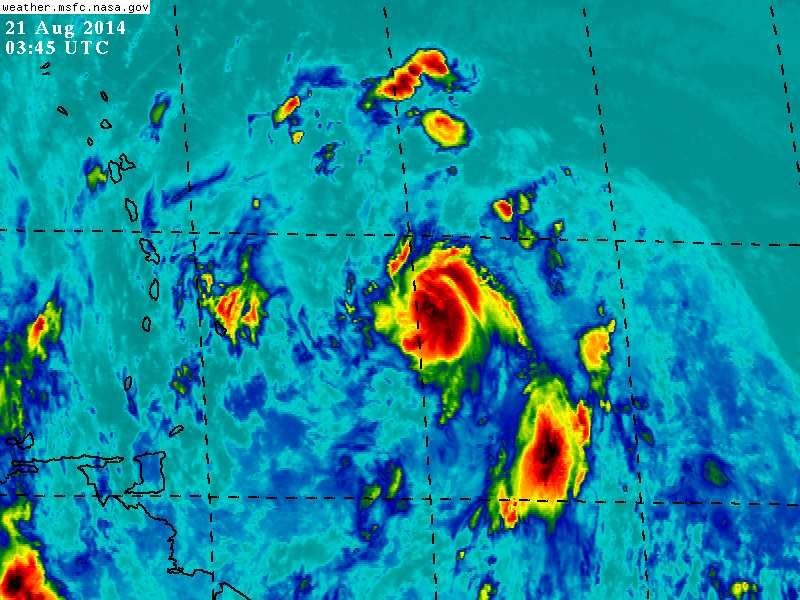
Yes, but the pass is missing some data, and that is still a marked improvement from the pass an hour earlier. Starting to see outflow improving in all quadrants on satellite. I think one more convective burst can put this over the top and become a TC.
My forecast: If we get another strong convective burst before sunrise, recon will probably find a TC tomorrow afternoon. If not, then who knows
To be honest, conditions seem favorable. Not quite sure why the models aren't eager to develop this before it crashes into some mountains...


meriland23 wrote:I am curious. Would a stronger storm bring this more westward or does the strength of the storm have little to do with the path of this specific storm?

xtyphooncyclonex wrote:meriland23 wrote:I am curious. Would a stronger storm bring this more westward or does the strength of the storm have little to do with the path of this specific storm?
A met said before that the stronger it is, the more westward it goes. A weaker storm would move faster and move in another direction.
Users browsing this forum: No registered users and 6 guests