Florida Weather

U.S. & Caribbean Weather Discussions and Severe Weather Events

Moderator: S2k Moderators

Forum rules

The posts in this forum are NOT official forecast and should not be used as such. They are just the opinion of the poster and may or may not be backed by sound meteorological data. They are NOT endorsed by any professional institution or STORM2K.

Help Support Storm2K
Message
Author
TheStormExpert

Re:

#8701 Postby TheStormExpert » Fri Nov 14, 2014 6:35 pm

gatorcane wrote:18Z GFS and Parallel GFS not backing down on some cold anomalies for peninsula Florida:

http://i57.tinypic.com/16k5b1e.png

http://i58.tinypic.com/dxfm7p.png

GFS shows mid 30s into Central Florida:
http://i58.tinypic.com/2vknnv8.png

Actually it has backed off especially since last night. 18z GFS no longer shows 40's digging down into S. FL, it only shows low 50's now.

My guess is it is trending towards the Euro now. Never question "King Euro"!
0 likes   

User avatar
northjaxpro
S2K Supporter
S2K Supporter
Posts: 8900
Joined: Mon Sep 27, 2010 11:21 am
Location: Jacksonville, FL

Re: Re:

#8702 Postby northjaxpro » Fri Nov 14, 2014 6:49 pm

psyclone wrote:
northjaxpro wrote:Psyclone, let's wait and see. I respect your thoughts and definitely understand your skepticism with the GFS. But, I have seen the GFS at times in the past perform quite well with these arctic airmasses. The GFS may not be as consistent as EURO, but imo GFS is still very respectable with very large scale winter patterns or extreme anomulous patterns like this current situation evolving.

As for this being mid-November, it would be very unusual indeed to get a solid cold outbreak this time of year across the state. However, we have had November cold spells in the past. The extreme anomalies with the deep layered upper trough for next week will be in place and giving the trends, all I am stating here is that the GFS this particular time may have it right and could come close to verifying. We shall see.

Well I'd be lying were I to state I'm a fan of cold weather so my commentary may be tinged with warm weather -removed- glasses. Having said that, in all weather my inclination is to bet against record breaking extremes until said event is imminent. I'm sure that's why the forecast lows aren't nearly as cold as some of the model runs...they have time to adjust as the event draws nearer should the need arise.


Fair enough psyclone. I respect your thoughts above. I have observed the weather many years to know the old rule of thumb you mentioned above. We have had some good discussions amongst ourselves on this forum in the past. I enjoy our chats.
0 likes   
NEVER, EVER SAY NEVER in the tropics and weather in general, and most importantly, with life itself!!

________________________________________________________________________________________

Fay 2008 Beryl 2012 Debby 2012 Colin 2016 Hermine 2016 Julia 2016 Matthew 2016 Irma 2017 Dorian 2019

psyclone
S2K Supporter
S2K Supporter
Posts: 4779
Joined: Wed Aug 24, 2005 9:04 pm
Location: palm harbor fl

#8703 Postby psyclone » Fri Nov 14, 2014 6:52 pm

The cold season is young and with el nino coming on I'm hopeful we'll get some classic cold season squall lines this winter. Looking forward to all weather with the gang on here is always a hoot. :D
0 likes   

asd123
Category 1
Category 1
Posts: 265
Joined: Tue Sep 06, 2011 7:06 pm
Location: Orlando, Florida

Re: Florida Weather

#8704 Postby asd123 » Fri Nov 14, 2014 7:12 pm

With the effect of the SSW and the historic Bering Sea Storm in the GFS's reach, I have noticed the GFS is not picking up on any cold for Florida at all.

On next week's note, GFS has slightly trended warmer, GEM however stayed about the same. The GFS and GEM are much lower than the ECMWF as the ECMWF is forecasting upper 30s low 40s for cfla and GFS and GEM lower 30s. Weather stations and NOAA are started to lower their temp forecasts.

The models show a nose of warm air in se fla. for wed morning

note the se 3rd of fla.
Image courtesy of Tropical Tidbits
Image

ECMWF also shows this warmth. To see ECMWF go to http://www.wunderground.com/wundermap/ , uncheck boxes to clear clutter, scroll in the list to where it says model data, check model data box, click on the tool symbol right next to model (in the same row), select ECMWF and appropriate parameters.
0 likes   
This post is NOT AN OFFICIAL FORECAST and should not be used as such. It is just the opinion of the poster and may or may not be backed by sound meteorological data. It is NOT endorsed by any professional institution including storm2k.org. For Official Information please refer to the NHC and NWS products.

User avatar
NDG
S2K Supporter
S2K Supporter
Posts: 15473
Joined: Sun Jul 09, 2006 10:14 pm
Location: Orlando, FL

Re: Florida Weather

#8705 Postby NDG » Fri Nov 14, 2014 7:37 pm

Melbourne NWS office is siding with the ECMWF & UKMET, at least with the progression of the cold front next week.

SUN-TUE NIGHT...MID/UPPER FLOW WILL GENERALLY REMAIN FLAT OUT OF THE
WSW TO SW THROUGH THE SHORT RANGE...WITH H50 HGTS FALLING MON-TUE AS
ANOTHER LARGE/DEEP TROUGH DEVELOPS AND EXPANDS OVER THE ENTIRETY OF
THE CTRL-ERN CONUS. AT THE SURFACE...SUNDAY STARTS WITH A LARGE HIGH
PRES RIDGE OVER THE ERN CONUS/WRN ATLC AND A WEAK INVERTED TROUGH
UNDERNEATH THE HIGH OFFSHORE THE SE CONUS/NE FL. THIS WEAK FEATURE
WILL LIFT NE AS THE HIGH RETREATS EWD INTO THE ATLC IN ADVANCE OF
THE NEXT COLD FRONT...WHICH LOOKS FAIRLY STRONG. GFS REMAINS ABOUT
6-9HR FASTER WITH THE FROPA (MON NIGHT) THAN THE EURO/UKM/CMC (TUE)
SO THE GRIDDED CONSENSUS LEANS TOWARD THE SLOWER SOLNS
. MILD TO WARM
SUN-MON AS LIGHT SE WIND FLOW VEERS TO SW AND INCREASES. THE CHC FOR
SHOWERS AND ISOLD STORMS INCREASES STARTING MON AFTERNOON/CONTINUES
THROUGH LATE TUE BEFORE TAPERING OFF FROM N-S TUE NIGHT
COMPARED TO MON...TEMPS TUE AFTERNOON BEHIND THE FRONT WILL BE ABOUT
10F COOLER OVER THE SRN CWA...AND AS MUCH AS 20F COOLER ACROSS THE
NORTH...WITH MINS TUE NIGHT A SOLID 15-20F COLDER...WITH U30S-L40S
ALONG/NORTH OF THE I-4 CORRIDOR.
WCI`S IN THE 30S AND LOWER 40S OVER
ALL AREAS EXCEPT THE IMMEDIATE SPACE/TREASURE COAST BY SUNRISE WED.


http://forecast.weather.gov/product.php ... glossary=0
0 likes   

User avatar
NDG
S2K Supporter
S2K Supporter
Posts: 15473
Joined: Sun Jul 09, 2006 10:14 pm
Location: Orlando, FL

#8706 Postby NDG » Fri Nov 14, 2014 7:57 pm

One thing that if the Euro is correct, which I have been mentioning for the last couple of days, is that the trough next week will orient itself in a somewhat negative tilt and lift up as it progresses eastward after digging across the MS river valley, notice the winds at H50 staying from SW to WSW across the Peninsula, not the best ML support to drive down the core of an Arctic air down the FL Peninsula compared to 2 weeks ago which the trough dug right over the SE US driving the very chilly air down the Peninsula. If the Euro is correct, which has been very consistent, upper 30s to low 40s for lows Wednesday morning along the I-4 corridor look to be the best bet, IMO.
But still very cold for this time of the year regardless.

Image
Image
Image
Image
0 likes   

User avatar
northjaxpro
S2K Supporter
S2K Supporter
Posts: 8900
Joined: Mon Sep 27, 2010 11:21 am
Location: Jacksonville, FL

#8707 Postby northjaxpro » Fri Nov 14, 2014 8:07 pm

Hello NDG. Browsing the AFDs from a short while ago, it appears that the NWS offices in JAX and Tallahassee are generally siding with the GFS. The NWS WFOs in Melbourne and Miami are leaning on EURO for now. The Tampa WFO is mentioning the potential freeze possibility for their nothern zones i.e. Brooksvilleand the Nature coast region.

It will be very interesting to see if the GFS colder solution will come close to verfying for this upcoming event.
0 likes   
NEVER, EVER SAY NEVER in the tropics and weather in general, and most importantly, with life itself!!

________________________________________________________________________________________

Fay 2008 Beryl 2012 Debby 2012 Colin 2016 Hermine 2016 Julia 2016 Matthew 2016 Irma 2017 Dorian 2019

User avatar
northjaxpro
S2K Supporter
S2K Supporter
Posts: 8900
Joined: Mon Sep 27, 2010 11:21 am
Location: Jacksonville, FL

#8708 Postby northjaxpro » Fri Nov 14, 2014 8:18 pm

Also NDG, the cold spell a couple of weeks ago was very extreme considering the time of year as well. A very strong cold core mid-upper Low dive down and sharpen directly over South Carolina, which indeed lowered 500 mb heights significantly down over Florida. Bought snow to SC, incredible for Nov 1 as up to 5 inches fell in Lexington, SC, just outside of Columbia, the earliest snowfall ever there. And of course, bought record lows to several areas in the peninsula, including Orlando. At my locale, had a low of 36 degrees on Nov 2, the coldest so far this season to this point.
0 likes   
NEVER, EVER SAY NEVER in the tropics and weather in general, and most importantly, with life itself!!

________________________________________________________________________________________

Fay 2008 Beryl 2012 Debby 2012 Colin 2016 Hermine 2016 Julia 2016 Matthew 2016 Irma 2017 Dorian 2019

TheStormExpert

Re:

#8709 Postby TheStormExpert » Fri Nov 14, 2014 8:36 pm

northjaxpro wrote:Also NDG, the cold spell a couple of weeks ago was very extreme considering the time of year as well. A very strong cold core mid-upper Low dive down and sharpen directly over South Carolina, which indeed lowered 500 mb heights significantly down over Florida. Bought snow to SC, incredible for Nov 1 as up to 5 inches fell in Lexington, SC, just outside of Columbia, the earliest snowfall ever there. And of course, bought record lows to several areas in the peninsula, including Orlando. At my locale, had a low of 36 degrees on Nov 2, the coldest so far this season.

Yeah here in West Palm Beach on the morning of November 2nd we saw a record low of 48° beating the old record of 51°(1993)!
:thermo:
0 likes   

User avatar
northjaxpro
S2K Supporter
S2K Supporter
Posts: 8900
Joined: Mon Sep 27, 2010 11:21 am
Location: Jacksonville, FL

#8710 Postby northjaxpro » Fri Nov 14, 2014 8:44 pm

:uarrow: Yeah, just missed tying the record here on Nov 2, but I do know Tallahassee and Lake City both got down to below freezing that morning. It definitely was one of the most impressive early season cold spells I can recall in quite some time.
0 likes   
NEVER, EVER SAY NEVER in the tropics and weather in general, and most importantly, with life itself!!

________________________________________________________________________________________

Fay 2008 Beryl 2012 Debby 2012 Colin 2016 Hermine 2016 Julia 2016 Matthew 2016 Irma 2017 Dorian 2019

TheStormExpert

Re:

#8711 Postby TheStormExpert » Fri Nov 14, 2014 8:54 pm

northjaxpro wrote::uarrow: Yeah, just missed tying the record here on Nov 2, but I do know Tallahassee and Lake City both got down to below freezing that morning. It definitely was one of the most impressive early season cold spells I can recall in quite some time.

In some ways it will suprise me if we can't get a very similar cold spell next week with all the arctic air just sitting to the north of Florida throughout the U.S., we also have the NAO currently going negative briefly as well as a negative AO.
0 likes   

User avatar
NDG
S2K Supporter
S2K Supporter
Posts: 15473
Joined: Sun Jul 09, 2006 10:14 pm
Location: Orlando, FL

Re: Florida Weather

#8712 Postby NDG » Fri Nov 14, 2014 9:43 pm

:uarrow: SE FL may not the the brunt of the modified Arctic air next week but there is a potential for highs only in the 50s during the day Tuesday for central FL, that's a good 20 degrees colder than average for this time of the year.
0 likes   

User avatar
NDG
S2K Supporter
S2K Supporter
Posts: 15473
Joined: Sun Jul 09, 2006 10:14 pm
Location: Orlando, FL

Re: Florida Weather

#8713 Postby NDG » Sun Nov 16, 2014 5:41 pm

Official forecasted lows for Wednesday morning by the appropriate local NWS offices, they look good to me. GFS MOS is around a degree or two around those forecasted lows. The good news is that the GFS has been trending the last couple of days warmer closer to the Euro, though I think the Euro is a little too warm.

Image
0 likes   

User avatar
gatorcane
S2K Supporter
S2K Supporter
Posts: 23697
Age: 47
Joined: Sun Mar 13, 2005 3:54 pm
Location: Boca Raton, FL

#8714 Postby gatorcane » Sun Nov 16, 2014 5:58 pm

GFS and ECMWF starting to latch onto yet another cold shot into Northern and Central Florida around the Thanksgiving timeframe. GFS again is colder and a little faster than the ECMWF.

Image

Image
0 likes   

asd123
Category 1
Category 1
Posts: 265
Joined: Tue Sep 06, 2011 7:06 pm
Location: Orlando, Florida

Re: Florida Weather

#8715 Postby asd123 » Sun Nov 16, 2014 6:12 pm

I looked at the parallel GFS's animation of mslp and precip rate and towards the end close to Thanksgiving it looks to be a major storm. Just look at how deep the 540 line goes on the animation, you have to see it to believe it: http://www.tropicaltidbits.com/analysis ... n_eus.html

That cold air seems to be heading towards Florida, but it's beyond the model's reach.

Also there seems to be consensus amongst the models of a huge rainmaker for Florida early next week (Thanksgiving week)
0 likes   
This post is NOT AN OFFICIAL FORECAST and should not be used as such. It is just the opinion of the poster and may or may not be backed by sound meteorological data. It is NOT endorsed by any professional institution including storm2k.org. For Official Information please refer to the NHC and NWS products.

psyclone
S2K Supporter
S2K Supporter
Posts: 4779
Joined: Wed Aug 24, 2005 9:04 pm
Location: palm harbor fl

#8716 Postby psyclone » Sun Nov 16, 2014 6:37 pm

in the near term, portions of northern and central florida are outlooked in a slight risk for tomorrow with some decent rainfall totals possible. warm weather looks to be gracing us again by the weekend so there's certainly something for everyone over the upcoming week. as for the extended it is worth noting that both the 8-14 day and 6-10 day outlooks show above normal precip for Florida.
0 likes   

User avatar
northjaxpro
S2K Supporter
S2K Supporter
Posts: 8900
Joined: Mon Sep 27, 2010 11:21 am
Location: Jacksonville, FL

#8717 Postby northjaxpro » Sun Nov 16, 2014 10:09 pm

Yeah asd123, to follow up with your post above,the GFS Parallel shows the 540 thickness line goes extremely deep all the way into extreme Northern Mexico south of Brownsville and well into the NW GOM. It depicts an extremely deep, cold core pool of air all the way down to the Texas and Louisiana coast. Very rare to see that if that verified. The anomulous trough axis appears negatively tilted on the GFSP. Still 10 days out, but a plausible scenario now. This pattern is similar to the one we saw at the beginning of the month right along the Eastern U.S. seaboard directly, and a very strong cold core Low within the base of the upper trough dropped down into SC and gave them their earliest snowfall on record. If the 240 hour GFS parallel comes close to verifying, any moisture and lift in place with those low heights and thicknesses, snow would be possible all the way down to the Gulf Coast as crazy as that would be the week of Thanksgiving.

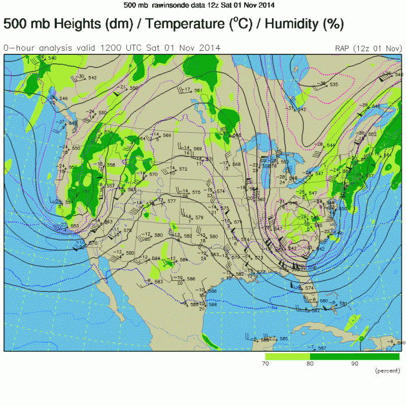
November 1st 500 mb analysis (courtesy of NDG above on this page)

Image

GFS Parallel 240 hr
Image

Also, with the SSW and its effects asd123, a big storm Thanksgiving week over the Eastern CONUS could be looming. Of course, we had that discussion a week to 10 days ago about the SSW and its potential effects with a big storm occuring somewhere across the Eastern U.S.,and indeed it just may take place Thanksgiving week. Also, another significant cold spell could be in store for our region again Thanksgiving week, as depicted in the GFS and EURO runs which gatorcane posted above as well. One big factor would be if the pattern the GFS is depicting evolves out 10 days, there will be the potential of copious amount of moisture moving out of the GOM and spreading over much of Florida. Still some potential interesting days ahead.
Last edited by northjaxpro on Mon Nov 17, 2014 12:18 am, edited 3 times in total.
0 likes   
NEVER, EVER SAY NEVER in the tropics and weather in general, and most importantly, with life itself!!

________________________________________________________________________________________

Fay 2008 Beryl 2012 Debby 2012 Colin 2016 Hermine 2016 Julia 2016 Matthew 2016 Irma 2017 Dorian 2019

User avatar
northjaxpro
S2K Supporter
S2K Supporter
Posts: 8900
Joined: Mon Sep 27, 2010 11:21 am
Location: Jacksonville, FL

#8718 Postby northjaxpro » Sun Nov 16, 2014 11:56 pm

Hard freeze potential still on track for all interior areas of North Florida as 20s will be widespread on both Wednesday and Thursday mornings. I would still be watching closely the next 36 hours pertaining to see if the GFS runs from a couple of days ago may come closer to verifying down in areas near the I-4 corridor. I still think there is a possibility of seeing temps down as low as the mid 30s in that region, particularly interior Seminole County, (west of the St Johns River), and Lake County.
Last edited by northjaxpro on Mon Nov 17, 2014 9:47 am, edited 1 time in total.
0 likes   
NEVER, EVER SAY NEVER in the tropics and weather in general, and most importantly, with life itself!!

________________________________________________________________________________________

Fay 2008 Beryl 2012 Debby 2012 Colin 2016 Hermine 2016 Julia 2016 Matthew 2016 Irma 2017 Dorian 2019

User avatar
northjaxpro
S2K Supporter
S2K Supporter
Posts: 8900
Joined: Mon Sep 27, 2010 11:21 am
Location: Jacksonville, FL

#8719 Postby northjaxpro » Mon Nov 17, 2014 8:30 am

Getting severe weather reports out in the panhadle area this morning. Tornado watch posted for much of GA and parts of AL and currently over the Florida panhandle and this probably will be shifted eastward as the day progresses. Tornadoes being reported out thereand the threat of severe weather will be ongoing today across the Northern peninsula as the dynamics are in place for severe thunderstorms in advance of the arctic front, which will charge through the Region this evening. may have to create a new thread topic for the severe weather risk potential across Georgia and North Florida into this evening.

Image
0 likes   
NEVER, EVER SAY NEVER in the tropics and weather in general, and most importantly, with life itself!!

________________________________________________________________________________________

Fay 2008 Beryl 2012 Debby 2012 Colin 2016 Hermine 2016 Julia 2016 Matthew 2016 Irma 2017 Dorian 2019

User avatar
gatorcane
S2K Supporter
S2K Supporter
Posts: 23697
Age: 47
Joined: Sun Mar 13, 2005 3:54 pm
Location: Boca Raton, FL

#8720 Postby gatorcane » Mon Nov 17, 2014 1:17 pm

Here come the watches for West-Central FL. Impressive line in the Gulf heading east :eek:

Tornado Watch
TORNADO WATCH OUTLINE UPDATE FOR WT 556
NWS STORM PREDICTION CENTER NORMAN OK
1230 PM EST MON NOV 17 2014

TORNADO WATCH 556 IS IN EFFECT UNTIL 800 PM EST FOR THE
FOLLOWING LOCATIONS

FLC009-015-017-027-049-053-055-057-069-071-075-081-083-095-097-
101-103-105-115-117-119-127-180100-
/O.NEW.KWNS.TO.A.0556.141117T1730Z-141118T0100Z/

FL
. FLORIDA COUNTIES INCLUDED ARE

BREVARD CHARLOTTE CITRUS
DESOTO HARDEE HERNANDO
HIGHLANDS HILLSBOROUGH LAKE
LEE LEVY MANATEE
MARION ORANGE OSCEOLA
PASCO PINELLAS POLK
SARASOTA SEMINOLE SUMTER
VOLUSIA
$$
0 likes   


Return to “USA & Caribbean Weather”

Who is online

Users browsing this forum: No registered users and 106 guests