Texas Winter 2014-2015

Winter Weather Discussion

Moderator: S2k Moderators

Forum rules

The posts in this forum are NOT official forecast and should not be used as such. They are just the opinion of the poster and may or may not be backed by sound meteorological data. They are NOT endorsed by any professional institution or STORM2K.

Help Support Storm2K
Message
Author
weatherdude1108
Category 5
Category 5
Posts: 4228
Joined: Tue Dec 13, 2011 1:04 pm
Location: Northwest Austin/Cedar Park, TX

#6501 Postby weatherdude1108 » Wed Feb 25, 2015 4:09 pm

They are still trying to tease us with some winter precip.
:roflmao:
Looking forward to rainstorms (if we get anything) out of this extended forecast.

000
FXUS64 KEWX 252057
AFDEWX

AREA FORECAST DISCUSSION
NATIONAL WEATHER SERVICE AUSTIN/SAN ANTONIO TX
257 PM CST WED FEB 25 2015

.SHORT TERM (TONIGHT THROUGH THURSDAY NIGHT)...
WINDS WILL DROP OFF TO LIGHT AFTER SUNSET...AND COMBINED WITH
CLEAR SKIES SHOULD PRODUCE IDEAL RADIATIONAL COOLING AND CHILLY
TEMPERATURES. SOME PATCHY GROUND FOG MAY OCCUR IN RIVER VALLEYS
ALONG AND NORTH OF TEXAS HIGHWAY 71 WHERE NEAR SURFACE MOISTURE
MAY RESULT IN LOW TEMPERATURE-DEW POINT SPREADS. A STRONG COLD
FRONT WILL MOVE THROUGH THE AREA BETWEEN 15Z AND 18Z ON
THURSDAY...WITH GUSTY NORTH WINDS BEHIND IT AND COLD AIR
ADVECTION. THE RESULT WILL BE ANOTHER DAY OF BELOW NORMAL
TEMPERATURES...BUT A LITTLE WARMER THAN THIS PAST MONDAY AND
TUESDAY. THURSDAY NIGHT WILL BE 5-7F COLDER THAN TONIGHT WITH
MODERATE COLD AIR ADVECTION STILL IN PLAY...EVEN THOUGH MOIST
ISENTROPIC LIFT OVER THE COLD DOME WILL PRODUCE CLOUDY SKIES.

&&

.LONG TERM (FRIDAY THROUGH WEDNESDAY)...
CONDITIONS GET INTERESTING AND HIGHLY VARIABLE ACROSS THE AREA ON
FRIDAY AND SATURDAY.
IN SHORT...THE NEAR-SURFACE COLD DOME WILL
REMAIN IN PLACE WITH A SMALL DIURNAL TEMPERATURE RANGE.
HOWEVER...TEMPERATURES IN THE SFC TO 800 MB LAYER WILL BE AT OR
BELOW 0C...SUGGESTING ANOTHER ROUND OF SLEET...SNOW...AND FREEZING
RAIN/DRIZZLE MIXED WITH RAIN. SNOW SHOULD BE CONFINED MAINLY TO
THE HILL COUNTRY...AND SLEET AND FREEZING RAIN/DRIZZLE CONFINED TO
ALONG THE I-35 CORRIDOR AND BALCONES ESCARPMENT. FORTUNATELY...
THERE ARE NO SIGNIFICANT UPPER LEVEL WAVES MOVING ACROSS THE
AREA...SO PRECIPITATION SHOULD REMAIN LIGHT.
THE MOST LIKELY
IMPACTS WILL BE MINOR ROAD ICING...MOSTLY ON ELEVATED ROADS AND BRIDGES.
THE MAIN THREAT TIME WILL BE FROM 00Z-12Z SATURDAY.

THERE WILL BE BRIEF WARM-UP THROUGH SUNDAY AND MONDAY...BUT
PROXIMITY TO THE JET STREAM AND PASSING DISTURBANCES WILL MAINTAIN
LOW POPS THROUGH THE PERIOD. A SHORTWAVE TROUGH AND PACIFIC FRONT
WILL MOVE ACROSS TEXAS ON TUESDAY...BRINGING A LINE OF SHOWERS AND
THUNDERSTORMS THROUGH THE AREA.
THIS WILL BE FOLLOWED BY ANOTHER
INCURSION OF ARCTIC AIR BEHIND A COLD FRONT ON WEDNESDAY...WITH
THE PROSPECTS FOR COLD CONDITIONS THE LAST HALF OF NEXT WEEK.


&&
0 likes   
The preceding post is NOT an official forecast, and should not be used as such. It is only the opinion of the poster and may or may not be backed by sound meteorological data. It is NOT endorsed by any professional institution including storm2k.org. For Official Information please refer to the NHC and NWS products.

User avatar
SouthernMet
Category 3
Category 3
Posts: 857
Joined: Sun Aug 29, 2010 8:23 pm
Location: fort worth, tx

Re: Texas Winter 2014-2015

#6502 Postby SouthernMet » Wed Feb 25, 2015 4:19 pm

Latest SREF gives San Angelo, Stephenville, Abilene & Brownwood 4-6"+ of snow for friday, with 1-3" for dfw and up to 2" for Georgetown (but 6 ensembles showed significant accumulations of 3-6")

Just one run, consistency though, details to come...
0 likes   
Nothing that SouthernMet posts, is an official forecast,nor does it reflect views of STORM2K.. SouthernMet is just adding to the great discussions on STORM2K.. Refer to NWS for official forecasts.

Wntrwthrguy
Tropical Storm
Tropical Storm
Posts: 161
Joined: Thu Nov 21, 2013 8:48 pm
Location: North Austin

Re: Texas Winter 2014-2015

#6503 Postby Wntrwthrguy » Wed Feb 25, 2015 4:22 pm

SouthernMet wrote:Latest SREF gives San Angelo, Stephenville, Abilene & Brownwood 4-6"+ of snow for friday, with 1-3" for dfw and up to 2" for Georgetown (but 6 ensembles showed significant accumulations of 3-6")

Just one run, consistency though, details to come...


If there's no upper level low that's triggering the precip, where is it getting the snow accumulation amounts from?
0 likes   
Any post should not be taken as a forecast. I am just an amateur living the dream.

User avatar
SouthernMet
Category 3
Category 3
Posts: 857
Joined: Sun Aug 29, 2010 8:23 pm
Location: fort worth, tx

Re: Texas Winter 2014-2015

#6504 Postby SouthernMet » Wed Feb 25, 2015 4:24 pm

There is plenty of lift friday.... :uarrow:
0 likes   
Nothing that SouthernMet posts, is an official forecast,nor does it reflect views of STORM2K.. SouthernMet is just adding to the great discussions on STORM2K.. Refer to NWS for official forecasts.

User avatar
wxman57
Moderator-Pro Met
Moderator-Pro Met
Posts: 22987
Age: 67
Joined: Sat Jun 21, 2003 8:06 pm
Location: Houston, TX (southwest)

Re: Texas Winter 2014-2015

#6505 Postby wxman57 » Wed Feb 25, 2015 4:26 pm

With the sky clearing across the D-FW metroplex, I'm not sure how there will be more snow early in the morning. I can see a weak disturbance approaching the NW Panhandle, but I don't know if it will move across NE TX. All the MOS guidance says the area will be overcast through tomorrow.
0 likes   

Brent
S2K Supporter
S2K Supporter
Posts: 38102
Age: 37
Joined: Sun May 16, 2004 10:30 pm
Location: Tulsa Oklahoma
Contact:

Re: Texas Winter 2014-2015

#6506 Postby Brent » Wed Feb 25, 2015 4:28 pm

Image
0 likes   
#neversummer

User avatar
SouthernMet
Category 3
Category 3
Posts: 857
Joined: Sun Aug 29, 2010 8:23 pm
Location: fort worth, tx

Re: Texas Winter 2014-2015

#6507 Postby SouthernMet » Wed Feb 25, 2015 4:30 pm

Like i said 18z nam backed off on tomorrow's light snow making it to dfw.

but latest HRRR has a disturbance in northwest texas at the end of its run (5am) : http://rapidrefresh.noaa.gov/HRRR/jsloo ... omain=full

and latest sref has light snow on top of north texas in the afternoon : http://www.spc.noaa.gov/exper/sref/gifs ... r_f030.gif

RGEM at 6am moderate snow in nw texas : http://www.tropicaltidbits.com/analysis ... scus_6.png

(RGEM has it falling apart before reaching dfw at noon)
Last edited by SouthernMet on Wed Feb 25, 2015 4:39 pm, edited 2 times in total.
0 likes   
Nothing that SouthernMet posts, is an official forecast,nor does it reflect views of STORM2K.. SouthernMet is just adding to the great discussions on STORM2K.. Refer to NWS for official forecasts.

downsouthman1
Category 2
Category 2
Posts: 663
Age: 45
Joined: Fri Jan 07, 2011 8:14 pm
Location: Rowlett, TX

#6508 Postby downsouthman1 » Wed Feb 25, 2015 4:31 pm

http://www.hpc.ncep.noaa.gov/pwpf/wwd_a ... babilities leads me to believe that we'll be looking at a potentially accumulating snow event Friday transitioning to an ice storm Saturday & Sunday.
0 likes   
Not a professional MET! My posts are merely speculation.

User avatar
wxman57
Moderator-Pro Met
Moderator-Pro Met
Posts: 22987
Age: 67
Joined: Sat Jun 21, 2003 8:06 pm
Location: Houston, TX (southwest)

Re: Texas Winter 2014-2015

#6509 Postby wxman57 » Wed Feb 25, 2015 4:34 pm

There should be strong low-level warm advection across Texas by Saturday afternoon. I wouldn't expect any ice on Sunday anywhere.
0 likes   

downsouthman1
Category 2
Category 2
Posts: 663
Age: 45
Joined: Fri Jan 07, 2011 8:14 pm
Location: Rowlett, TX

Re: Texas Winter 2014-2015

#6510 Postby downsouthman1 » Wed Feb 25, 2015 4:35 pm

wxman57 wrote:There should be strong low-level warm advection across Texas by Saturday afternoon. I wouldn't expect any ice on Sunday anywhere.

Makes sense actually.
0 likes   
Not a professional MET! My posts are merely speculation.

User avatar
JDawg512
Category 5
Category 5
Posts: 1078
Age: 45
Joined: Mon Aug 26, 2013 8:56 pm
Location: Austin
Contact:

Re: Texas Winter 2014-2015

#6511 Postby JDawg512 » Wed Feb 25, 2015 4:36 pm

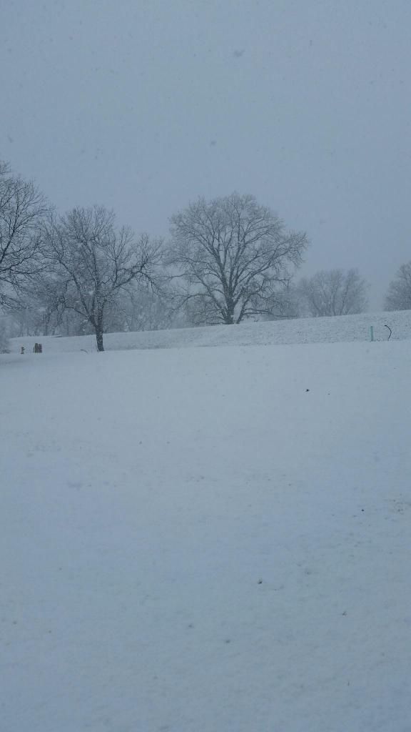
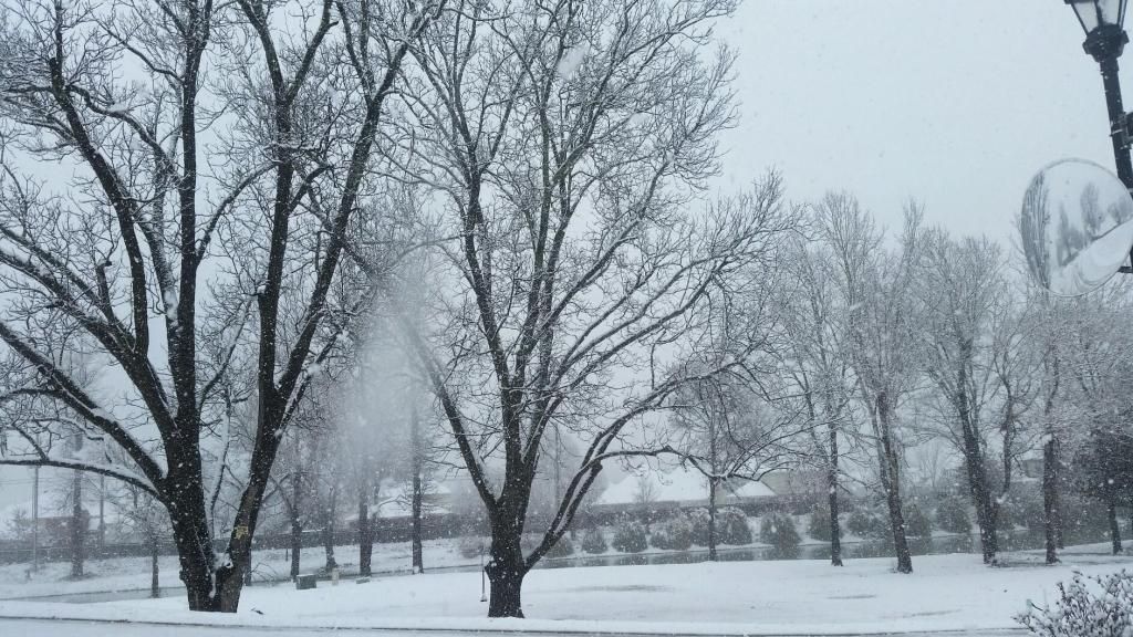
Here are two pictures my sister sent me earlier. She lives in Shreveport.

Image

Image
0 likes   
Resident Rain Miser

I am a weather hobbyist living 3.5 miles south of Downtown Austin and in no way or fashion should anything I say concerning forecasts be taken seriously. Please check your local NWS for accurate weather forecasting and conditions.

User avatar
SouthernMet
Category 3
Category 3
Posts: 857
Joined: Sun Aug 29, 2010 8:23 pm
Location: fort worth, tx

Re: Texas Winter 2014-2015

#6512 Postby SouthernMet » Wed Feb 25, 2015 4:38 pm

Yeah downsouthman1 I'm seeing strong WAA sunday, 40' & 50's possible.
0 likes   
Nothing that SouthernMet posts, is an official forecast,nor does it reflect views of STORM2K.. SouthernMet is just adding to the great discussions on STORM2K.. Refer to NWS for official forecasts.

Yukon Cornelius
S2K Supporter
S2K Supporter
Posts: 1798
Age: 41
Joined: Thu Dec 20, 2012 9:23 pm
Location: Dean, TX/Westcliffe, CO

#6513 Postby Yukon Cornelius » Wed Feb 25, 2015 4:39 pm

In not paying any attention to models the rest of the week, even given the chance of precip. If I see it falling from the sky on Friday I'll know it is snowing.
0 likes   
#neversummer

Brent
S2K Supporter
S2K Supporter
Posts: 38102
Age: 37
Joined: Sun May 16, 2004 10:30 pm
Location: Tulsa Oklahoma
Contact:

#6514 Postby Brent » Wed Feb 25, 2015 4:41 pm

Yeah I've about had my fill of models... I still cant forgive what they did to me last night! :cry:
0 likes   
#neversummer

User avatar
dhweather
S2K Supporter
S2K Supporter
Posts: 6199
Joined: Sat Aug 14, 2004 9:29 pm
Location: Heath, TX
Contact:

#6515 Postby dhweather » Wed Feb 25, 2015 4:44 pm

SPECIAL WEATHER STATEMENT
NATIONAL WEATHER SERVICE FORT WORTH TX
342 PM CST WED FEB 25 2015

TXZ091>095-100>107-115>123-129>135-141>148-156>162-174-175-252345-
MONTAGUE-COOKE-GRAYSON-FANNIN-LAMAR-YOUNG-JACK-WISE-DENTON-COLLIN-
HUNT-DELTA-HOPKINS-STEPHENS-PALO PINTO-PARKER-TARRANT-DALLAS-
ROCKWALL-KAUFMAN-VAN ZANDT-RAINS-EASTLAND-ERATH-HOOD-SOMERVELL-
JOHNSON-ELLIS-HENDERSON-COMANCHE-MILLS-HAMILTON-BOSQUE-HILL-
NAVARRO-FREESTONE-ANDERSON-LAMPASAS-CORYELL-BELL-MCLENNAN-FALLS-
LIMESTONE-LEON-MILAM-ROBERTSON-
INCLUDING THE CITIES OF...BOWIE...NOCONA...GAINESVILLE...
SHERMAN...DENISON...BONHAM...PARIS...GRAHAM...OLNEY...JACKSBORO...
DECATUR...BRIDGEPORT...DENTON...LEWISVILLE...FLOWER MOUND...
THE COLONY...PLANO...GREENVILLE...COMMERCE...COOPER...
SULPHUR SPRINGS...BRECKENRIDGE...MINERAL WELLS...WEATHERFORD...
BRIAR...FORT WORTH...ARLINGTON...DALLAS...ROCKWALL...TERRELL...
KAUFMAN...FORNEY...WILLS POINT...CANTON...GRAND SALINE...VAN...
EDGEWOOD...EMORY...POINT...EAST TAWAKONI...CISCO...EASTLAND...
RANGER...GORMAN...STEPHENVILLE...DUBLIN...GRANBURY...
OAK TRAIL SHORES...GLEN ROSE...CLEBURNE...BURLESON...WAXAHACHIE...
ENNIS...MIDLOTHIAN...GLENN HEIGHTS...ATHENS...GUN BARREL CITY...
COMANCHE...DE LEON...GOLDTHWAITE...HAMILTON...HICO...CLIFTON...
MERIDIAN...VALLEY MILLS...HILLSBORO...CORSICANA...TEAGUE...
FAIRFIELD...PALESTINE...LAMPASAS...COPPERAS COVE...GATESVILLE...
KILLEEN...TEMPLE...FORT HOOD...WACO...MARLIN...MEXIA...
GROESBECK...BUFFALO...CENTERVILLE...JEWETT...OAKWOOD...CAMERON...
ROCKDALE...HEARNE...FRANKLIN...CALVERT
342 PM CST WED FEB 25 2015

...WINTER WEATHER OUTLOOK THROUGH THIS WEEKEND...
...REFREEZING OF ROADS POSSIBLE TONIGHT WITH MORE WINTER
WEATHER POSSIBLE THURSDAY THROUGH SATURDAY...

CLEARING SKIES TONIGHT WILL LIKELY RESULT IN REFREEZING OF ANY
MELTED ICE OR SNOW THAT FELL OVERNIGHT AND EARLY TODAY. BRIDGES
AND OVERPASSES WILL ESPECIALLY BE SUSCEPTIBLE TO RE-FREEZING
OVERNIGHT INTO THURSDAY MORNING. SLOW DOWN AND ALLOW EXTRA TIME
IF YOU PLAN ON COMMUTING TONIGHT AND EARLY THURSDAY.

AN ARCTIC COLD FRONT WILL ARRIVE BY DAYBREAK THURSDAY MORNING AND
CLEAR THROUGH CENTRAL TEXAS BEFORE MIDDAY. A BROAD UPPER TROUGH
ALOFT WILL BRING A FAST MOVING UPPER DISTURBANCE ACROSS THE AREA
ON THURSDAY. THIS SYSTEM WILL NOT HAVE A LOT OF MOISTURE TO WORK
UPON WITH ONLY LOW CHANCES FOR VERY LIGHT SNOW OR FLURRIES
NORTHWEST OF A GOLDTHWAITE TO WACO TO ATHENS LINE. NO IMPACTS ARE
EXPECTED ON THURSDAY.

ANOTHER FAST-MOVING...YET STRONGER UPPER DISTURBANCE ARRIVES ON
FRIDAY INTO FRIDAY NIGHT AND WILL YIELD LOW CHANCES FOR LIGHT SNOW
ACROSS AREAS NORTHWEST OF A TEMPLE TO MEXIA TO ATHENS LINE.
ACCUMULATIONS WILL RANGE FROM A DUSTING TO NEAR AN INCH...WITH
HIGHEST TOTALS EXPECTED AREAS WEST OF INTERSTATE 35 AND 35 WEST.
LITTLE TO NO IMPACTS ARE EXPECTED ON MAIN ROADS OR HIGHWAYS...
THOUGH MINOR IMPACTS OF SLICK SPOTS ON BRIDGES AND OVERPASSES
WILL BE POSSIBILE.

VERY LIGHT FREEZING DRIZZLE...FREEZING RAIN...OR SLEET WILL BE
POSSIBLE BY SATURDAY MORNING AS WARMER AIR ALOFT OVERRIDES THE
ARCTIC AIRMASS AT THE SURFACE. LIGHT ICING ON SATURDAY COULD RESULT
IN MINOR IMPACTS OF ICING ON ALL ROADS AND HIGHWAYS. ELEVATED
SURFACES SUCH AS BRIDGES AND OVERPASSES WILL BE ESPECIALLY
SUSCEPTIBLE TO LIGHT ICING DUE TO SUB-FREEZING TEMPERATURES
SATURDAY MORNING. THIS TIME PERIOD HOLDS THE MOST UNCERTAINTY AS
WE AWAIT FUTURE MODEL SOLUTIONS TO NARROW DOWN THE PRECIPITATION
TYPE AND EVENTUAL IMPACTS.

WE URGE YOU TO CLOSELY MONITOR FUTURE FORECASTS REGARDING THE
POTENTIAL WINTER WEATHER AND IMPACTS ACROSS NORTH AND CENTRAL
TEXAS THURSDAY THROUGH SATURDAY.
0 likes   
The above post and any post by dhweather is NOT an official forecast and should not be used as such. It is just the opinion of the poster and may or may not be backed by sound meteorological data. It is NOT endorsed by any professional institution including storm2k.org. For official information, please refer to NWS products.

User avatar
SouthernMet
Category 3
Category 3
Posts: 857
Joined: Sun Aug 29, 2010 8:23 pm
Location: fort worth, tx

Re:

#6516 Postby SouthernMet » Wed Feb 25, 2015 4:45 pm

Brent wrote:Yeah I've about had my fill of models... I still cant forgive what they did to me last night! :cry:


Blame the ULL + Warm nose not the models

But yeah models have definitely been teasing us this winter.
0 likes   
Nothing that SouthernMet posts, is an official forecast,nor does it reflect views of STORM2K.. SouthernMet is just adding to the great discussions on STORM2K.. Refer to NWS for official forecasts.

Lagreeneyes03
Category 2
Category 2
Posts: 558
Joined: Mon Dec 09, 2013 10:53 am
Location: Luxurious Lake Grapevine

Re: Texas Winter 2014-2015

#6517 Postby Lagreeneyes03 » Wed Feb 25, 2015 4:52 pm

Ntxw wrote:
wxman57 wrote::uarrow: Saturday afternoon sleet under southerly flow (warm advection). Not a snow event. I think NE TX is seeing its last snow of the winter today.


We will fight on till the last freeze! March Miracle, -NAO Greenland block, no sir we will not give in for as long as we can. Looks like a wet summer is coming.


Stormy and Tornadoey? (is that even a word?) Let's just bust this drought. I remember summer of 2005 I think it was. June, storms 1x a week, i worked at the airport and it was nuts. Was always worried about coming home to a tree through my roof, my neighborhood lost 2 huge ones that year. They just toppled over.
0 likes   
I'm a Princess, not a forecaster.

User avatar
SouthernMet
Category 3
Category 3
Posts: 857
Joined: Sun Aug 29, 2010 8:23 pm
Location: fort worth, tx

Re: Texas Winter 2014-2015

#6518 Postby SouthernMet » Wed Feb 25, 2015 4:56 pm

This : http://www.tropicaltidbits.com/analysis ... cus_16.png

& This : http://www.spc.noaa.gov/exper/sref/gifs ... r_f051.gif

With 18-22 degrees could be a hell of a lot more than a dusting lol :roll:
0 likes   
Nothing that SouthernMet posts, is an official forecast,nor does it reflect views of STORM2K.. SouthernMet is just adding to the great discussions on STORM2K.. Refer to NWS for official forecasts.

gpsnowman
S2K Supporter
S2K Supporter
Posts: 3191
Joined: Fri Jan 07, 2011 10:35 am
Location: Grand Prairie Tx

#6519 Postby gpsnowman » Wed Feb 25, 2015 5:04 pm

So three days with three chances of winter precip. All in. Why not? Have nothing to lose because winter is almost over and done with. Winter needs to exit in a blaze of glory!!
0 likes   

Brent
S2K Supporter
S2K Supporter
Posts: 38102
Age: 37
Joined: Sun May 16, 2004 10:30 pm
Location: Tulsa Oklahoma
Contact:

Re:

#6520 Postby Brent » Wed Feb 25, 2015 5:15 pm

gpsnowman wrote:So three days with three chances of winter precip. All in. Why not? Have nothing to lose because winter is almost over and done with. Winter needs to exit in a blaze of glory!!


This week could make up for it... but last night kind of killed it for me. Talk about a stab to the heart when you're already down...
0 likes   
#neversummer


Return to “Winter Weather”

Who is online

Users browsing this forum: No registered users and 12 guests