HURRICANELONNY wrote:you can see the outer bands in puerto rico. fast moving showers out of the n.e.
http://radar.weather.gov/ridge/radar.ph ... a&loop=yes
Also on the long range radar you can see the rain shield of the new flareup over the Antilles
Moderator: S2k Moderators

HURRICANELONNY wrote:you can see the outer bands in puerto rico. fast moving showers out of the n.e.
http://radar.weather.gov/ridge/radar.ph ... a&loop=yes


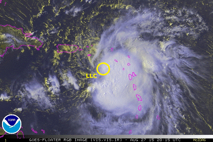
Evil Jeremy wrote:Hot tower firing directly over the LLC (or one of them). Erika is getting her act together... She heard all of you who were writing her off...

Evil Jeremy wrote:Hot tower firing directly over the LLC (or one of them). Erika is getting her act together... She heard all of you who were writing her off...


ozonepete wrote: And when you see a TS building good convection over the LLC during DMIN, look out.
Nederlander wrote:While not historically a big fan, TWC is actually doing a really good job of explaining in detail all of the variables at play with Erika. Even going so far as to explain the llc/mlc trouble she has been having. They also explained the new convection popping near the llc as a sign of organization along with shear developments. At any rate I thought I'd give credit where credit is due. Bryan Norcross was giving the breakdown and explained some of the more complicated aspects in layman's terms.

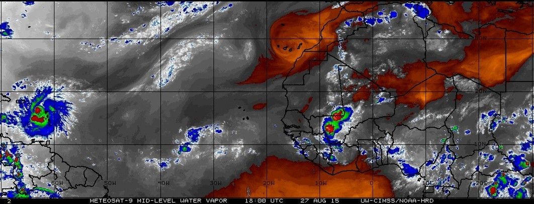
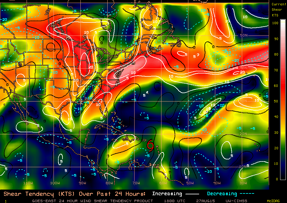
ozonepete wrote:Looks like it could be ready for take-off. Mid-level RH really good and shear dropping noticeably. And when you see a TS building good convection over the LLC during DMIN, look out.
]http://i189.photobucket.com/albums/z174/philnyc_2007/wvmid%20cimss%202015-08-27%201800.gif_zpswjbvxm8i.jpeg
[url=http://s189.photobucket.com/user/philnyc_2007/media/shear%20tend%20cimss%202015-08-27%201800_zpsurhwuqvz.gif.htmlhttp://i189.photobucket.com/albums/z174/philnyc_2007/shear%20tend%20cimss%202015-08-27%201800_zpsurhwuqvz.gif[/url]
http://i189.photobucket.com/albums/z174/philnyc_2007/sat%20rgb%202015-08-27%202015%20-%20anno_zpsqjdi7u6i.gif


Sanibel wrote:ozonepete wrote: And when you see a TS building good convection over the LLC during DMIN, look out.
Not a system you would want to see get into open waters on a track to Florida.

From 5pm Disco... Because of the marginal upper-level wind environment and potential
interaction with land over the next few days, there is unusually
high uncertainty in the forecast intensity, especially at days 3 to
5.
Users browsing this forum: No registered users and 37 guests