ATL: JOAQUIN - Models
Moderator: S2k Moderators
-
Blizzard96x

- Tropical Depression

- Posts: 84
- Joined: Wed Aug 19, 2015 4:34 am
-
Kingarabian

- S2K Supporter

- Posts: 16350
- Joined: Sat Aug 08, 2009 3:06 am
- Location: Honolulu, Hawaii

-
Kingarabian
- S2K Supporter
- Posts: 16350
- Joined: Sat Aug 08, 2009 3:06 am
- Location: Honolulu, Hawaii

Re: ATL: JOAQUIN - Models
So has the Euro been upgraded lately, like in past week or so?
It was the only model that was correct with 99L and so far has done really good with Joaquin.
One thing about the Euro is that when it locks in within the 4-5 day range syptonic set up it is usually more right than wrong.
It was the only model that was correct with 99L and so far has done really good with Joaquin.
One thing about the Euro is that when it locks in within the 4-5 day range syptonic set up it is usually more right than wrong.
0 likes
-
Weatherwatcher98
- Category 1

- Posts: 346
- Joined: Sat Sep 12, 2015 10:53 am
Re: ATL: JOAQUIN - Models
Lets hope it is right this time as it spares the United StatesNDG wrote:So has the Euro been upgraded lately, like in past week or so?
It was the only model that was correct with 99L and so far has done really good with Joaquin.
One thing about the Euro is that when it locks in within the 4-5 day range syptonic set up it is usually more right than wrong.
0 likes
Personal Forecast Disclaimer:
The posts in this forum are NOT official forecast and should not be used as such. They are just the opinion of the poster and may or may not be backed by sound meteorological data. They are NOT endorsed by any professional institution or storm2k.org. For official information, please refer to the NHC and NWS products.
The posts in this forum are NOT official forecast and should not be used as such. They are just the opinion of the poster and may or may not be backed by sound meteorological data. They are NOT endorsed by any professional institution or storm2k.org. For official information, please refer to the NHC and NWS products.
-
Kingarabian
- S2K Supporter
- Posts: 16350
- Joined: Sat Aug 08, 2009 3:06 am
- Location: Honolulu, Hawaii
Re: ATL: JOAQUIN - Models
NDG wrote:So has the Euro been upgraded lately, like in past week or so?
It was the only model that was correct with 99L and so far has done really good with Joaquin.
One thing about the Euro is that when it locks in within the 4-5 day range syptonic set up it is usually more right than wrong.
Bit too soon to declare a winner IMO. Euro did shift a bit west.
0 likes
RIP Kobe Bryant
Re: ATL: JOAQUIN - Models
I don't have spaghetti charts of the Euro ensemble, but here is the mean. There as to be lot of members not agreeing with the op

0 likes
Re: ATL: JOAQUIN - Models
Kingarabian wrote:NDG wrote:So has the Euro been upgraded lately, like in past week or so?
It was the only model that was correct with 99L and so far has done really good with Joaquin.
One thing about the Euro is that when it locks in within the 4-5 day range syptonic set up it is usually more right than wrong.
Bit too soon to declare a winner IMO. Euro did shift a bit west.
Well so far it has done better the GFS which just a day or two ago it was not showing it strengthen it like has been for the last 12 hrs or so.
BTW, I don't see that it has shifted that much west, if at all, during the last couple of runs.
Last edited by NDG on Wed Sep 30, 2015 5:47 am, edited 1 time in total.
0 likes
-
Kingarabian
- S2K Supporter
- Posts: 16350
- Joined: Sat Aug 08, 2009 3:06 am
- Location: Honolulu, Hawaii

-
tolakram
- Admin

- Posts: 20179
- Age: 62
- Joined: Sun Aug 27, 2006 8:23 pm
- Location: Florence, KY (name is Mark)
Re: ATL: JOAQUIN - Models
The euro ensemble mean is still off the coast of Virginia, and it was the euro that failed with Erika, insisting it was going up near the Bahamas while the GFS sniffed out death over Hispaniola. If it wasn't for these two things I would agree the Euro is the one to believe.
0 likes
M a r k
- - - - -
Join us in chat: Storm2K Chatroom Invite. Android and IOS apps also available.
The posts in this forum are NOT official forecasts and should not be used as such. Posts are NOT endorsed by any professional institution or STORM2K.org. For official information and forecasts, please refer to NHC and NWS products.


Re: ATL: JOAQUIN - Models
NDG wrote:So has the Euro been upgraded lately, like in past week or so?
It was the only model that was correct with 99L and so far has done really good with Joaquin.
One thing about the Euro is that when it locks in within the 4-5 day range syptonic set up it is usually more right than wrong.
ECM ensembles favor a NC hit - its the only model out on its own. is an outlier at this point.
0 likes
-
Kingarabian
- S2K Supporter
- Posts: 16350
- Joined: Sat Aug 08, 2009 3:06 am
- Location: Honolulu, Hawaii
-
Weatherwatcher98
- Category 1
- Posts: 346
- Joined: Sat Sep 12, 2015 10:53 am
Re: ATL: JOAQUIN - Models
Interesting to Note much weaker than others at 1003 mbronjon wrote:NDG wrote:So has the Euro been upgraded lately, like in past week or so?
It was the only model that was correct with 99L and so far has done really good with Joaquin.
One thing about the Euro is that when it locks in within the 4-5 day range syptonic set up it is usually more right than wrong.
ECM ensembles favor a NC hit - its the only model out on its own. is an outlier at this point.
0 likes
Personal Forecast Disclaimer:
The posts in this forum are NOT official forecast and should not be used as such. They are just the opinion of the poster and may or may not be backed by sound meteorological data. They are NOT endorsed by any professional institution or storm2k.org. For official information, please refer to the NHC and NWS products.
The posts in this forum are NOT official forecast and should not be used as such. They are just the opinion of the poster and may or may not be backed by sound meteorological data. They are NOT endorsed by any professional institution or storm2k.org. For official information, please refer to the NHC and NWS products.
-
Kingarabian
- S2K Supporter
- Posts: 16350
- Joined: Sat Aug 08, 2009 3:06 am
- Location: Honolulu, Hawaii
Re: ATL: JOAQUIN - Models
Weatherwatcher98 wrote:Interesting to Note much weaker than others at 1003 mbronjon wrote:NDG wrote:So has the Euro been upgraded lately, like in past week or so?
It was the only model that was correct with 99L and so far has done really good with Joaquin.
One thing about the Euro is that when it locks in within the 4-5 day range syptonic set up it is usually more right than wrong.
ECM ensembles favor a NC hit - its the only model out on its own. is an outlier at this point.
Weatherwatcher98, typically the mean of 20 or so individual ensemble runs is weaker then a single operation model run. It's because you're basically averaging many runs so I wouldn't read too much into it.
0 likes
Re: ATL: JOAQUIN - Models
I'm seeing the biggest difference between the operational runs of the GFS and ECM is the orientation of the 500 mb cutoff low over the SE. GFS has more of a negative tilt from 72-96 hours while ECM does not. I think this is the big difference influencing track.
0 likes
-
Weatherwatcher98
- Category 1
- Posts: 346
- Joined: Sat Sep 12, 2015 10:53 am
Re: ATL: JOAQUIN - Models
Thanks ronjon 

0 likes
Personal Forecast Disclaimer:
The posts in this forum are NOT official forecast and should not be used as such. They are just the opinion of the poster and may or may not be backed by sound meteorological data. They are NOT endorsed by any professional institution or storm2k.org. For official information, please refer to the NHC and NWS products.
The posts in this forum are NOT official forecast and should not be used as such. They are just the opinion of the poster and may or may not be backed by sound meteorological data. They are NOT endorsed by any professional institution or storm2k.org. For official information, please refer to the NHC and NWS products.


-
Weatherwatcher98
- Category 1
- Posts: 346
- Joined: Sat Sep 12, 2015 10:53 am
Re: ATL: JOAQUIN - Models
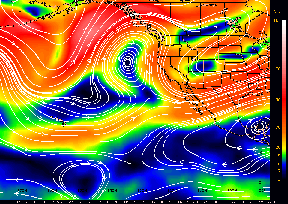
http://tropic.ssec.wisc.edu/real-time/eastpac/winds/wg9dlm5-1.GIF According to the pattern downstream That may change??ronjon wrote:I'm seeing the biggest difference between the operational runs of the GFS and ECM is the orientation of the 500 mb cutoff low over the SE. GFS has more of a negative tilt from 72-96 hours while ECM does not. I think this is the big difference influencing track.
0 likes
Personal Forecast Disclaimer:
The posts in this forum are NOT official forecast and should not be used as such. They are just the opinion of the poster and may or may not be backed by sound meteorological data. They are NOT endorsed by any professional institution or storm2k.org. For official information, please refer to the NHC and NWS products.
The posts in this forum are NOT official forecast and should not be used as such. They are just the opinion of the poster and may or may not be backed by sound meteorological data. They are NOT endorsed by any professional institution or storm2k.org. For official information, please refer to the NHC and NWS products.
Who is online
Users browsing this forum: No registered users and 33 guests