2016 Global Model Runs Discussion (Out to Day 16)
Moderator: S2k Moderators
Forum rules

The posts in this forum are NOT official forecasts and should not be used as such. They are just the opinion of the poster and may or may not be backed by sound meteorological data. They are NOT endorsed by any professional institution or STORM2K. For official information, please refer to products from the National Hurricane Center and National Weather Service.
Re: 2016 Global Model Runs Discussion
according to the CMC and EC, the trough shifts significantly westward over the next week
0 likes

-
SEASON_CANCELED

- Category 3

- Posts: 887
- Joined: Mon Jul 06, 2009 5:17 am
- Location: 8 Bit Charlie Sheen
Re: 2016 Global Model Runs Discussion
More texas problem i would think
0 likes
i am a big stupid ugly moron with an ugly face and a big butt and my butt stinks and i like to kiss my own butt
-
stormlover2013
Re: 2016 Global Model Runs Discussion
Yeah new gfs shows like sw la/tex but will keep changing, if euro is on board then I'll start to pay attention
0 likes
Re: 2016 Global Model Runs Discussion
CourierPR wrote:What would the implications be, Alyono?
An EPAC storm, not a Caribbean storm
0 likes

Re: 2016 Global Model Runs Discussion
http://arstechnica.com/science/2016/06/ ... the-world/
A little off topic but here's an article about the rough couple months the GFS has had. Note - This only measures the 5 day (120 hr) verification at 500 mb in the N hemisphere between 20 and 80N. It doesn't mean it applies to tropical cyclone development.
A little off topic but here's an article about the rough couple months the GFS has had. Note - This only measures the 5 day (120 hr) verification at 500 mb in the N hemisphere between 20 and 80N. It doesn't mean it applies to tropical cyclone development.
0 likes
-
stormwise
Re: 2016 Global Model Runs Discussion
It wont come as any real suprize to see a spinup on the end off the MT in the Western Caribbean end.. A vigorous MJO enhanced MT can have multi embedded lows along the trof.

0 likes
-
hurricanetrack

- HurricaneTrack.com

- Posts: 1781
- Joined: Tue Dec 02, 2003 10:46 pm
- Location: Wilmington, NC
- Contact:
Re: 2016 Global Model Runs Discussion
Speaking of global model runs....
The NCEP site GFS graphics are, in my opinion, awful now. The site seems oddly formatted too. Ugh. Loved to be able to go in and look at all the layers but now the images are just fuzzy and crappy looking. Anyone else notice this? What is the deal?
The NCEP site GFS graphics are, in my opinion, awful now. The site seems oddly formatted too. Ugh. Loved to be able to go in and look at all the layers but now the images are just fuzzy and crappy looking. Anyone else notice this? What is the deal?
0 likes
-
TheStormExpert
Re: 2016 Global Model Runs Discussion
The GFS is such a lost cause. 

Last edited by TheStormExpert on Wed Jun 22, 2016 12:10 pm, edited 1 time in total.
0 likes
Re: 2016 Global Model Runs Discussion
12Z MU basically goes full Katrina
I needed that good laugh today. That's not going to happen
I needed that good laugh today. That's not going to happen
0 likes
-
Hurricaneman

- Category 5
- Posts: 7404
- Age: 45
- Joined: Tue Aug 31, 2004 3:24 pm
- Location: central florida
Re: 2016 Global Model Runs Discussion
If I had to bet I could see a weak system in the Western Caribbean with a track similar to Opal in 1995 and a intensity similar to Cindy in 2005 but the brunt of the development will probably be in the EPAC from this but a low on both sides is possible but IMO not a complete blowup into something intense
The posts in this forum are NOT official forecast and should not be used as such. They are just the opinion of the poster and may or may not be backed by sound meteorological data. They are NOT endorsed by any professional institution or storm2k.org. For official information, please refer to NHC and NWS products
The posts in this forum are NOT official forecast and should not be used as such. They are just the opinion of the poster and may or may not be backed by sound meteorological data. They are NOT endorsed by any professional institution or storm2k.org. For official information, please refer to NHC and NWS products
0 likes
-
TropicalAnalystwx13

- Category 5
- Posts: 2109
- Age: 28
- Joined: Tue Jul 19, 2011 8:20 pm
- Location: Wilmington, NC
- Contact:
Re: 2016 Global Model Runs Discussion
Alyono wrote:12Z MU basically goes full Katrina
I needed that good laugh today. That's not going to happen
...what? It shows a Category 1 hurricane making landfall, in no way comparable to Katrina.
0 likes
-
srainhoutx

- S2K Supporter

- Posts: 6919
- Age: 68
- Joined: Sun Jan 14, 2007 11:34 am
- Location: Haywood County, NC
- Contact:
Re: 2016 Global Model Runs Discussion
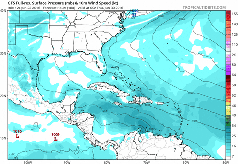
Personally I would not be too quick dismissing the possibility of TC genesis in the NW Caribbean/Bay of Campeche. A very robust MJO pulse should arrive across the Eastern Pacific, Western Caribbean and the Western Gulf around July 1st. There are a couple of tropical wave candidates that will be nearing the Western Atlantic Basin during that timeframe. Time will tell if all the upgrades to the GFS are in fact beneficial. We heard directly from the Scientists at the NCEP this Spring at various Hurricane Conferences the work that had been completed as well as increased computing power.
0 likes
Carla/Alicia/Jerry(In The Eye)/Michelle/Charley/Ivan/Dennis/Katrina/Rita/Wilma/Ike/Harvey
Member: National Weather Association
Wx Infinity Forums
http://wxinfinity.com/index.php
Facebook.com/WeatherInfinity
Twitter @WeatherInfinity
Member: National Weather Association
Wx Infinity Forums
http://wxinfinity.com/index.php
Facebook.com/WeatherInfinity
Twitter @WeatherInfinity
-
cycloneye

- Admin

- Posts: 149405
- Age: 69
- Joined: Thu Oct 10, 2002 10:54 am
- Location: San Juan, Puerto Rico
Re: 2016 Global Model Runs Discussion
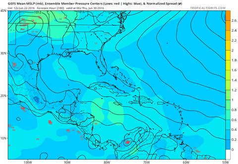
We need the Euro to be like GFS to believe the scenario. I am 50/50 on this waiting to see if the model joins GFS.
0 likes
Visit the Caribbean-Central America Weather Thread where you can find at first post web cams,radars
and observations from Caribbean basin members Click Here
and observations from Caribbean basin members Click Here
-
srainhoutx
- S2K Supporter
- Posts: 6919
- Age: 68
- Joined: Sun Jan 14, 2007 11:34 am
- Location: Haywood County, NC
- Contact:
Re: 2016 Global Model Runs Discussion
cycloneye wrote:We need the Euro to be like GFS to believe the scenario.
We need ensemble support from the Global models at that range, Luis...
0 likes
Carla/Alicia/Jerry(In The Eye)/Michelle/Charley/Ivan/Dennis/Katrina/Rita/Wilma/Ike/Harvey
Member: National Weather Association
Wx Infinity Forums
http://wxinfinity.com/index.php
Facebook.com/WeatherInfinity
Twitter @WeatherInfinity
Member: National Weather Association
Wx Infinity Forums
http://wxinfinity.com/index.php
Facebook.com/WeatherInfinity
Twitter @WeatherInfinity
-
cycloneye
- Admin
- Posts: 149405
- Age: 69
- Joined: Thu Oct 10, 2002 10:54 am
- Location: San Juan, Puerto Rico
Re: 2016 Global Model Runs Discussion
srainhoutx wrote:cycloneye wrote:We need the Euro to be like GFS to believe the scenario.
We need ensemble support from the Global models at that range, Luis...
Yes,agree 100%.
0 likes
Visit the Caribbean-Central America Weather Thread where you can find at first post web cams,radars
and observations from Caribbean basin members Click Here
and observations from Caribbean basin members Click Here
-
Yellow Evan

- Professional-Met

- Posts: 16232
- Age: 27
- Joined: Fri Jul 15, 2011 12:48 pm
- Location: Henderson, Nevada/Honolulu, HI
- Contact:
Re: 2016 Global Model Runs Discussion
srainhoutx wrote:cycloneye wrote:We need the Euro to be like GFS to believe the scenario.
We need ensemble support from the Global models at that range, Luis...
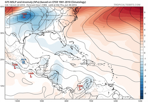
Tbf most GEFS runs do support to a reasonable extent what the GFS is showing.
0 likes
-
TheStormExpert
Re: 2016 Global Model Runs Discussion
0 likes
Re: 2016 Global Model Runs Discussion
Two days ago the GFS had landfall on FL panhandle on the 3rd. Now it's LA on the 6th. It's been in the 300 hr range for a week now.
0 likes
-
cycloneye
- Admin
- Posts: 149405
- Age: 69
- Joined: Thu Oct 10, 2002 10:54 am
- Location: San Juan, Puerto Rico
Re: 2016 Global Model Runs Discussion
RL3AO wrote:Two days ago the GFS had landfall on FL panhandle on the 3rd. Now it's LA on the 6th. It's been in the 300 hr range for a week now.
GFS has been in the same place in the 7 thru 8 day range for the past 2 days of runs.
0 likes
Visit the Caribbean-Central America Weather Thread where you can find at first post web cams,radars
and observations from Caribbean basin members Click Here
and observations from Caribbean basin members Click Here
Who is online
Users browsing this forum: No registered users and 75 guests