hurricanes1234 wrote:leanne_uk wrote:Are we thinking that this may cause issues for Jamaica or will it just bring some rain and wind?
I've got friends out there on holiday at the moment and they are asking questions about the situation.
(I'm currently in hospital so don't have my full net access to check this out in depth)
Hi
Yes, according to the NHC, it is likely to bring heavy rain and tropical storm force winds to Jamaica by tonight. An excerpt from the 2 PM update of the area today from the Tropical Weather Outlook page:Regardless of
development, locally heavy rainfall and gusty winds, perhaps to
tropical storm force, will continue over portions of the Dominican
Republic and Haiti through this evening. Tropical storm conditions
are likely to occur over Jamaica by this evening, and could reach
the Cayman Islands overnight. Interests in these areas and
elsewhere in the western Caribbean Sea should continue to monitor
the progress of this disturbance.
ATL: EARL - Remnants - Discussion
Moderator: S2k Moderators
-
leanne_uk
- Tropical Storm

- Posts: 214
- Age: 43
- Joined: Fri Sep 04, 2009 4:38 pm
- Location: Loughborough countryside, Leicestershire, UK
Re: ATL: INVEST 97L - Discussion
Thank you so much.... that is exactly the info I was trying to get hold of 

0 likes
-
cycloneye

- Admin

- Posts: 149294
- Age: 69
- Joined: Thu Oct 10, 2002 10:54 am
- Location: San Juan, Puerto Rico
Re: ATL: INVEST 97L - Recon - Discussion
Alyono,they add this to the TWO about the next mission.
An Air Force
Reserve Reconnaissance aircraft is scheduled to investigate the
system Tuesday morning.
Reserve Reconnaissance aircraft is scheduled to investigate the
system Tuesday morning.
0 likes
Visit the Caribbean-Central America Weather Thread where you can find at first post web cams,radars
and observations from Caribbean basin members Click Here
and observations from Caribbean basin members Click Here
-
weathaguyry

- Category 5

- Posts: 1273
- Age: 22
- Joined: Wed Jun 15, 2016 5:16 am
- Location: Long Island, NY
Re: ATL: INVEST 97L - Discussion
If I had to guess, I would say that this would get upgraded at either a special advisory at 8:00AM tomorrow or they may just wait until 11:00AM, 5:00AM is too early, because recon probably wouldn't even reach the area by then.
0 likes
My posts are only my opinions and NOT official forecasts. For official forecasts, consult the National Hurricane Center or the National Weather Service.
Irene 11', Sandy 12', Fay 20’, Isaias 20’, Elsa 21’, Henri 21’, Ida 21’
Irene 11', Sandy 12', Fay 20’, Isaias 20’, Elsa 21’, Henri 21’, Ida 21’

Re: ATL: INVEST 97L - Discussion
There are a few spotty areas that are likely low cloud rain on the Jamaica radar, just SE of the km in at the 210 km mark, that appear to have an ENE component to the movement, so this could actually be attempting to close off at this point--it's the strongest evidence as I can't tell from satellite now since the sun has set.
http://andrew.rsmas.miami.edu/bmcnoldy/tropics/earl16/Earl_2Aug16_Jamaica.gif
http://andrew.rsmas.miami.edu/bmcnoldy/tropics/earl16/Earl_2Aug16_Jamaica.gif
0 likes
The above post is not official and should not be used as such. It is the opinion of the poster and may or may not be backed by sound meteorological data. It is not endorsed by any professional institution or storm2k.org. For official information, please refer to the NHC and NWS products.
-
weathaguyry
- Category 5
- Posts: 1273
- Age: 22
- Joined: Wed Jun 15, 2016 5:16 am
- Location: Long Island, NY
Re: ATL: INVEST 97L - Discussion
I mean, the only thing stopping this from being Earl is that the NHC isn't fully convinced that this is a closed circulation, so if we can get some solid evidence tonight that this is closed from the Jamaica radar, then the NHC will most likely upgrade it
0 likes
My posts are only my opinions and NOT official forecasts. For official forecasts, consult the National Hurricane Center or the National Weather Service.
Irene 11', Sandy 12', Fay 20’, Isaias 20’, Elsa 21’, Henri 21’, Ida 21’
Irene 11', Sandy 12', Fay 20’, Isaias 20’, Elsa 21’, Henri 21’, Ida 21’
-
tarheelprogrammer

- S2K Supporter

- Posts: 1793
- Joined: Mon Mar 28, 2016 9:25 pm
- Location: Raleigh, NC area (Garner, NC)
Re: ATL: INVEST 97L - Discussion
What is that big blow up of convection to the west of Earl?
0 likes
My posts are not official forecasts. They are just my opinion and may or may not be backed by sound meteorological data. They are NOT endorsed by any professional institution or storm2k.org. For official information, please refer to the NHC and NWS products.
Re: ATL: INVEST 97L - Discussion
weathaguyry wrote:I mean, the only thing stopping this from being Earl is that the NHC isn't fully convinced that this is a closed circulation, so if we can get some solid evidence tonight that this is closed from the Jamaica radar, then the NHC will most likely upgrade it
At this point, since there's a plane planned in the next 12 hours, they'll probably just wait unless they get buoy information. If it was another day or so without the plane they'd probably use the radar if there was enough evidence though.
0 likes
The above post is not official and should not be used as such. It is the opinion of the poster and may or may not be backed by sound meteorological data. It is not endorsed by any professional institution or storm2k.org. For official information, please refer to the NHC and NWS products.
-
TheAustinMan

- Category 5
- Posts: 1060
- Joined: Mon Jul 08, 2013 4:26 pm
- Location: Central TX / United States
Re: ATL: INVEST 97L - Discussion
RapidScat scatterometer pass at 21:49 UTC earlier today.

0 likes
Treat my opinions with a grain of salt. For official information see your local weather service.
“It's tough to make predictions, especially about the future.”
“It's tough to make predictions, especially about the future.”
-
weathaguyry
- Category 5
- Posts: 1273
- Age: 22
- Joined: Wed Jun 15, 2016 5:16 am
- Location: Long Island, NY
Re: ATL: INVEST 97L - Discussion
Hammy wrote:weathaguyry wrote:I mean, the only thing stopping this from being Earl is that the NHC isn't fully convinced that this is a closed circulation, so if we can get some solid evidence tonight that this is closed from the Jamaica radar, then the NHC will most likely upgrade it
At this point, since there's a plane planned in the next 12 hours, they'll probably just wait unless they get buoy information. If it was another day or so without the plane they'd probably use the radar if there was enough evidence though.
Ok, I think all of us have been at least a little antsy ever since the recon mission turned back
1 likes
My posts are only my opinions and NOT official forecasts. For official forecasts, consult the National Hurricane Center or the National Weather Service.
Irene 11', Sandy 12', Fay 20’, Isaias 20’, Elsa 21’, Henri 21’, Ida 21’
Irene 11', Sandy 12', Fay 20’, Isaias 20’, Elsa 21’, Henri 21’, Ida 21’
-
tarheelprogrammer
- S2K Supporter
- Posts: 1793
- Joined: Mon Mar 28, 2016 9:25 pm
- Location: Raleigh, NC area (Garner, NC)
Re: ATL: INVEST 97L - Discussion
Jamaican radar appears to be showing some sort of circulation to the southeast of the island. 
0 likes
My posts are not official forecasts. They are just my opinion and may or may not be backed by sound meteorological data. They are NOT endorsed by any professional institution or storm2k.org. For official information, please refer to the NHC and NWS products.

Re: ATL: INVEST 97L - Discussion
t numbers down a little.
DATE/TIME LAT LON CLASSIFICATION STORM
01/2345 UTC 17.2N 74.6W T2.5/3.0 97L
DATE/TIME LAT LON CLASSIFICATION STORM
01/2345 UTC 17.2N 74.6W T2.5/3.0 97L
0 likes
The following post is NOT an official forecast and should not be used as such. It is just the opinion of the poster and may or may not be backed by sound meteorological data. It is NOT endorsed by any professional institution including storm2k.org For Official Information please refer to the NHC and NWS products.

Re: ATL: INVEST 97L - Discussion
the rapidscat also shows that the greatest surface turning is not with the wave. It is with the broad low in the SW caribbean.
Maybe the models not named ECMWF were correct on the genesis mechanism
Maybe the models not named ECMWF were correct on the genesis mechanism
0 likes
Re: ATL: INVEST 97L - Discussion
Alyono wrote:the rapidscat also shows that the greatest surface turning is not with the wave. It is with the broad low in the SW caribbean.
Maybe the models not named ECMWF were correct on the genesis mechanism
Is that why the vorticity appears to get pulled SW before 'bouncing' off of Honduras around the time of development?
0 likes
The above post is not official and should not be used as such. It is the opinion of the poster and may or may not be backed by sound meteorological data. It is not endorsed by any professional institution or storm2k.org. For official information, please refer to the NHC and NWS products.
-
wxman57

- Moderator-Pro Met

- Posts: 23172
- Age: 68
- Joined: Sat Jun 21, 2003 8:06 pm
- Location: Houston, TX (southwest)
Re: ATL: INVEST 97L - Discussion
tarheelprogrammer wrote:Jamaican radar appears to be showing some sort of circulation to the southeast of the island.
Note that radar in Jamaica is looking way above the surface that far out.
2 likes
Re: ATL: INVEST 97L - Discussion
Hammy wrote:Alyono wrote:the rapidscat also shows that the greatest surface turning is not with the wave. It is with the broad low in the SW caribbean.
Maybe the models not named ECMWF were correct on the genesis mechanism
Is that why the vorticity appears to get pulled SW before 'bouncing' off of Honduras around the time of development?
probably
0 likes
-
Rgv20

- S2K Supporter
- Posts: 2466
- Age: 39
- Joined: Wed Jan 05, 2011 5:42 pm
- Location: Edinburg/McAllen Tx
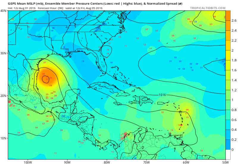
Re: ATL: INVEST 97L - Models
Not saying I agree but worth noting that some of the 12zCMC Ensembles are showing 97L gaining latitude once it enters the BOC.

1 likes
The following post is NOT an official forecast and should not be used as such. It is just the opinion of the poster and may or may not be backed by sound meteorological data. It is NOT endorsed by any professional institution including storm2k.org For Official Information please refer to the NHC and NWS products.
-
gatorcane

- S2K Supporter
- Posts: 23708
- Age: 48
- Joined: Sun Mar 13, 2005 3:54 pm
- Location: Boca Raton, FL
Re: ATL: INVEST 97L - Discussion
850mb vorticity looks stretched vertically according to CIMSS maps, not what you want to see if the system has a closed surface low.
0 likes
-
tolakram
- Admin
- Posts: 20179
- Age: 62
- Joined: Sun Aug 27, 2006 8:23 pm
- Location: Florence, KY (name is Mark)
Re: ATL: INVEST 97L - Discussion
1 likes
M a r k
- - - - -
Join us in chat: Storm2K Chatroom Invite. Android and IOS apps also available.
The posts in this forum are NOT official forecasts and should not be used as such. Posts are NOT endorsed by any professional institution or STORM2K.org. For official information and forecasts, please refer to NHC and NWS products.
-
wflamholtz

- Tropical Low

- Posts: 30
- Age: 30
- Joined: Sun Jul 31, 2016 8:30 pm
- Contact:
Re: ATL: INVEST 97L - Discussion
I wanna give my opinion on this system, which is heavily influenced by Tropical Tidbits discussion from tonight. Invest 97L hasn't developed yet mainly due to the lower-level vorticity moving faster than the mid-level circulation. The trade winds are essentially advecting that vorticity eastward, inhibiting it from consolidating. On several conditions it has come close, but the mixture of the decoupling of the two entities and the forward speed of vorticity/wave axis has not allowed it to be classified. So in a way, it is being sheared , but not in the traditional way.
As the storm moves past Jamaica, the trade winds slow, which should cause the entirety of the system to consolidate. At this point, a TC will develop, if not before. The SW movement of the vorticity you see in the models is basically the vorticity following the orientation of what's left of the wave axis, as it will be the mode of steering in the short term. The SW movement will be very subtle and will be a blip in 97L's progression, and the W/WNW movement will resume. Now a colleague of mine and I earlier were looking at the regions in the Atlantic Basin which rapid intensification is most significant/most likely. That happens to be the W Caribbean based on the historical record, just out of coincidence. The environment as the storm moves in the Bay of Honduras will be pretty good, where this storm may be able to make some noise. Maybe not an RI per say, but something significant is possible. After it hits the Yucatan, it remains to be seen where it ends up on the other side, and truthfully, is too early to tell. It may make it into the S Bay of Campeche, or get buried in Central America. So here are my thoughts, and I welcome any comments or criticism.
As the storm moves past Jamaica, the trade winds slow, which should cause the entirety of the system to consolidate. At this point, a TC will develop, if not before. The SW movement of the vorticity you see in the models is basically the vorticity following the orientation of what's left of the wave axis, as it will be the mode of steering in the short term. The SW movement will be very subtle and will be a blip in 97L's progression, and the W/WNW movement will resume. Now a colleague of mine and I earlier were looking at the regions in the Atlantic Basin which rapid intensification is most significant/most likely. That happens to be the W Caribbean based on the historical record, just out of coincidence. The environment as the storm moves in the Bay of Honduras will be pretty good, where this storm may be able to make some noise. Maybe not an RI per say, but something significant is possible. After it hits the Yucatan, it remains to be seen where it ends up on the other side, and truthfully, is too early to tell. It may make it into the S Bay of Campeche, or get buried in Central America. So here are my thoughts, and I welcome any comments or criticism.
3 likes

Re: ATL: INVEST 97L - Discussion
wflamholtz wrote:I wanna give my opinion on this system, which is heavily influenced by Tropical Tidbits discussion from tonight. Invest 97L hasn't developed yet mainly due to the lower-level vorticity moving faster than the mid-level circulation. The trade winds are essentially advecting that vorticity eastward, inhibiting it from consolidating. On several conditions it has come close, but the mixture of the decoupling of the two entities and the forward speed of vorticity/wave axis has not allowed it to be classified. So in a way, it is being sheared , but not in the traditional way.
As the storm moves past Jamaica, the trade winds slow, which should cause the entirety of the system to consolidate. At this point, a TC will develop, if not before. The SW movement of the vorticity you see in the models is basically the vorticity following the orientation of what's left of the wave axis, as it will be the mode of steering in the short term. The SW movement will be very subtle and will be a blip in 97L's progression, and the W/WNW movement will resume. Now a colleague of mine and I earlier were looking at the regions in the Atlantic Basin which rapid intensification is most significant/most likely. That happens to be the W Caribbean based on the historical record, just out of coincidence. The environment as the storm moves in the Bay of Honduras will be pretty good, where this storm may be able to make some noise. Maybe not an RI per say, but something significant is possible. After it hits the Yucatan, it remains to be seen where it ends up on the other side, and truthfully, is too early to tell. It may make it into the S Bay of Campeche, or get buried in Central America. So here are my thoughts, and I welcome any comments or criticism.
Nice thoughts. It is on the cusp of being Earl, but it just can't develop fully. Even as a wave, it still is producing TS conditions nonetheless. And over the western caribbean it should intensify before making landfall, and possibly remerge into the southern Bay of Campeche.
0 likes
Igor 2010, Sandy 2012, Fay 2014, Gonzalo 2014, Joaquin 2015, Nicole 2016, Humberto 2019, Imelda 2025
I am only a tropical weather enthusiast. My predictions are not official and may or may not be backed by sound meteorological data. For official information, please refer to the NHC and NWS products.
I am only a tropical weather enthusiast. My predictions are not official and may or may not be backed by sound meteorological data. For official information, please refer to the NHC and NWS products.
Who is online
Users browsing this forum: No registered users and 15 guests