ATL: HERMINE - Post-Tropical - Discussion
Moderator: S2k Moderators
-
hurricanehunter69
- Category 1

- Posts: 344
- Joined: Sun May 16, 2010 5:21 pm
- Location: New Orleans
Re: ATL: NINE - Tropical Depression - Discussion
I am "almost" convinced that this system has finally consolidated and we finally have Tropical Storm Hermine. Most all of us use the same tools but the one that closes the deal for me is (Mimic-TPW ). Check out how impressive and consolidated it looks on the link I posted. AS for track....I am not at all impressed with the development of the trough. It looks weak to me so far? I would be more worried about a "Hurricane" on the Florida Panhandle, and maybe as far west as Alabama. http://tropic.ssec.wisc.edu/real-time/m ... /main.html
1 likes
-
tropicwatch

- Category 5

- Posts: 3426
- Age: 62
- Joined: Sat Jun 02, 2007 10:01 am
- Location: The Villages, Florida
- Contact:
Re: ATL: NINE - Tropical Depression - Discussion
1am advisory: "...DEPRESSION MEANDERING OVER THE SOUTH-CENTRAL GULF OF MEXICO..."
Love the terminology
Love the terminology
1 likes
Tropicwatch
Agnes 72', Eloise 75, Elena 85', Kate 85', Charley 86', Florence 88', Beryl 94', Dean 95', Erin 95', Opal 95', Earl 98', Georges 98', Ivan 2004', Arlene 2005', Dennis 2005', Ida 2009' Debby 2012' Irma 2017' Michael 2018'
Agnes 72', Eloise 75, Elena 85', Kate 85', Charley 86', Florence 88', Beryl 94', Dean 95', Erin 95', Opal 95', Earl 98', Georges 98', Ivan 2004', Arlene 2005', Dennis 2005', Ida 2009' Debby 2012' Irma 2017' Michael 2018'

Re: ATL: NINE - Tropical Depression - Discussion
hurricanehunter69 wrote:I am "almost" convinced that this system has finally consolidated and we finally have Tropical Storm Hermine. Most all of us use the same tools but the one that closes the deal for me is (Mimic-TPW ). Check out how impressive and consolidated it looks on the link I posted. AS for track....I am not at all impressed with the development of the trough. It looks weak to me so far? I would be more worried about a "Hurricane" on the Florida Panhandle, and maybe as far west as Alabama. http://tropic.ssec.wisc.edu/real-time/m ... /main.html
A weaker trough usually means a more zonal flow, which a stronger trough would have a sharper tilt. Thus, the weak nature of the trough is why this is forecast to make a fairly hard ENE turn
4 likes

Re: ATL: NINE - Tropical Depression - Discussion
I don't think there's any doubt the system looks vastly improved over previous nights. It's big so I would suspect any strengthening would be gradual. I would continue to expect a rather sharp gradient in the heavy rain on the west side due to that dry air but the east and south sides are incredibly juiced.
0 likes
-
hurricanehunter69
- Category 1
- Posts: 344
- Joined: Sun May 16, 2010 5:21 pm
- Location: New Orleans
Re: ATL: NINE - Tropical Depression - Discussion
Alyono wrote:hurricanehunter69 wrote:I am "almost" convinced that this system has finally consolidated and we finally have Tropical Storm Hermine. Most all of us use the same tools but the one that closes the deal for me is (Mimic-TPW ). Check out how impressive and consolidated it looks on the link I posted. AS for track....I am not at all impressed with the development of the trough. It looks weak to me so far? I would be more worried about a "Hurricane" on the Florida Panhandle, and maybe as far west as Alabama. http://tropic.ssec.wisc.edu/real-time/m ... /main.html
A weaker trough usually means a more zonal flow, which a stronger trough would have a sharper tilt. Thus, the weak nature of the trough is why this is forecast to make a fairly hard ENE turn
Makes good sense man...cool! Ya know...at the end of the day, I don't care how strong storms get or for "the most part" where they go? I just like to know "why" they got as strong as they got and "why" they went where they went? So again, thanx!
1 likes

Re: ATL: NINE - Tropical Depression - Discussion
Aric Dunn wrote:Hammy wrote:SeGaBob wrote::uarrow: There is no way this is just a 30 mph TD
The planes have been in and out over the last day, and despite it looking better on satellite it's not actually improving much at the surface and based on the last ASCAT pass I don't think tonight is any different.
did you even read the discussion ?
I have indeed--and it was similar to last night only for the plane to arrive later and find that the system was just as disorganized as when the plane last left. Tomorrow will be no different especially with ASCAT showing this is not intensifying in the least. Latest satellite also shows a shrinking area of reds, and the convective burst from less than an hour ago has already collapsed with another line of convection even further away from the center.
1 likes
The above post is not official and should not be used as such. It is the opinion of the poster and may or may not be backed by sound meteorological data. It is not endorsed by any professional institution or storm2k.org. For official information, please refer to the NHC and NWS products.
Re: ATL: NINE - Tropical Depression - Discussion
Latest SAB fix is up to T3.0.
1 likes
Personal Forecast Disclaimer:
The posts in this forum are NOT official forecast and should not be used as such. They are just the opinion of the poster and may or may not be backed by sound meteorological data. They are NOT endorsed by any professional institution or storm2k.org. For official information, please refer to RSMC and NWS products.
The posts in this forum are NOT official forecast and should not be used as such. They are just the opinion of the poster and may or may not be backed by sound meteorological data. They are NOT endorsed by any professional institution or storm2k.org. For official information, please refer to RSMC and NWS products.
Re: ATL: NINE - Tropical Depression - Discussion
really starting to remind me of Fay (2008) pre genesis. I was quite frustrated with that one as well as it looked like a strong tropical storm on satellite, and very weak at the surface.
Not entirely sure how a setup like this occurs
Not entirely sure how a setup like this occurs
2 likes

Re: ATL: NINE - Tropical Depression - Discussion
this has got to be as far west as 9 can get. IMHO it should be moving at least N if not with some type of E component at least by noon. Also there is some energy pumping into the GA coast. That shouldnt develop into anything but it's a sign of things to come. Could be a few anxious days ahead. And y'all chill on Alyono.
3 likes
-
vbhoutex

- Storm2k Executive

- Posts: 29149
- Age: 74
- Joined: Wed Oct 09, 2002 11:31 pm
- Location: Cypress, TX
- Contact:
Re: ATL: NINE - Tropical Depression - Discussion
I have just deleted several posts and sent warnings concerning them.
EVERYONE is welcome to post their opinion concerning the weather on this site as long as it is done in a respectful manner.
EVERYONE is allowed to disagree with ANYONE on this site if it is done in a respectful manner.
The posts I have deleted were not respectful in any way. That is why they were deleted. We have a report button for a reason. Please use it so staff is aware of the "problem". That way we can take a look and address it as it needs to be addressed.
With the site running a t full tilt due to the very active tropics and possible landfalling systems within the next few days staff is being directed to at their discretion delete posts that do not adhere to our rules. This will be done without warning.
7 likes
Skywarn, C.E.R.T.
Please click below to donate to STORM2K to help with the expenses of keeping the site going:

Please click below to donate to STORM2K to help with the expenses of keeping the site going:
Re: ATL: NINE - Tropical Depression - Discussion
Steve wrote:this has got to be as far west as 9 can get. IMHO it should be moving at least N if not with some type of E component at least by noon. Also there is some energy pumping into the GA coast. That shouldnt develop into anything but it's a sign of things to come. Could be a few anxious days ahead. And y'all chill on Alyono.
We've got some good showers moving north along the west coast of florida too. lots of river flood warnings coming out for the usual suspects in west central florida.
1 likes
-
hurricanehunter69
- Category 1
- Posts: 344
- Joined: Sun May 16, 2010 5:21 pm
- Location: New Orleans
Re: ATL: NINE - Tropical Depression - Discussion
These things can and "Do" make "hard" right turns. Check out (on the link I provided) how Gaston comes to a complete stop and makes a hard right turn. However, we can clearly observe how it took a series of "strong" troughs to do the job. We are not observing anything even remotely close to the troughs in the NW Atlantic impinging upon future Hermine. I just don't see the storm making a hard right turn anytime soon. " Soon" being the proverbial word. moreover, I'm actually even having a hard time believing it will make a "right" turn at all....? Outside of rounding the periphery of a ridge. http://tropic.ssec.wisc.edu/real-time/m ... /main.html
1 likes
-
otowntiger
- Category 5
- Posts: 1932
- Joined: Tue Aug 31, 2004 7:06 pm
Re: ATL: NINE - Tropical Depression - Discussion
"really starting to remind me of Fay (2008) pre genesis. I was quite frustrated with that one as well as it looked like a strong tropical storm on satellite, and very weak at the surface."
Faye bright record rain and flooding to much of the peninsula that year.
Faye bright record rain and flooding to much of the peninsula that year.
1 likes
-
stormchasr
Re: ATL: NINE - Tropical Depression - Discussion
Looks as though the NNE turn is commencing.
0 likes

Re: ATL: NINE - Tropical Depression - Discussion
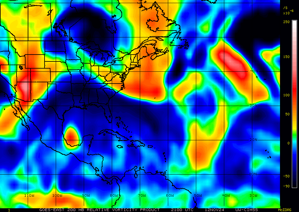
I have been watching the GFS 350K PV forecast and this may get interesting as TD9 gets close to the coast.
http://tc.met.psu.edu/tcgengifs/GFS/201 ... 350PV.anim
It will have some interaction with the ULL to the west for the next 24 hrs but then break away from it.
It looks like then the tropopause will be relatively high which would give it an opportunity for the cyclone to expand vertically.
Here is a closer look at it at +36 hrs
http://www.atmos.albany.edu/student/abe ... sen_63.gif
I will be watching future runs to see if more gray areas develop ahead of it.
Another measure of tropopause height is ozone.
It looks like it will be relatively lower over the GOM in the next couple days indicating a relatively higher level of the tropopause.
http://199.212.19.52/tmp/fn-4-n-de-e-32 ... 160902.gif
This will give TD9 vertical room for it to mantain its vorticity thru all levels.
0 likes
Re: ATL: NINE - Tropical Depression - Discussion
1C warm core but removed from the CoC with a 1C inversion at 1km.
In all honesty, I thought this would look better with the towers firing so close to the CoC.

In all honesty, I thought this would look better with the towers firing so close to the CoC.
0 likes
Re: ATL: NINE - Tropical Depression - Discussion
may be showing some signs of organization now
0 likes
Re: ATL: NINE - Tropical Depression - Discussion
Definitely getting some PV interaction with the ULL to its immediate west. It should break away in the next 24 hrs and give it an opportunity to possibly spin up.
0 likes
Re: ATL: NINE - Tropical Depression - Discussion
Alyono, will a stronger storm pull it more east or more northerly?
0 likes

Who is online
Users browsing this forum: No registered users and 89 guests