

http://www.opc.ncep.noaa.gov/Atl_tab.shtml
https://www.facebook.com/NWSOPC/posts/1164839483574781
Understanding current conditions is the starting point, and the most critical part, of any weather forecast. -cmc-
Moderator: S2k Moderators


SFLcane wrote:57 don't get not including dade in hurricane watch being 20 min away. With such a powerful hurricane and potential wind field expansions and wobbles its a very risky call. Also time table for a TS warning for me please?


SouthFLTropics wrote:Keep this for the models guys...please.


Evil Jeremy wrote:SFLcane wrote:57 don't get not including dade in hurricane watch being 20 min away. With such a powerful hurricane and potential wind field expansions and wobbles its a very risky call. Also time table for a TS warning for me please?
Warnings should come at 11pm. I won't be surprised if Dade gets a TS Warning/H Watch combo while everything north is H Warning.
I'm also expecting H Watches through Jax (at least) at 11.


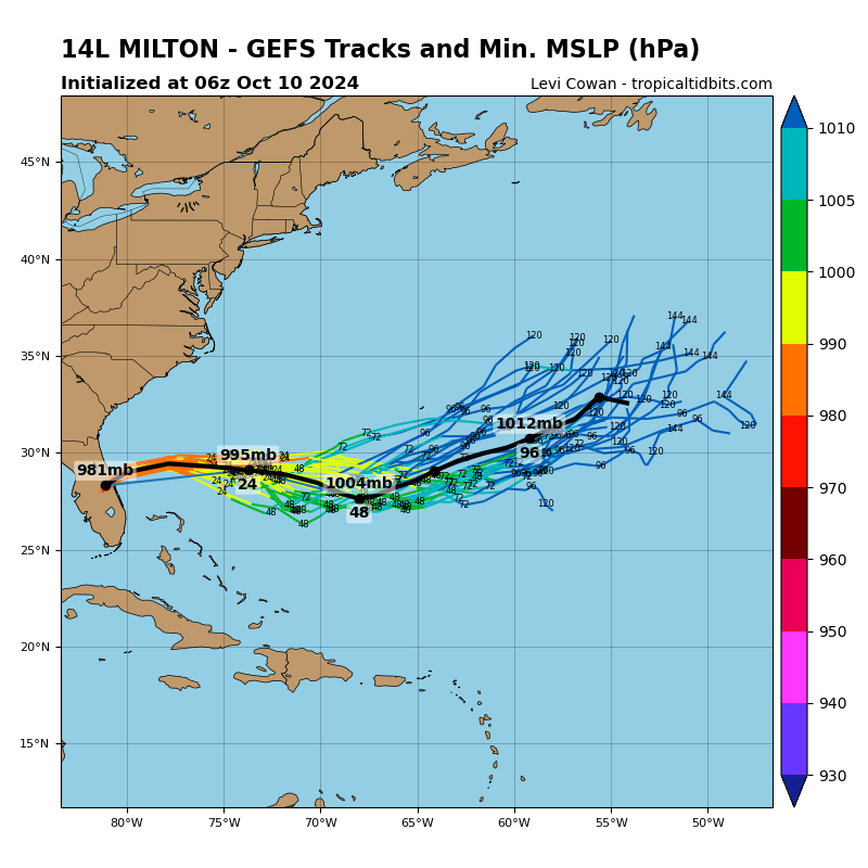
tolakram wrote:For those needing to catch up click the link in my signature to see an experimental tracking page with graphics of the last few GFS and ECMWF runs plus links to Tropical Tidbits where you can peruse all the recent runs.
Miami Storm Tracker wrote:Are the pages not refreashing or does no one have any way of updating me on the models
Miami Storm Tracker wrote:Are the pages not refreashing or does no one have any way of updating me on the models
ConvergenceZone wrote:Don't models suppose to run every 6 hours? For some reason we'd have one more EURO run before the one late tonight?
ConvergenceZone wrote:Don't models suppose to run every 6 hours? For some reason we'd have one more EURO run before the one late tonight?
Users browsing this forum: No registered users and 25 guests


