ATL: NATE - Post Tropical - Discussion

Moderator: S2k Moderators

Message
Author
User avatar
Steve
S2K Supporter
S2K Supporter
Posts: 9621
Joined: Sat Apr 05, 2003 11:41 pm
Location: Not a state-caster

Re: ATL: NATE - Models

#921 Postby Steve » Thu Oct 05, 2017 4:46 pm

SoupBone wrote:
Steve wrote:GFS 18Z is running. 2mb higher pressure (998 v 996) and a hair East though probably like 5 miles.

Slightly NNE of 12Z and both at 995mb at 18 hours

30 hours 993 both this and last run but a bit farther off the coast in this run.


Well that's not good. Graphic?


I'm on mobile but if you go to TT and click or toggle previous run/next run at 30 hours it will display.
1 likes   

Chris90
Category 2
Category 2
Posts: 646
Age: 35
Joined: Thu Jun 01, 2017 9:36 pm

Re: ATL: NATE - Tropical Storm - Discussion

#922 Postby Chris90 » Thu Oct 05, 2017 4:46 pm

That 50kts of shear, is it from the UL that Alyono mentioned was moving southwest and could enhance outflow? I know last year Matthew was under shear that from what I understand enhanced his outflow and he rapidly intensified.
I think Nate's time over the western Carib will give a better idea of his overall intensity. If his outflow is enhanced while over that extreme ohc, I think there's a chance he could rapidly intensified. I know it's a completely different set of conditions, but Wilma dropped from 954mb to 901mb in a period of only 5-6 hours in the west Carib. Dean went crazy there too. I think what Nate manages to do there and bring into the gulf will give everyone a better idea of what to expect in a few days.

This is a totally amateur opinion though, so it's just a guess.
0 likes   
Solar Aquarian
Lunar Cancerian
:uarrow: Sagittarian

Javlin
Category 5
Category 5
Posts: 1620
Age: 64
Joined: Fri Jul 09, 2004 7:58 pm
Location: ms gulf coast

Re: ATL: NATE - Tropical Storm - Discussion

#923 Postby Javlin » Thu Oct 05, 2017 4:48 pm

CrazyC83 wrote:
SoupBone wrote:Since it's quiet, someone humor me on a hypothetical. He has 50kts of shear right in his path, and I understand he's not supposed to strengthen until he hits the GoM. What's the disruptive potential with 50kts shear (short term)?


If it remained 50 kt, Nate would likely dissipate. I still think it is not impossible that such happens...but we'll see.


ULL moving out quick https://atmos.washington.edu/~ovens/loo ... nhanced+24
1 likes   

stormlover2013

Re: ATL: NATE - Models

#924 Postby stormlover2013 » Thu Oct 05, 2017 4:50 pm

Lol it's pretty close to the 12z
0 likes   

SunnyThoughts
Category 5
Category 5
Posts: 2263
Joined: Wed Jul 09, 2003 12:42 pm
Location: Pensacola, Florida

Re: ATL: NATE - Models

#925 Postby SunnyThoughts » Thu Oct 05, 2017 4:52 pm

The 2 things I take away from this run is the fact that the west trend may be over, and hopefully a trend of less intensity, although I know models don't necessarily get intensity correct.
1 likes   

Alyono
Professional-Met
Professional-Met
Posts: 6961
Joined: Fri Apr 26, 2013 3:52 pm
Location: Texas Coast

Re: ATL: NATE - Tropical Storm - Discussion

#926 Postby Alyono » Thu Oct 05, 2017 4:54 pm

I'm not seeing the rapid intensification NHC is talking about. While steady intensification is likely, I'm not convinced yet the UL gets far enough out of the way to allow this to explode. Low end hurricane is a good bet
5 likes   

User avatar
Bamagirl2408
Tropical Depression
Tropical Depression
Posts: 80
Joined: Wed Aug 24, 2016 11:19 pm
Location: Mobile AL

Re: ATL: NATE - Tropical Storm - Discussion

#927 Postby Bamagirl2408 » Thu Oct 05, 2017 4:55 pm

Mobile here. We are supposed to travel to Birmingham Friday and return Sat night. I keep seeing models and talk shift west to Louisiana. Would you go or do you think a shift back east is possible?
0 likes   

User avatar
Steve
S2K Supporter
S2K Supporter
Posts: 9621
Joined: Sat Apr 05, 2003 11:41 pm
Location: Not a state-caster

Re: ATL: NATE - Models

#928 Postby Steve » Thu Oct 05, 2017 4:57 pm

SunnyThoughts wrote:The 2 things I take away from this run is the fact that the west trend may be over, and hopefully a trend of less intensity, although I know models don't necessarily get intensity correct.


Not sure. GFS had not much this morning and reversed on the 12 and 18 runs. Most models trended west today. I have no idea on intensification but I don't think we see any or at least not much until off the YP. Also, with the speed Nate should be moving across the Gulf through landfall, there doesn't appear to be enough time for this to get very strong at all. That's not to downplay toppled trees, power outages, coastal flooding and flooding outside the levee protection areas. But instead of a couple of days of weather, it's probably 6-10 hours and out. Hopefully there are no levee issues here because that's the only way the City of N.O. pays.
2 likes   

stormreader

Re: ATL: NATE - Models

#929 Postby stormreader » Thu Oct 05, 2017 4:59 pm

SunnyThoughts wrote:The 2 things I take away from this run is the fact that the west trend may be over, and hopefully a trend of less intensity, although I know models don't necessarily get intensity correct.

Basically GFS is holding firm with a central-west La solution.
0 likes   

tolakram
Admin
Admin
Posts: 20010
Age: 62
Joined: Sun Aug 27, 2006 8:23 pm
Location: Florence, KY (name is Mark)

Re: ATL: NATE - Tropical Storm - Discussion

#930 Postby tolakram » Thu Oct 05, 2017 4:59 pm

Bamagirl2408 wrote:Mobile here. We are supposed to travel to Birmingham Friday and return Sat night. I keep seeing models and talk shift west to Louisiana. Would you go or do you think a shift back east is possible?


Yes, always possible.

As for shear, step through the frames to see how it's changing. If the ULL moves west fast enough Nate gets less shear, otherwise a weak and sheared TS seems most likely IMO.

http://tropic.ssec.wisc.edu/real-time/windmain.php?&basin=atlantic&sat=wg8&prod=shr&zoom=&time=
1 likes   
M a r k
- - - - -
Join us in chat: Storm2K Chatroom Invite. Android and IOS apps also available.

The posts in this forum are NOT official forecasts and should not be used as such. Posts are NOT endorsed by any professional institution or STORM2K.org. For official information and forecasts, please refer to NHC and NWS products.

User avatar
tailgater
S2K Supporter
S2K Supporter
Posts: 3339
Joined: Sun Jul 11, 2004 9:13 pm
Location: St. Amant La.

Re: ATL: NATE - Tropical Storm - Discussion

#931 Postby tailgater » Thu Oct 05, 2017 5:02 pm

The little" non" Tropical low west of Key West is showing up nicely on tropical moisture loop. Interesting times ahead.
Image
2 likes   
The following post is NOT an official forecast and should not be used as such. It is just the opinion of the poster and may or may not be backed by sound meteorological data. It is NOT endorsed by any professional institution including storm2k.org For Official Information please refer to the NHC and NWS products.

bella_may
Category 4
Category 4
Posts: 908
Joined: Wed Dec 22, 2010 2:13 pm
Location: SE Mississippi coast

Re: ATL: NATE - Models

#932 Postby bella_may » Thu Oct 05, 2017 5:07 pm

stormreader wrote:
SunnyThoughts wrote:The 2 things I take away from this run is the fact that the west trend may be over, and hopefully a trend of less intensity, although I know models don't necessarily get intensity correct.

Basically GFS is holding firm with a central-west La solution.


Actually about 25 miles or so to the east of the last run. Right into New Orleans
1 likes   

Javlin
Category 5
Category 5
Posts: 1620
Age: 64
Joined: Fri Jul 09, 2004 7:58 pm
Location: ms gulf coast

Re: ATL: NATE - Models

#933 Postby Javlin » Thu Oct 05, 2017 5:10 pm

5pm discussion

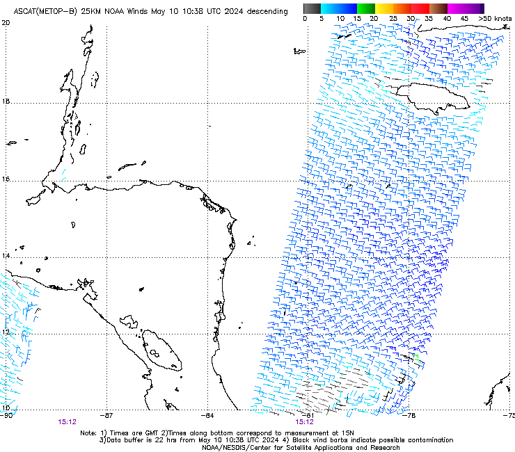
Analyses from CIMSS at the University of Wisconsin suggest that
Nate is currently experiencing about 20 kt of southwesterly vertical
wind shear, which is more than suggested by the SHIPS model. The
large-scale models are in good agreement that this shear should
diminish during the next 12-24 h, leaving Nate in an favorable
environment for strengthening. One change in the models from the
previous advisory is that the GFS now shows more development as Nate
crosses the Gulf of Mexico. The new intensity forecast shows little
change during the first 12 h due to the shear and land interaction,
then it calls for steady intensification though landfall on the
northern Gulf Coast. After landfall, Nate should weaken as it
traverses the eastern United States. It should be noted that while
the forecast shows a peak intensity of 70 kt at 48 h, Nate is
expected to continue to strengthen between 48 h and landfall and
thus is likely to be stronger than 70 kt.
It should also be noted
that SHIPS Rapid Intensification Index values remain quite high, and
any period of rapid intensification would lead to Nate being
stronger than currently forecast.

The initial motion is now 330/9. A combination of a large cyclonic
gyre over Central America, a trough of low pressure moving westward
across the Gulf of Mexico, and a building subtropical ridge over
the western Atlantic should steer Nate generally north-northwestward
with an increase in forward speed during the next 48 h or so,
followed by a turn toward the north as the storm reaches the
western end of the ridge.
The guidance is in decent agreement on
the direction of motion, but there remains disagreement on the speed
despite a continued trend toward a faster motion. The new forecast
track is similar to the direction of the previous track, but again
shows a faster forward speed that now has the center near the
northeastern Yucatan Peninsula in 24-36 h and near the northern Gulf
Coast in 60-72 h. After the Gulf Coast landfall, Nate or its
remnants are expected to recurve northeastward upon encountering the
mid-latitude westerlies.
0 likes   

User avatar
bevgo
S2K Supporter
S2K Supporter
Posts: 634
Joined: Tue Jul 22, 2003 12:46 pm
Location: Ocean Springs, MS

Re: ATL: NATE - Tropical Storm - Discussion

#934 Postby bevgo » Thu Oct 05, 2017 5:21 pm

How did I find my elevation above sea level for my home?
0 likes   

User avatar
wxman57
Moderator-Pro Met
Moderator-Pro Met
Posts: 22979
Age: 67
Joined: Sat Jun 21, 2003 8:06 pm
Location: Houston, TX (southwest)

Re: ATL: NATE - Tropical Storm - Discussion

#935 Postby wxman57 » Thu Oct 05, 2017 5:22 pm

No recon yet today, but ASCAT hit Nate at 1534Z this morning. No TS winds offshore Nicaragua or Honduras. As the NHC stated, they were being a bit generous with the 35kt assessment. Meanwhile, models are coming into very good agreement on a SE LA landfall. How strong, though? Lots of uncertainty there.

Image
0 likes   

bohaiboy
Tropical Depression
Tropical Depression
Posts: 86
Joined: Sat Aug 09, 2008 11:20 am

Re: ATL: NATE - Tropical Storm - Discussion

#936 Postby bohaiboy » Thu Oct 05, 2017 5:25 pm

Download Google Earth. In the lower right corner it will give you the elevation of where your cursor is placed on the screen. PM me your rough location and I will look it up for you.
0 likes   
TW in Texas Hill Country :flag:

User avatar
galaxy401
Category 5
Category 5
Posts: 2419
Age: 30
Joined: Sat Aug 25, 2012 9:04 pm
Location: Casa Grande, Arizona

Re: ATL: NATE - Tropical Storm - Discussion

#937 Postby galaxy401 » Thu Oct 05, 2017 5:29 pm

Nate is already a deadly storm. 22 dead and could still climb some more.
1 likes   
Got my eyes on moving right into Hurricane Alley: Florida.

Alyono
Professional-Met
Professional-Met
Posts: 6961
Joined: Fri Apr 26, 2013 3:52 pm
Location: Texas Coast

Re: ATL: NATE - Tropical Storm - Discussion

#938 Postby Alyono » Thu Oct 05, 2017 5:36 pm

galaxy401 wrote:Nate is already a deadly storm. 22 dead and could still climb some more.


hundreds of dead will not surprise me as that rainband could bring another 10-15 inches of rain to Costa Rica and Nicaragua
0 likes   

User avatar
latitude_20
Tropical Storm
Tropical Storm
Posts: 196
Joined: Wed Jun 30, 2010 6:46 am
Location: Tulum, Mexico
Contact:

Re: ATL: NATE - Tropical Storm - Discussion

#939 Postby latitude_20 » Thu Oct 05, 2017 5:40 pm

Chris90 wrote:That 50kts of shear, is it from the UL that Alyono mentioned was moving southwest and could enhance outflow? I know last year Matthew was under shear that from what I understand enhanced his outflow and he rapidly intensified.
I think Nate's time over the western Carib will give a better idea of his overall intensity. If his outflow is enhanced while over that extreme ohc, I think there's a chance he could rapidly intensified. I know it's a completely different set of conditions, but Wilma dropped from 954mb to 901mb in a period of only 5-6 hours in the west Carib. Dean went crazy there too. I think what Nate manages to do there and bring into the gulf will give everyone a better idea of what to expect in a few days.

This is a totally amateur opinion though, so it's just a guess.


Sure hope that doesn't happen. At this point Nate is projected to make landfall on the Yucatan right on my front lawn, lol.
1 likes   

SunnyThoughts
Category 5
Category 5
Posts: 2263
Joined: Wed Jul 09, 2003 12:42 pm
Location: Pensacola, Florida

Re: ATL: NATE - Tropical Storm - Discussion

#940 Postby SunnyThoughts » Thu Oct 05, 2017 5:55 pm

Image


Do you guys think it has emerged back into the water?
0 likes   


Return to “2017”

Who is online

Users browsing this forum: No registered users and 7 guests