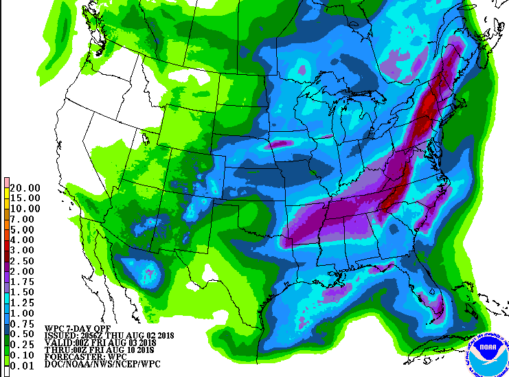
#1074 Postby weatherdude1108 » Thu Aug 02, 2018 3:32 pm
Slight hint of a pattern change at the end of the discussion, compared to "status quo" on yesterday's discussion.
I think EWX is partial to the GFS. They seem to mimick what I see on the GFS. Although they sometimes side with the Euro. Anyway, just a passing thought.
Area Forecast Discussion
National Weather Service Austin/San Antonio TX
241 PM CDT Thu Aug 2 2018
.SHORT TERM (Tonight through Friday Night)...
Return flow this afternoon will start to increase moisture levels
going into the weekend. Trough that is located over the Mississippi
Valley has begun to lift today and will continue to, as the
subtropical ridge out west slowly works its way into West TX and the
subtropical ridge out east begins to build. Light winds and clear
skies are expected overnight tonight and will allow for effective
radiative cooling. However, slightly higher surface moisture values
in place should prevent the exceptional cooling the region saw last
night. Daytime temperatures for Friday are expected to be a couple
degrees above climo norms.
&&
.LONG TERM (Saturday through Thursday)...
As the upper level trough fractures from the subtropical ridge
building in over the central US, an inverted trough will be left in
the western Gulf. This feature will move into far southern TX on
Saturday and then into Mexico, bringing a surge of moisture and a
chance for diurnally driven seabreeze convection. Have kept 20-30
afternoon POPs for the weekend and into Monday for the Coastal Plains.
Temperatures after Monday will begin a mild warming trend as the
ridge makes it`s present felt with less cloud cover and general
subsidence. Towards the end of the forecast period, the ridge will
again shift back out to the western part of the country. This
movement of the ridge should allow chances for disturbances to make
their way over central TX embedded in the mean flow of a developing
trough over the central US.
1 likes
The preceding post is NOT an official forecast, and should not be used as such. It is only the opinion of the poster and may or may not be backed by sound meteorological data. It is NOT endorsed by any professional institution including storm2k.org. For Official Information please refer to the NHC and NWS products.


