2018 Tropics: Global Model Runs Discussion (Out to day 16)
Moderator: S2k Moderators
Forum rules

The posts in this forum are NOT official forecasts and should not be used as such. They are just the opinion of the poster and may or may not be backed by sound meteorological data. They are NOT endorsed by any professional institution or STORM2K. For official information, please refer to products from the National Hurricane Center and National Weather Service.
-
gatorcane

- S2K Supporter

- Posts: 23708
- Age: 48
- Joined: Sun Mar 13, 2005 3:54 pm
- Location: Boca Raton, FL
Re: 2018 Tropics: Global Model Runs Discussion (Out to day 16)
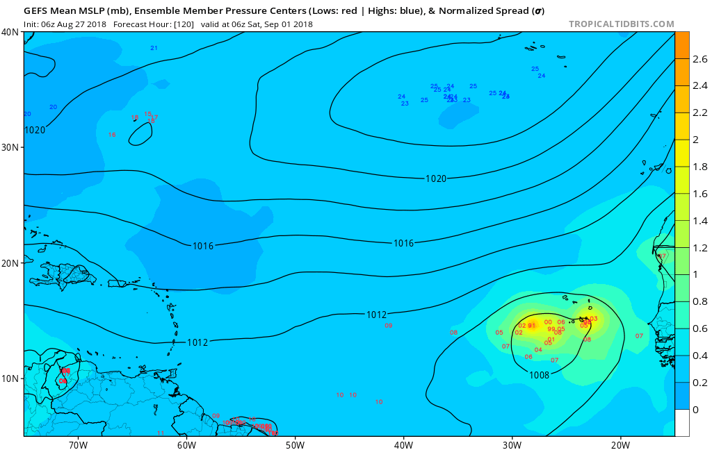
GFS ensembles remain bullish. Just 5 days from now:
0 likes


Re: 2018 Tropics: Global Model Runs Discussion (Out to day 16)
Pretty stout 500 mb ridging setting up over the western Atlantic/Eastern US for the westernmost low pressure in the ECM in both the 00z operational and ensemble run.
https://www.tropicaltidbits.com/analysis/models/?model=ecmwf®ion=atl&pkg=z500_mslp&runtime=2018082700&fh=240
https://www.tropicaltidbits.com/analysis/models/?model=ecmwf®ion=atl&pkg=z500_mslp&runtime=2018082700&fh=240
0 likes
-
Aric Dunn
- Category 5

- Posts: 21238
- Age: 43
- Joined: Sun Sep 19, 2004 9:58 pm
- Location: Ready for the Chase.
- Contact:
Re: 2018 Tropics: Global Model Runs Discussion (Out to day 16)
That circ just off the African Coast is slowly moving.. looking at the models. appears it will stay rather stationary until the next surge/ wave approaches. It is still looking rather good all by itself.
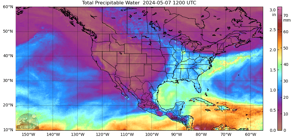
You can see it quite nicely on TPW.. HIghly likely something comes from this or the combination of this and another wave.

You can see it quite nicely on TPW.. HIghly likely something comes from this or the combination of this and another wave.
1 likes
Note: If I make a post that is brief. Please refer back to previous posts for the analysis or reasoning. I do not re-write/qoute what my initial post said each time.
If there is nothing before... then just ask
Space & Atmospheric Physicist, Embry-Riddle Aeronautical University,
I believe the sky is falling...
If there is nothing before... then just ask
Space & Atmospheric Physicist, Embry-Riddle Aeronautical University,
I believe the sky is falling...
-
stormlover2013
Re: 2018 Tropics: Global Model Runs Discussion (Out to day 16)
Looks like these waves will get to the Carrib and GOM or the will be fish storms, if I was a betting man the GOM will have 2-3 named storms in sept.
0 likes

Re: 2018 Tropics: Global Model Runs Discussion (Out to day 16)
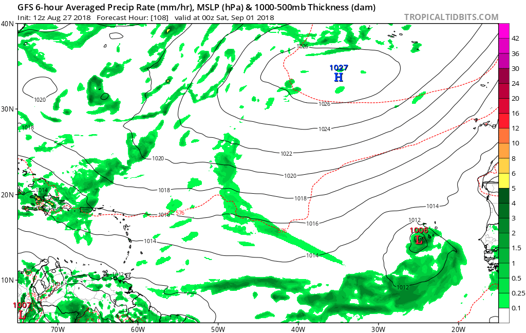
Looks like we have consistency on the twin development in MDR.
Euro:

GFS

CMC

Euro:
GFS
CMC
0 likes
The following post is NOT an official forecast and should not be used as such. It is just the opinion of the poster and may or may not be backed by sound meteorological data. It is NOT endorsed by any professional institution including storm2k.org For Official Information please refer to the NHC and NWS products.
-
chris_fit

- Category 5
- Posts: 3261
- Age: 43
- Joined: Wed Sep 10, 2003 11:58 pm
- Location: Tampa Bay Area, FL
Re: 2018 Tropics: Global Model Runs Discussion (Out to day 16)
Yea, that is some pretty good agreement between various models. Kinda ominous looking to be honest.
0 likes
-
Aric Dunn
- Category 5
- Posts: 21238
- Age: 43
- Joined: Sun Sep 19, 2004 9:58 pm
- Location: Ready for the Chase.
- Contact:
Re: 2018 Tropics: Global Model Runs Discussion (Out to day 16)
Anyone else notice the Euro and GFS have something potentially developing in the western atlantic and gulf? GFS into florida the EUro farther south and does not develop till gulf. small and weak but worth watching..
Also just randomly noticed a nice Pouch on the TPW Cruising west few hundred miles north of PR and DR. models dont do much with it. but convection has increased this morning and there is some weak circ/vorticity. also worth watching.

Also just randomly noticed a nice Pouch on the TPW Cruising west few hundred miles north of PR and DR. models dont do much with it. but convection has increased this morning and there is some weak circ/vorticity. also worth watching.
0 likes
Note: If I make a post that is brief. Please refer back to previous posts for the analysis or reasoning. I do not re-write/qoute what my initial post said each time.
If there is nothing before... then just ask
Space & Atmospheric Physicist, Embry-Riddle Aeronautical University,
I believe the sky is falling...
If there is nothing before... then just ask
Space & Atmospheric Physicist, Embry-Riddle Aeronautical University,
I believe the sky is falling...
-
Bocadude85

- Category 5
- Posts: 2991
- Age: 39
- Joined: Mon Apr 18, 2005 2:20 pm
- Location: Honolulu,Hi
Re: 2018 Tropics: Global Model Runs Discussion (Out to day 16)
Aric Dunn wrote:Anyone else notice the Euro and GFS have something potentially developing in the western atlantic and gulf? GFS into florida the EUro farther south and does not develop till gulf. small and weak but worth watching..
Also just randomly noticed a nice Pouch on the TPW Cruising west few hundred miles north of PR and DR. models dont do much with it. but convection has increased this morning and there is some weak circ/vorticity. also worth watching.
Yes I saw that on the model runs this morning, very weak but definitely worth watching. GFS is into central Florida and Euro is through the straits and into the GOM, split the difference and we could be looking at a weak TS hitting S.Fla and then heading into the GOM.
0 likes
Re: 2018 Tropics: Global Model Runs Discussion (Out to day 16)
The German Icon model has something forming east of the Bahamas in two days.
Last edited by BobHarlem on Mon Aug 27, 2018 10:00 am, edited 1 time in total.
0 likes
Re: 2018 Tropics: Global Model Runs Discussion (Out to day 16)
Aric Dunn wrote:Anyone else notice the Euro and GFS have something potentially developing in the western atlantic and gulf? GFS into florida the EUro farther south and does not develop till gulf. small and weak but worth watching..
Also just randomly noticed a nice Pouch on the TPW Cruising west few hundred miles north of PR and DR. models dont do much with it. but convection has increased this morning and there is some weak circ/vorticity. also worth watching.
[]http://tropic.ssec.wisc.edu/real-time/mtpw2/webAnims/tpw_nrl_colors/conus/mimictpw_conus_latest.gif[/img]
[https://weather.msfc.nasa.gov/goes/abi/dynamic/GOES13172018239QNrhOQ.jpg[/img]
Aric, we have been following that wave in the thread for the Lesser Antilles. It has been showing potential for several days.
1 likes
The following post is NOT an official forecast and should not be used as such. It is just the opinion of the poster and may or may not be backed by sound meteorological data. It is NOT endorsed by any professional institution including storm2k.org For Official Information please refer to the NHC and NWS products.

Re: 2018 Tropics: Global Model Runs Discussion (Out to day 16)
BobHarlem wrote:The German Icon model has something forming east of the Bahamas in two days.
I just started a new thread on the vorticity you and Aric pointed out earlier this morning.
2 likes
-
gatorcane
- S2K Supporter
- Posts: 23708
- Age: 48
- Joined: Sun Mar 13, 2005 3:54 pm
- Location: Boca Raton, FL
Re: 2018 Tropics: Global Model Runs Discussion (Out to day 16)
The GFS again going with development near the Cabo Verde islands within 5 days. The model has shifted south with the track. Time for the NHC to mention this area:
0 likes
-
cycloneye

- Admin

- Posts: 149339
- Age: 69
- Joined: Thu Oct 10, 2002 10:54 am
- Location: San Juan, Puerto Rico
Re: 2018 Tropics: Global Model Runs Discussion (Out to day 16)
I made a thread for the Tropical Wave that models develop so post the runs over there.
viewtopic.php?f=31&t=119793&p=2694332#p2694332
viewtopic.php?f=31&t=119793&p=2694332#p2694332
0 likes
Visit the Caribbean-Central America Weather Thread where you can find at first post web cams,radars
and observations from Caribbean basin members Click Here
and observations from Caribbean basin members Click Here
-
chris_fit
- Category 5
- Posts: 3261
- Age: 43
- Joined: Wed Sep 10, 2003 11:58 pm
- Location: Tampa Bay Area, FL
Re: 2018 Tropics: Global Model Runs Discussion (Out to day 16)
12Z GFS not really enthusiastic... couple lack luster TS that die off or get curved out to sea
0 likes
-
wxGuy
Re: 2018 Tropics: Global Model Runs Discussion (Out to day 16)
stormlover2013 wrote:Looks like these waves will get to the Carrib and GOM or the will be fish storms, if I was a betting man the GOM will have 2-3 named storms in sept.
me and you both bullish on a gom storm
1 likes
-
SFLcane

- S2K Supporter
- Posts: 10281
- Age: 48
- Joined: Sat Jun 05, 2010 1:44 pm
- Location: Lake Worth Florida
Re: 2018 Tropics: Global Model Runs Discussion (Out to day 16)
chris_fit wrote:12Z GFS not really enthusiastic... couple lack luster TS that die off or get curved out to sea
Bla...yep few likely sheared systems recurving into open Atlantic. It’s been a quite one that’s for sure enjoying it to after last yrs season.
0 likes
-
galaxy401

- Category 5
- Posts: 2446
- Age: 30
- Joined: Sat Aug 25, 2012 9:04 pm
- Location: Casa Grande, Arizona
Re: 2018 Tropics: Global Model Runs Discussion (Out to day 16)
SFLcane wrote:chris_fit wrote:12Z GFS not really enthusiastic... couple lack luster TS that die off or get curved out to sea
Bla...yep few likely sheared systems recurving into open Atlantic. It’s been a quite one that’s for sure enjoying it to after last yrs season.
12Z GFS runs are the only ones that don't show much development. All the other runs are more enthusiastic.
0 likes
Got my eyes on moving right into Hurricane Alley: Florida.
-
toad strangler

- S2K Supporter
- Posts: 4546
- Joined: Sun Jul 28, 2013 3:09 pm
- Location: Earth
- Contact:
Re: 2018 Tropics: Global Model Runs Discussion (Out to day 16)
SFLcane wrote:chris_fit wrote:12Z GFS not really enthusiastic... couple lack luster TS that die off or get curved out to sea
Bla...yep few likely sheared systems recurving into open Atlantic. It’s been a quite one that’s for sure enjoying it to after last yrs season.
Not me. I want them lined up like 5PM flights into O'Hare. Oh well.
0 likes
My Weather Station
https://www.wunderground.com/dashboard/pws/KFLPORTS603
https://www.wunderground.com/dashboard/pws/KFLPORTS603
-
chris_fit
- Category 5
- Posts: 3261
- Age: 43
- Joined: Wed Sep 10, 2003 11:58 pm
- Location: Tampa Bay Area, FL
Re: 2018 Tropics: Global Model Runs Discussion (Out to day 16)
Is it just me or did CMC model stop at 128 hours for the 12z run?
0 likes
Who is online
Users browsing this forum: JetFuel_SE and 83 guests