hurricaneCW wrote:The Euro initialized this about 30mb weaker than it currently is, makes me think it's still too far west.
Gun to my head I would go with a track in between the Euro and Gfs.
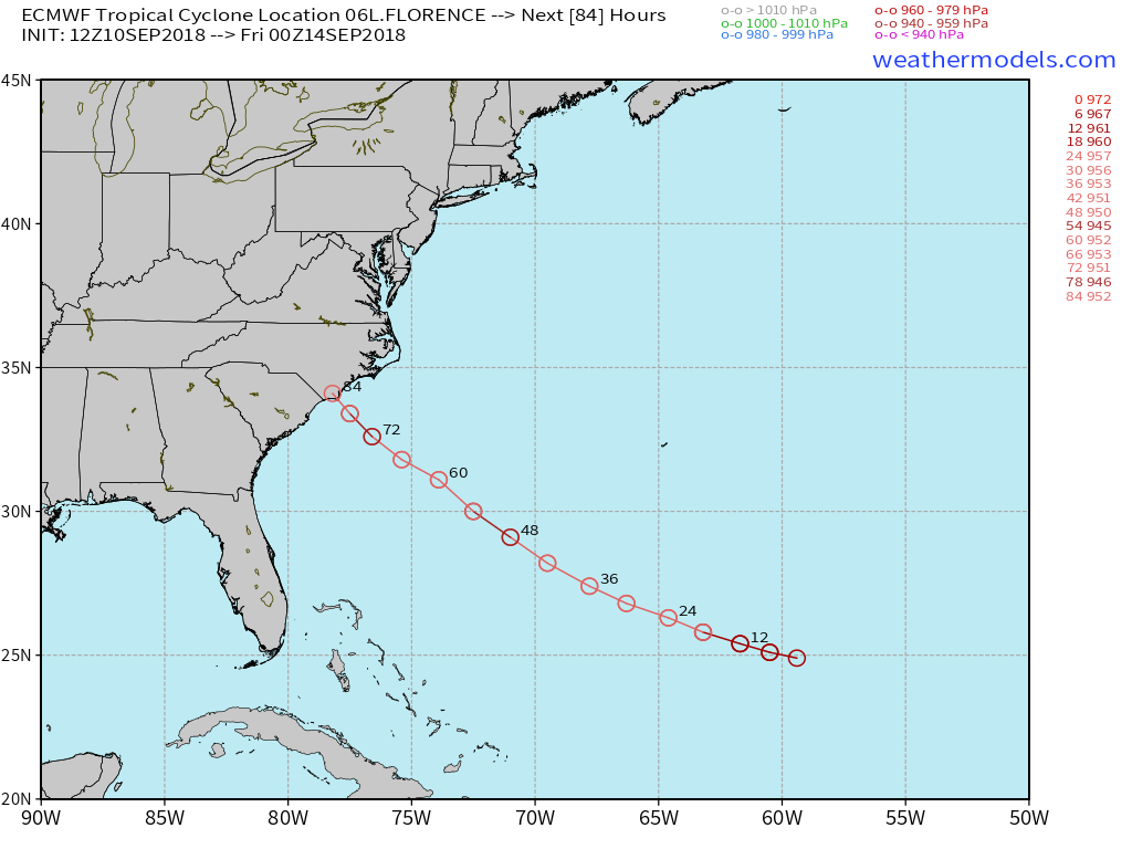
Morehead City.
Moderator: S2k Moderators
hurricaneCW wrote:The Euro initialized this about 30mb weaker than it currently is, makes me think it's still too far west.
Gun to my head I would go with a track in between the Euro and Gfs.

Ken711 wrote:hurricaneCW wrote:The Euro initialized this about 30mb weaker than it currently is, makes me think it's still too far west.
Gun to my head I would go with a track in between the Euro and Gfs.
Morehead City.
tarheelprogrammer wrote:txwatcher91 wrote:Euro shifted north some and no longer bends this west once inland. Instead it seems to take the center up to the Raleigh area. See below link.
http://wx.graphics/models/ecmwf_florence.png
Trending toward the GFS.


txwatcher91 wrote:To summarize the 12z runs...
GFS - East shift, stalls off the coast then shoved west and inland.
FV3 - Nearly the same track with landfall between ILM and MHX.
HWRF - Shifts north, landfall near ILM
Euro - Shifts north, landfall near ILM
HMON - Slight west shift, landfall near MHX
ICON - Shifts west to MHX stall and then drifts north to VA
UK - Shifts west with landfall between ILM and MHX
JMA - Shifts west with landfall between ILM and MHX
Users browsing this forum: No registered users and 349 guests


