bubba hotep wrote:For those still looking for some small iota of hope, there are 4 SREF members that have over 2" of snow at DFW. The mean is 0.64 with nearly 20 members showing no snow at all.
Many GEFS still have at least a trace as well.
Moderator: S2k Moderators


bubba hotep wrote:For those still looking for some small iota of hope, there are 4 SREF members that have over 2" of snow at DFW. The mean is 0.64 with nearly 20 members showing no snow at all.


srainhoutx wrote:TexasF6 wrote:Anyone have a source region for the air? US Snow cover is ok, but I look for moderating to be an issue with temps unless the source is a good one!
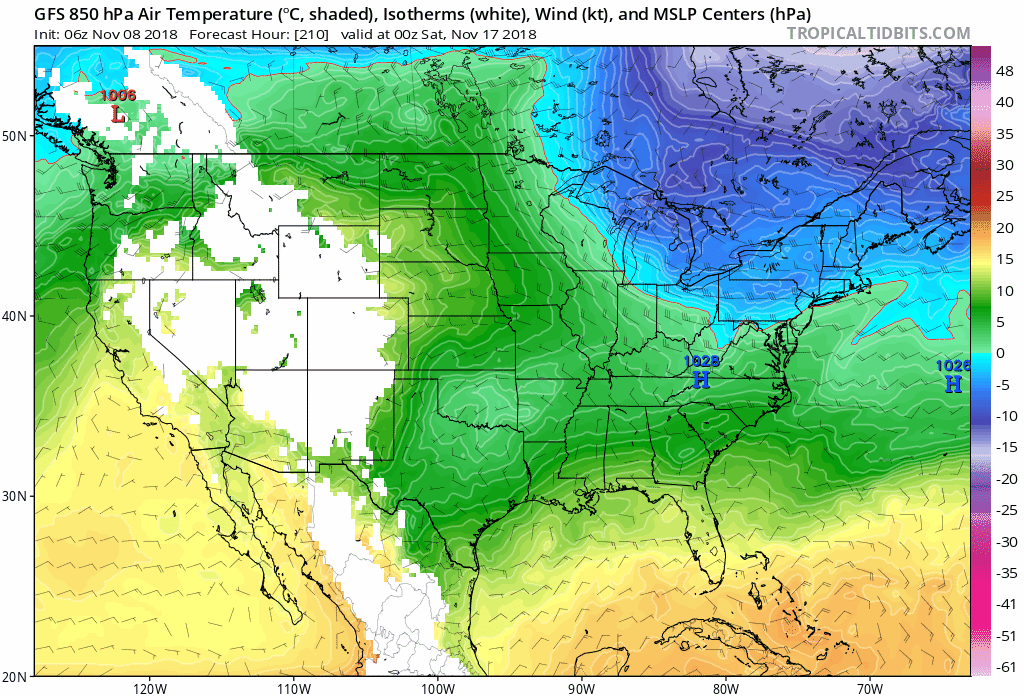
The cold air originated in Siberia and near Greenland A sprawling 1050mb High over Eastern Russia and Eastern Europe is assisting with shuffling the cold air across the North Pole into Canada. A strong shortwave upper trough is currently diving S over the Yukon Territories that will send a 1040mb+ Artic High into Colorado Monday. That High may build to near 1050mb Monday into Tuesday. It actually a function of perturbed Polar Vortex event that happened about a week ago. Interestingly the long range 10mb models suggest and perturbed round of that Polar Vortex may occur around Thanksgiving that may lead to another strong shot of Artic Air in early to mid December. Time will tell.
bubba hotep wrote:I posted a bit ago that my winter thinking was that December would carry the greatest warm risk out of DJF. However, a disrupted Polar Vortex could total change that by unleashing a big cold dump.
Ntxw wrote:bubba hotep wrote:I posted a bit ago that my winter thinking was that December would carry the greatest warm risk out of DJF. However, a disrupted Polar Vortex could total change that by unleashing a big cold dump.
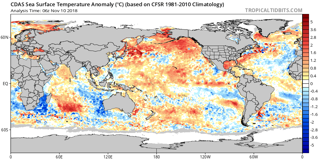
A warm December is good Nino climo. I'd make the argument the very warm NE Pacific is going to muddle that traditional logic. 500mb heights have averaged much above the past 90 days over that region. In a normal Nino state you'll see a very cold Aleutians->GOA.
So instead of a warm W-Canada the opposite is going to happen with a very cold region.
https://images2.imgbox.com/a6/25/H9HhdiPa_o.png


Cerlin wrote:Models are trending farther and farther away from DFW snow. 18z NAM (12k) has virtually nothing for DFW.
Brent wrote:Cerlin wrote:Models are trending farther and farther away from DFW snow. 18z NAM (12k) has virtually nothing for DFW.
How shocking
Cerlin wrote:Models are trending farther and farther away from DFW snow. 18z NAM (12k) has virtually nothing for DFW.
Ralph's Weather wrote:Cerlin wrote:Models are trending farther and farther away from DFW snow. 18z NAM (12k) has virtually nothing for DFW.
At this point have to hope for the STJ to supply some additional moisture that the models are missing.


somethingfunny wrote:How much rain is expected though?
Return to “USA & Caribbean Weather”
Users browsing this forum: Brent, ElectricStorm and 35 guests


