 The posts in this forum are NOT official forecast and should not be used as such. They are just the opinion of the poster and may or may not be backed by sound meteorological data. They are NOT endorsed by any professional institution or

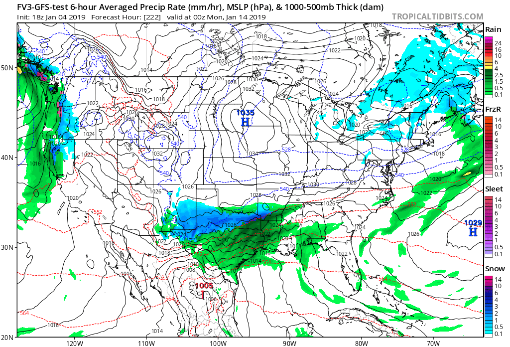
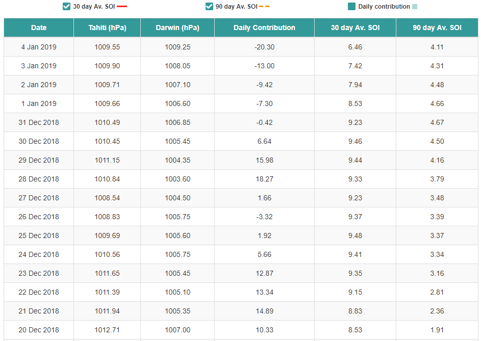
Cpv17 wrote:Ntxw wrote:Here is your first sign the Pacific is changing below with the SOI crash. Tahiti's pressures is lowering while Darwin's is rising. These mean tropical convection is moving out of the Maritimes/WPAC and into the Central Pacific. Continuous retrogression of the Aleutian low to follow the convection pullback from the IO which raises heights over western North America. SSW is a very slow process as the MSLP configuration changes from warmer Arctic to colder Continents. We like to think of SSW as instant game changers but top down events are not. It took heat fluxes from October to November to get the vortex perturbed then split didn't happen until this past week. The circulations will take a few weeks longer to propagate downward as it is not a bottom-up event.
https://images2.imgbox.com/ee/d6/sUXJflyd_o.png
There is a small set of years with warm ENSO and a flip from +Dec soi to -Jan since 1950. Those years are 2003-2004, 1993-1994, 1969-1970, 1968-1969, 1965-1966. These are not all analogs only the complete reversal of the SOI in a particular ENSO state.
It’s strange because I saw many winter forecasts that called for below average rain for the NW and it’s been anything but that. They’ve been getting slammed with deluge after deluge and some of the higher elevated areas around there and in far SW Canada have measured snow totals by the dozens.
We have had a lot of storms slamming the NW then diving south into the SW before slicing NE. As the NE Pacific pattern retrogrades then the NW should dry out and our storms will come more from Baja as a more El Nino like pattern sets up. The December pattern is not indicative of the overall winter pattern as it was really the loading month for the atmosphere, this load is just now beginning to show signs of being unleashed.


