Kingarabian wrote:FWIW, GEPS (CMC ensembles) mean is also OTS:
https://i.imgur.com/DRTt5LS.png
How can they have it approaching the coast at 997mb? That just seems incredibly unlikely, doesn't it?
Moderator: S2k Moderators


Kingarabian wrote:FWIW, GEPS (CMC ensembles) mean is also OTS:
https://i.imgur.com/DRTt5LS.png

Hurrilurker wrote:Kingarabian wrote:FWIW, GEPS (CMC ensembles) mean is also OTS:
https://i.imgur.com/DRTt5LS.png
How can they have it approaching the coast at 997mb? That just seems incredibly unlikely, doesn't it?

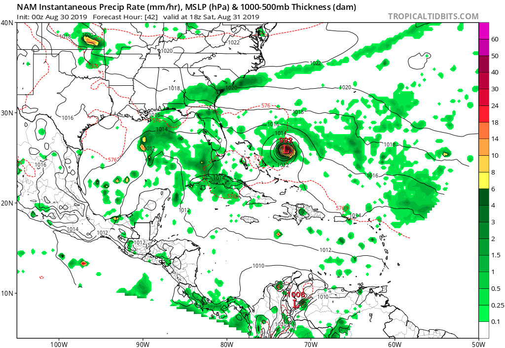
It's not snowing yet. NAM don't work till then. Lolgatorcane wrote:00Z NAM put through 42 hours is more south, turns Dorian sooner.
https://i.postimg.cc/mrtxzsFj/nam-mslp-pcpn-watl-14.png


Miami Storm Tracker wrote:Evening all,
Between preping down south in Key Largo and getting the things I need here in Miami im exhausted. So clean cut and dry where do we stand with this storm.

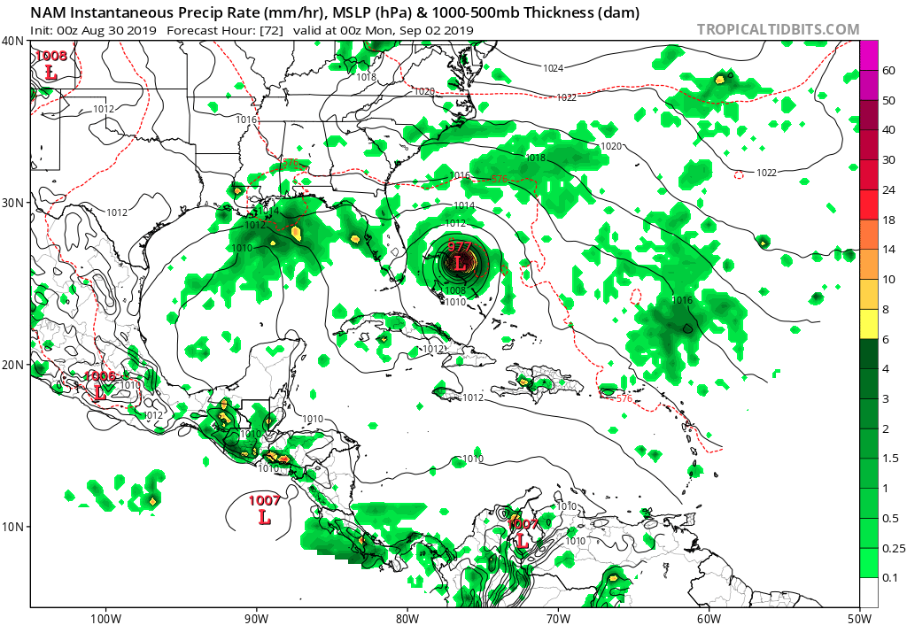
gatorcane wrote:00Z NAM put through 42 hours is more south, turns Dorian sooner.
https://i.postimg.cc/mrtxzsFj/nam-mslp-pcpn-watl-14.png


Aric Dunn wrote:actually, slightly more ridging and tilled ne sw on the 00z NAM

Aric Dunn wrote:actually, slightly more ridging and tilled ne sw on the 00z NAM


TheProfessor wrote:0z NAM seems a bit slower than its 18z run.
Users browsing this forum: No registered users and 17 guests


