

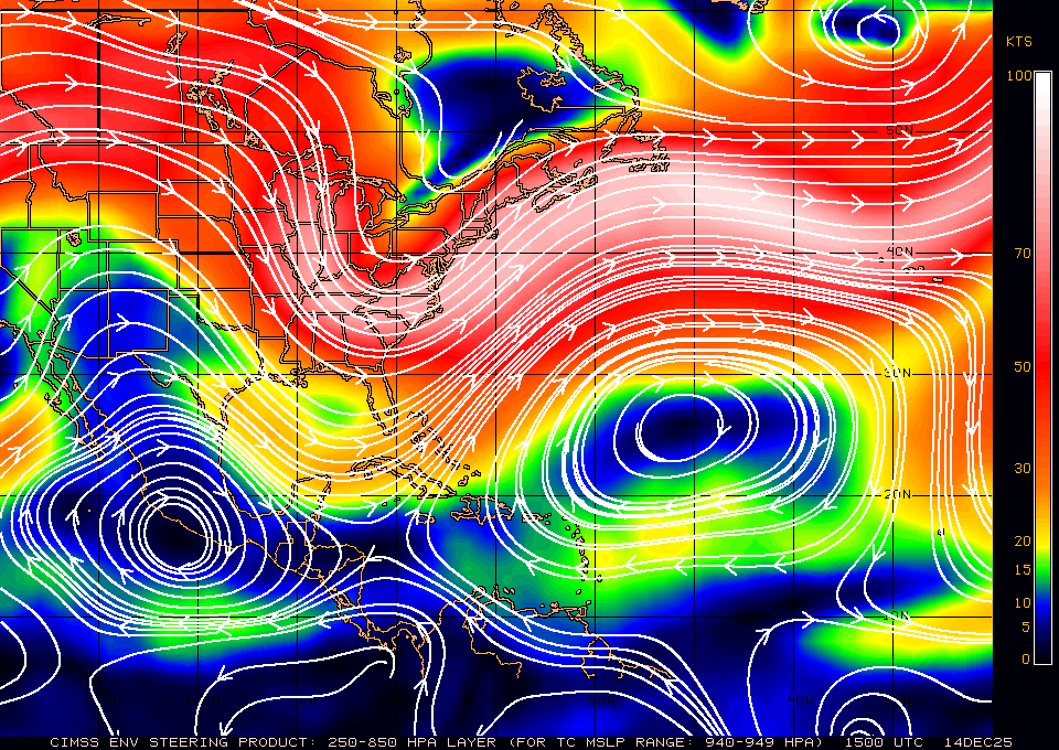
NDG wrote:This is what I see this morning, there's a broad circulation W of the deep convection, which will reform or move north while weak following the convection, once it becomes influenced by the ridge over the TN river valley it will track through the northern Bahamas, unfortunately, what happens after that is still up in the air, but the trend is that it will not get into GOM, that's for sure, whether it will get to FL or stay away from FL is still 50/50. IMO.
https://i.imgur.com/IrW8v5B.jpg
First and foremost, at this point now, I think the chance of seeing this emerge in the GOM is very very slim now.
I will hedge my bet that we will see almost unfortunately something similar to Dorian's path . My heart breaks in me saying this as it will take a path into the NW Bahamas. Godspeed to our neighbors down there!!
Once again, we will have another close watch with how close the center of the cyclone will get to FL, GA or up along the SE Atlantic Coast. It is yet another very complex pattern/ set-up as was the case with Dorian.
Wow, it is like Groundhog Day again


