Thread that was the topic at Talking Tropics forum on this area
viewtopic.php?f=31&t=120890&p=2803503#p2803503

Moderator: S2k Moderators


BadLarry95 wrote:If we get Cristobal pre season too, I think it’s fairly likely we can exhaust the list

aspen wrote:BadLarry95 wrote:If we get Cristobal pre season too, I think it’s fairly likely we can exhaust the list
It’s possible we could get to Dolly by mid-June, but between that and the end of August, we could very well see a quiet phase with maybe 2 or 3 total storms at most. I doubt we’ll exhaust the list, but we could get close.


TheStormExpert wrote:Now up to 50%. Surprised at this considering it looks like crap this morning.A broad area of low pressure appears to be developing over the
central Atlantic Ocean several hundred miles east-southeast of
Bermuda. This disturbance is producing a large area of showers and
thunderstorms and gusty winds. Additional development of this
system is possible, and a subtropical depression could form tonight
or on Saturday as it moves generally northward. Development is not
expected after that time due to unfavorable environmental
conditions. The next Special Tropical Weather Outlook will be
issued by 9 PM EDT today, or earlier if necessary.
* Formation chance through 48 hours...medium...50 percent.
* Formation chance through 5 days...medium...50 percent.
aspen wrote:TheStormExpert wrote:Now up to 50%. Surprised at this considering it looks like crap this morning.A broad area of low pressure appears to be developing over the
central Atlantic Ocean several hundred miles east-southeast of
Bermuda. This disturbance is producing a large area of showers and
thunderstorms and gusty winds. Additional development of this
system is possible, and a subtropical depression could form tonight
or on Saturday as it moves generally northward. Development is not
expected after that time due to unfavorable environmental
conditions. The next Special Tropical Weather Outlook will be
issued by 9 PM EDT today, or earlier if necessary.
* Formation chance through 48 hours...medium...50 percent.
* Formation chance through 5 days...medium...50 percent.
Probably got bumped up because the Euro still shows development, as well as the CMC to a lesser extent.


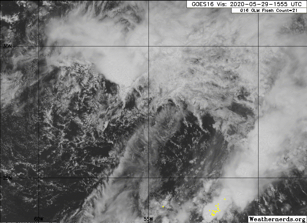
TheStormExpert wrote:Can someone please post the latest satellite presentation of Invest 92L?
Anyways the latest 12z Euro is less enthusiastic with development, unless it surprises us I think 50/50 is all we’ll get from this as it has till Sunday to do anything.

Users browsing this forum: No registered users and 50 guests


