
With the exception of the Euro (which gets really unlucky and rams this system in every island in the northern Caribbean), all of the global models show development in 2-4 days, followed by a Jose-like turn to the north and pass near the NW Leeward Islands, and then a mix of an Irene/Dorian track north of the Caribbean and through the Bahamas. The GFS and NAVGEM are the most aggressive and show a Cat 1 hurricane in 5 days passing near Antigua and Barbuda; the CMC and ICON are a little tamer and show a run-of-the-mill TS in that region. The CMC does get this to a hurricane, but the 06z ICON model doesn’t go far enough out to see whether it follows suit.
I’m starting to get Irene vibes from 92L. The tracks are surprisingly similar as of now, and there’s a decent chance future Isaias could become a Cat 3 and threaten the East Coast if it adheres to the models.
ATL: ISAIAS - Models
Moderator: S2k Moderators
Re: ATL: INVEST 92L - Models
1 likes
Irene '11 Sandy '12 Hermine '16 5/15/2018 Derecho Fay '20 Isaias '20 Elsa '21 Henri '21 Ida '21
I am only a meteorology enthusiast who knows a decent amount about tropical cyclones. Look to the professional mets, the NHC, or your local weather office for the best information.
I am only a meteorology enthusiast who knows a decent amount about tropical cyclones. Look to the professional mets, the NHC, or your local weather office for the best information.
-
hurrtracker79
- Tropical Depression

- Posts: 94
- Joined: Sun Jul 28, 2013 1:32 pm
-
toad strangler

- S2K Supporter

- Posts: 4546
- Joined: Sun Jul 28, 2013 3:09 pm
- Location: Earth
- Contact:
Re: ATL: INVEST 92L - Models
6z GFS ensembles show a heavy signal for a classic climatological correct re-curving cyclone that scrapes Hatteras aka the "Cow Catcher" on it's way to the N Atlantic
0 likes
My Weather Station
https://www.wunderground.com/dashboard/pws/KFLPORTS603
https://www.wunderground.com/dashboard/pws/KFLPORTS603

Re: ATL: INVEST 92L - Models
I would expect a trend towards the west by the models as time goes by.
3 likes
-
Evil Jeremy

- S2K Supporter
- Posts: 5463
- Age: 32
- Joined: Mon Apr 10, 2006 2:10 pm
- Location: Los Angeles, CA
Re: ATL: INVEST 92L - Models
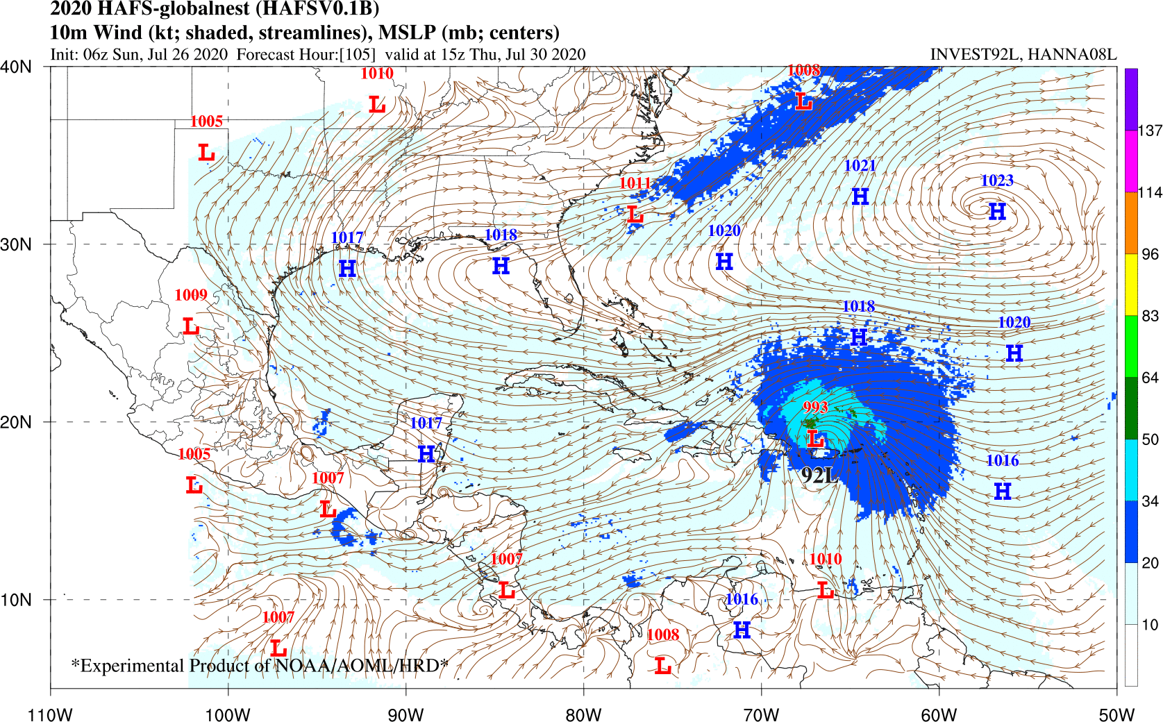
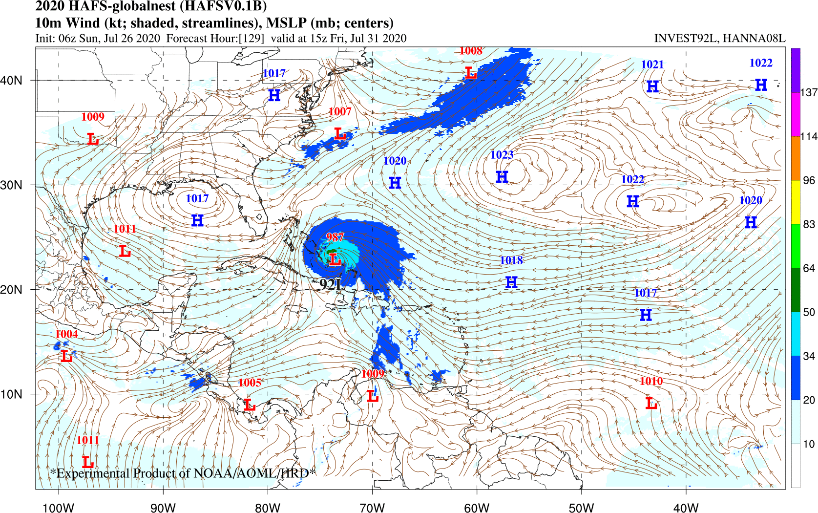
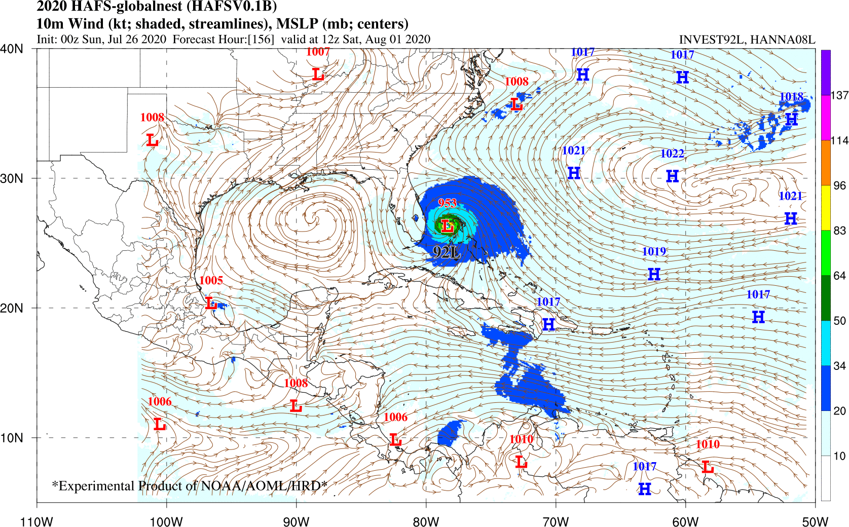
Does this HAFS model have a known good/bad track record yet? This is the first time I'm seeing it.... I think I saw someone earlier say that it's intended to replace the HWRF (which itself was a replacement for GFDL) but otherwise it's new to me. Seems to be consistent on taking this to SE FL, but the timeframe is laughably faster than the rest of the model suite.
0 likes
Frances 04 / Jeanne 04 / Katrina 05 / Wilma 05 / Fay 08 / Debby 12 / Andrea 13 / Colin 16 / Hermine 16 / Matthew 16 / Irma 17

Re: ATL: INVEST 92L - Models
NDG wrote:I would expect a trend towards the west by the models as time goes by.
On cue...
https://twitter.com/_jwall/status/1287369369530413057
2 likes

Re: ATL: INVEST 92L - Models
How many times has GFS had to adjust left the closer to landfall a storm gets? I can name several.
3 likes
-
SFLcane

- S2K Supporter
- Posts: 10281
- Age: 48
- Joined: Sat Jun 05, 2010 1:44 pm
- Location: Lake Worth Florida
Re: ATL: INVEST 92L - Models
This run not done yet but it’s seems to be doing a stair step towards the southeast.
0 likes


Re: ATL: INVEST 92L - Models
hurrtracker79 wrote:https://twitter.com/hurrtrackerapp/status/1287367169093840897
A weaker system getting into the Caribbean is most certainly doomed, reguardless of what the say about the lower shear there.
2 likes
-
cybercane
Re: ATL: INVEST 92L - Models
MetroMike wrote:hurrtracker79 wrote:https://twitter.com/hurrtrackerapp/status/1287367169093840897
A weaker system getting into the Caribbean is most certainly doomed, reguardless of what the say about the lower shear there.
that's so not true lol
3 likes
-
TheStormExpert
Re: ATL: INVEST 92L - Models
At this point a weaker further south and west solution might be more likely a lot like the operational 00z Euro run shows in my opinion.
0 likes
-
toad strangler
- S2K Supporter
- Posts: 4546
- Joined: Sun Jul 28, 2013 3:09 pm
- Location: Earth
- Contact:
Re: ATL: INVEST 92L - Models
TheStormExpert wrote:At this point a weaker further south and west solution might be more likely a lot like the operational 00z Euro run shows in my opinion.
Yesterday you were reminding us that you thought the Carolina's were favored in "this set up"
4 likes
My Weather Station
https://www.wunderground.com/dashboard/pws/KFLPORTS603
https://www.wunderground.com/dashboard/pws/KFLPORTS603
-
karenfromheaven

- Tropical Storm

- Posts: 171
- Age: 71
- Joined: Thu Sep 09, 2004 4:45 pm
- Location: North Naples, FL
Re: ATL: INVEST 92L - Models
Evil Jeremy wrote:
Does this HAFS model have a known good/bad track record yet? This is the first time I'm seeing it.... I think I saw someone earlier say that it's intended to replace the HWRF (which itself was a replacement for GFDL) but otherwise it's new to me. Seems to be consistent on taking this to SE FL, but the timeframe is laughably faster than the rest of the model suite.
HAFS is a new development intended to bring 5 day accuracy to a 7 day forecast.
White paper: http://www.hfip.org/documents/HFIP_Stra ... 190625.pdf
Model Viewer: https://storm.aoml.noaa.gov/basin/?projectName=BASIN
4 likes
-
Aric Dunn
- Category 5

- Posts: 21238
- Age: 43
- Joined: Sun Sep 19, 2004 9:58 pm
- Location: Ready for the Chase.
- Contact:
Re: ATL: INVEST 92L - Models
Forgot about this model.. I remember it doing really well last year.
Does appear that there is plenty of 500 mb ridging here to be a SE Florida threat.
but it is still too far out.

4 likes
Note: If I make a post that is brief. Please refer back to previous posts for the analysis or reasoning. I do not re-write/qoute what my initial post said each time.
If there is nothing before... then just ask
Space & Atmospheric Physicist, Embry-Riddle Aeronautical University,
I believe the sky is falling...
If there is nothing before... then just ask
Space & Atmospheric Physicist, Embry-Riddle Aeronautical University,
I believe the sky is falling...
-
HurricaneFrances04
- Category 2

- Posts: 597
- Joined: Mon Jun 25, 2012 8:09 am
- Location: Fort Lauderdale, Florida
Re: ATL: INVEST 92L - Models
12Z GFS coming in much stronger through 42 hours
And also looks further north. Assuming nothing changes, may not impact any land on this run
And also looks further north. Assuming nothing changes, may not impact any land on this run
1 likes
-
Shell Mound
- Category 5
- Posts: 2432
- Age: 33
- Joined: Thu Sep 07, 2017 3:39 pm
- Location: St. Petersburg, FL → Scandinavia
Re: ATL: INVEST 92L - Models
TheStormExpert wrote:At this point a weaker further south and west solution might be more likely a lot like the operational 00z Euro run shows in my opinion.
This is the same ECMWF that, like the GFS, failed to detect Gonzalo and significantly underestimated the organisation/intensification of Hanna.
If anything, 92L is likely to become (significantly?) stronger than many people anticipate at this time. Of course, as is usual, “time will tell.”
2 likes
CVW / MiamiensisWx / Shell Mound
The posts in this forum are NOT official forecasts and should not be used as such. They are just the opinion of the poster and may or may not be backed by sound meteorological data. They are NOT endorsed by any professional institution or STORM2K. For official information, please refer to products from the NHC and NWS.
-
HurricaneFrances04
- Category 2
- Posts: 597
- Joined: Mon Jun 25, 2012 8:09 am
- Location: Fort Lauderdale, Florida
Re: ATL: INVEST 92L - Models
No model has performed worse than the NAVGEM, which until 18Z yesterday had Gonzalo becoming a major hurricane in the GOM 
3 likes
-
SFLcane
- S2K Supporter
- Posts: 10281
- Age: 48
- Joined: Sat Jun 05, 2010 1:44 pm
- Location: Lake Worth Florida
Re: ATL: INVEST 92L - Models
HurricaneFrances04 wrote:12Z GFS coming in much stronger through 42 hours
And also looks further north. Assuming nothing changes, may not impact any land on this run
No ridging.
0 likes
-
AutoPenalti
- Category 5
- Posts: 4091
- Age: 29
- Joined: Mon Aug 17, 2015 4:16 pm
- Location: Ft. Lauderdale, Florida
Re: ATL: INVEST 92L - Models
There’s a lack of ridging on the 12z...
0 likes
The posts in this forum are NOT official forecasts and should not be used as such. They are just the opinion of the poster and may or may not be backed by sound meteorological data. They are NOT endorsed by any professional institution or STORM2K. For official information, please refer to products from the NHC and NWS.
Model Runs Cheat Sheet:
GFS (5:30 AM/PM, 11:30 AM/PM)
HWRF, GFDL, UKMET, NAVGEM (6:30-8:00 AM/PM, 12:30-2:00 AM/PM)
ECMWF (1:45 AM/PM)
TCVN is a weighted averaged
Who is online
Users browsing this forum: No registered users and 35 guests