

Moderator: S2k Moderators


TheStormExpert wrote:AxaltaRacing24 wrote:TheStormExpert wrote:00z EPS is much less enthusiastic.
It would be quite something if we couldn’t buy a major hurricane from this.
reminds me of when everything dropped irma for a day or two.
Yeah I don't remember that. Either the Euro is right or it's wrong. We are heading into the last third of August so it would be pathetic if we couldn't buy a major hurricane fro this.
TheStormExpert wrote:I've lost track of how many times this season the GFS has fooled me showing a Tropical Atlantic hurricane many runs in a row only to drop it suddenly in just 1 run. The takeaway is despite the season peak just being less than 2 weeks away the Tropical Atlantic remains EXTREMELY unfavorable for whatever reasons.


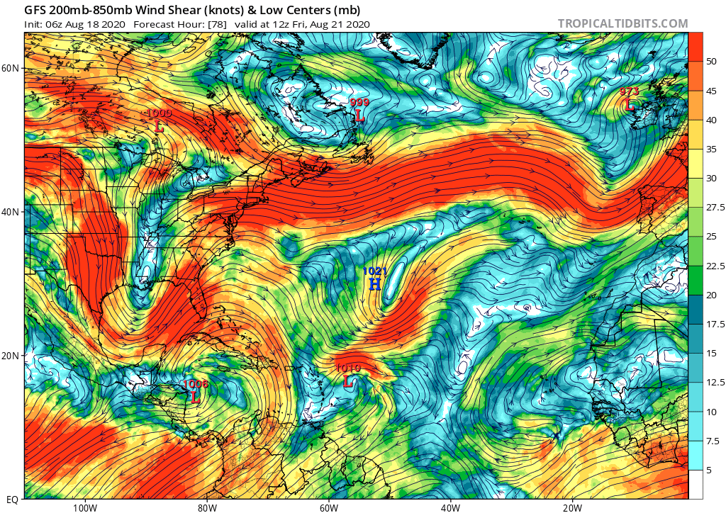
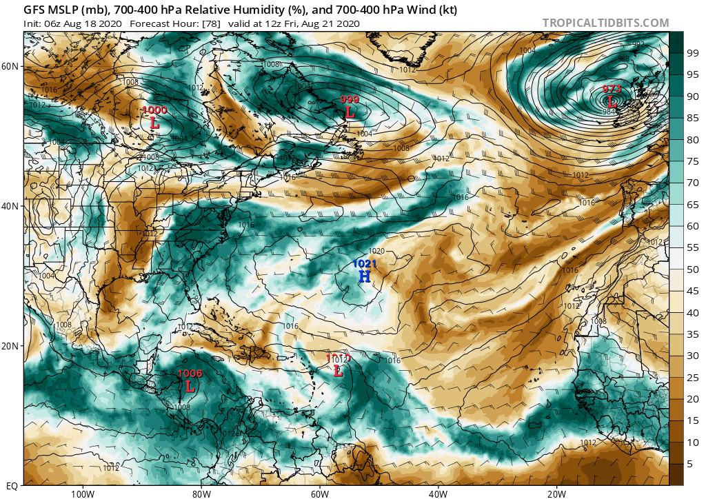
NDG wrote:Models have trended to a stronger Bermuda ridge developing, Gatorcane's eastern US trough is no where to be found.
https://i.imgur.com/19hUmIa.gif
https://i.imgur.com/cSJY2tt.gif
SouthFLTropics wrote:I noticed that they have started running the hurricane models as of 00z last night. The 00z HWRF takes it into PR as a 95 knot hurricane in 126 hours while the HMON keeps it north of there, albeit weaker. Looking at the intensity guidance it appears that the HWRF kills it off shortly thereafter, most likely due to a run in with the big islands.
Sent from my iPhone using Tapatalk
blp wrote:The key takeaway for me is the ridge is strong. We all know how unreliable intensity modeling is especially this far out. We will most likely have a storm that will impact landmasses in the Carribean and US because of the strong ridge.
Blown Away wrote:At least the Euro is back on the left and GFS is on the right...

SFLcane wrote:NDG wrote:Models have trended to a stronger Bermuda ridge developing, Gatorcane's eastern US trough is no where to be found.
https://i.imgur.com/19hUmIa.gif
https://i.imgur.com/cSJY2tt.gif
Indeed! Pretty potent ridging when this gets into the Bahamas.

gatorcane wrote:SFLcane wrote:NDG wrote:Models have trended to a stronger Bermuda ridge developing, Gatorcane's eastern US trough is no where to be found.
https://i.imgur.com/19hUmIa.gif
https://i.imgur.com/cSJY2tt.gif
Indeed! Pretty potent ridging when this gets into the Bahamas.
Models are also trending weaker with the Euro barely showing a TS and GFS doesn’t even develop.
SouthFLTropics wrote:06z HWRF coming in SOUTH of Puerto Rico
This wave is starting to look like the early stages of Isaias, Part 2.
Florida1118 wrote:TheStormExpert wrote:AxaltaRacing24 wrote:reminds me of when everything dropped irma for a day or two.
Yeah I don't remember that. Either the Euro is right or it's wrong. We are heading into the last third of August so it would be pathetic if we couldn't buy a major hurricane fro this.
Here you go. A direct quote from you in the Irma Models thread when the models stopped developing Irma for a short time.TheStormExpert wrote:I've lost track of how many times this season the GFS has fooled me showing a Tropical Atlantic hurricane many runs in a row only to drop it suddenly in just 1 run. The takeaway is despite the season peak just being less than 2 weeks away the Tropical Atlantic remains EXTREMELY unfavorable for whatever reasons.

Users browsing this forum: No registered users and 67 guests


