
12z GFS-Parallel... Once 98L gets off the islands it's finds fuel to intensify... I think if the GFS were to trend a little N of the islands I think it would intensify... Plus a future runner coming into play after 98L...
Moderator: S2k Moderators


Blown Away wrote:18z GFS... Circulation consolidated at 42 hours... Slightly N of 12z


SouthFLTropics wrote:18z GFS...It looks like it cleared the islands to the north but like the Euro it just doesn't want to pop. I think it's picking up on dry air and lack of instability. That's the only thing I can see.

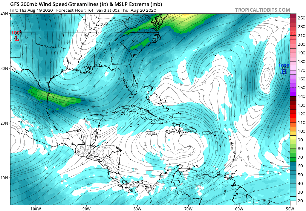
gatorcane wrote:18Z GFS nearly identical to 12Z through 4 days. The model is not budging that is for sure. Take a look at the 200mb winds while 98l is near Eastern Cuba. That does not look favorable at all. You want to see clockwise flow at that level with the light winds on top of the low-level vorticity. That and the system is just moving too fast. In a way the ridge might be too strong which is squashing development before Florida:
https://i.postimg.cc/PryW6CKH/gfs-uv200-watl-2.png


Evil Jeremy wrote:I honestly don’t know why people still rely on the global models for intensity guidance 5 days out. Or at all really. Putting aside how horrible all the models have been this year, I’ve always understood the global to be a better guide of track than intensity.
gatorcane wrote:18Z GFS nearly identical to 12Z through 4 days. The model is not budging that is for sure. Take a look at the 200mb winds while 98l is near Eastern Cuba. That does not look favorable at all. You want to see clockwise flow at that level with the light winds on top of the low-level vorticity. That and the system is just moving too fast. In a way the ridge might be too strong which is squashing development before Florida:
https://i.postimg.cc/PryW6CKH/gfs-uv200-watl-2.png
ConvergenceZone wrote:gatorcane wrote:18Z GFS nearly identical to 12Z through 4 days. The model is not budging that is for sure. Take a look at the 200mb winds while 98l is near Eastern Cuba. That does not look favorable at all. You want to see clockwise flow at that level with the light winds on top of the low-level vorticity. That and the system is just moving too fast. In a way the ridge might be too strong which is squashing development before Florida:
https://i.postimg.cc/PryW6CKH/gfs-uv200-watl-2.png
I guess you missed the posts about the latest EURO ensembles becoming more bullish, which is a sign that the EURO maybe changing its tune
is this sarcasm?gatorcane wrote:gatorcane wrote:18Z GFS nearly identical to 12Z through 4 days. The model is not budging that is for sure. Take a look at the 200mb winds while 98l is near Eastern Cuba. That does not look favorable at all. You want to see clockwise flow at that level with the light winds on top of the low-level vorticity. That and the system is just moving too fast. In a way the ridge might be too strong which is squashing development before Florida:
https://i.postimg.cc/PryW6CKH/gfs-uv200-watl-2.png
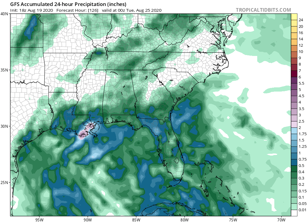
The 18Z GFS is actually slightly drier into Florida with this wave at 120 hours. Would love to at least get some rain from this.
ConvergenceZone wrote:So many people worship the GFS and EURO, it’s actually quite comical... No matter how many times they are wrong during this season, they will keep worshiping them
Users browsing this forum: No registered users and 44 guests
