2020 Global Model Runs Discussion (Out thru day 16)
Moderator: S2k Moderators
Forum rules

The posts in this forum are NOT official forecasts and should not be used as such. They are just the opinion of the poster and may or may not be backed by sound meteorological data. They are NOT endorsed by any professional institution or STORM2K. For official information, please refer to products from the National Hurricane Center and National Weather Service.
-
SconnieCane
- Category 5

- Posts: 1013
- Joined: Thu Aug 02, 2018 5:29 pm
- Location: Madison, WI
Re: 2020 Global Model Runs Discussion (Out thru day 16)
2 likes
-
GeneratorPower

- S2K Supporter

- Posts: 1648
- Age: 46
- Joined: Sun Dec 18, 2005 11:48 pm
- Location: Huntsville, AL
Re: 2020 Global Model Runs Discussion (Out thru day 16)
There is no reason for anyone to downplay the remainder of the season aside from playing psychological games. This has been an extremely active La Nina season and looks to continue that way. I think the recent ensembles continuing to advertise development in the long range is a top sign of continued activity.
8 likes
-
GeneratorPower
- S2K Supporter
- Posts: 1648
- Age: 46
- Joined: Sun Dec 18, 2005 11:48 pm
- Location: Huntsville, AL
Re: 2020 Global Model Runs Discussion (Out thru day 16)
SconnieCane wrote::larrow: How does it plow NE right into increasing pressures?, lol. Forget about all the westward corrections we just saw with the cyclone that's occurring right now?
Personally, I am only looking for activity in general areas.
3 likes
-
gatorcane

- S2K Supporter
- Posts: 23708
- Age: 48
- Joined: Sun Mar 13, 2005 3:54 pm
- Location: Boca Raton, FL
Re: 2020 Global Model Runs Discussion (Out thru day 16)
The weak signal from the GEFS continues, saved loop:
2 likes
-
TheStormExpert
Re: 2020 Global Model Runs Discussion (Out thru day 16)
Bring on the first South Florida cold front!!
0 likes
-
chris_fit

- Category 5
- Posts: 3261
- Age: 43
- Joined: Wed Sep 10, 2003 11:58 pm
- Location: Tampa Bay Area, FL
Re: 2020 Global Model Runs Discussion (Out thru day 16)
Very weak signal from 12Z GFS EPS. Hopefully it continues to trend that way.
0 likes
-
chris_fit
- Category 5
- Posts: 3261
- Age: 43
- Joined: Wed Sep 10, 2003 11:58 pm
- Location: Tampa Bay Area, FL
Re: 2020 Global Model Runs Discussion (Out thru day 16)
00Z GFS Ens were VERY lackluster. On the contrary, through 280 hours So far, the 06 GFS Ens give the strongest signal yet - with development starting within 10 days in the W Carib.
1 likes
-
toad strangler

- S2K Supporter
- Posts: 4546
- Joined: Sun Jul 28, 2013 3:09 pm
- Location: Earth
- Contact:
Re: 2020 Global Model Runs Discussion (Out thru day 16)
chris_fit wrote:00Z GFS Ens were VERY lackluster. On the contrary, through 280 hours So far, the 06 GFS Ens give the strongest signal yet - with development starting within 10 days in the W Carib.
In looking at the last 5 or 6 ensemble runs the 6z appears to be way too random as activity pops out of nowhere in comparison. So, for me ....

0 likes
My Weather Station
https://www.wunderground.com/dashboard/pws/KFLPORTS603
https://www.wunderground.com/dashboard/pws/KFLPORTS603
-
chris_fit
- Category 5
- Posts: 3261
- Age: 43
- Joined: Wed Sep 10, 2003 11:58 pm
- Location: Tampa Bay Area, FL
Re: 2020 Global Model Runs Discussion (Out thru day 16)
toad strangler wrote:chris_fit wrote:00Z GFS Ens were VERY lackluster. On the contrary, through 280 hours So far, the 06 GFS Ens give the strongest signal yet - with development starting within 10 days in the W Carib.
In looking at the last 5 or 6 ensemble runs the 6z appears to be way too random as activity pops out of nowhere in comparison. So, for me ....
Yup - will have to see if the 12z and 18z follow suite for this to be taken a little more seriously.
0 likes
-
chris_fit
- Category 5
- Posts: 3261
- Age: 43
- Joined: Wed Sep 10, 2003 11:58 pm
- Location: Tampa Bay Area, FL
Re: 2020 Global Model Runs Discussion (Out thru day 16)
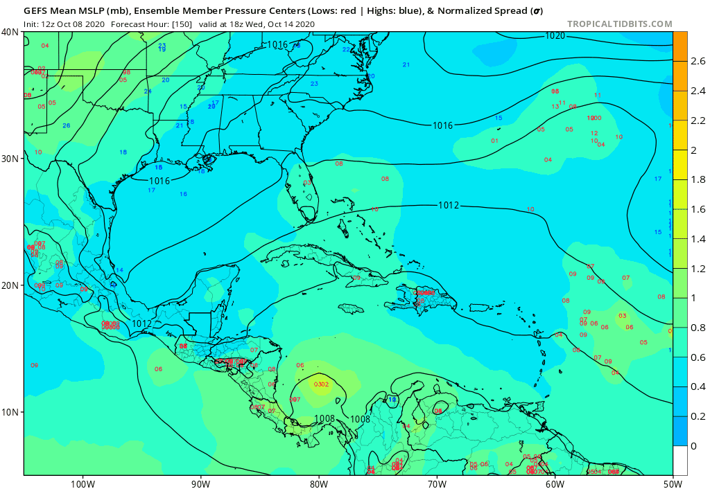
Here's a pic - I dont usually look past 300 hours.

0 likes

Re: 2020 Global Model Runs Discussion (Out thru day 16)
When is a CAG not a CAG? Well, pretty sure we'll see development from the southernmost extension of yet another wave moving west through the extreme southwestern Caribbean around the 17th-20th of the month. Surface pressures remain low and pattern consistency (along with climo) would suggest the Atlantic might pull yet another (Greek) name out of it's hat. Just too far out to guess whether it'll remain buried down there or move north. Also, there's strong hints of LaNina split jet flow aloft beginning to take shape so there seems to be a closing window as to how far north any system could venture into the GOM before impacted by strong upper level westerlies. South Florida not by any means out of the woods quite yet though.
3 likes
Andy D
(For official information, please refer to the NHC and NWS products.)
(For official information, please refer to the NHC and NWS products.)


-
chris_fit
- Category 5
- Posts: 3261
- Age: 43
- Joined: Wed Sep 10, 2003 11:58 pm
- Location: Tampa Bay Area, FL
Re: 2020 Global Model Runs Discussion (Out thru day 16)
12Z GFS ENS still showing strong signal (maybe even stronger) than 06Z which was somewhat active.
0 likes
-
SFLcane

- S2K Supporter
- Posts: 10281
- Age: 48
- Joined: Sat Jun 05, 2010 1:44 pm
- Location: Lake Worth Florida
Re: 2020 Global Model Runs Discussion (Out thru day 16)
chris_fit wrote:12Z GFS ENS still showing strong signal (maybe even stronger) than 06Z which was somewhat active.

1 likes

Re: 2020 Global Model Runs Discussion (Out thru day 16)
Multiple relatively strong signals in the 12z GFS ensemble.
#1: the 1st Cape Verde tropical wave. It continues to move closer in the timeframe with formation around +84 hours. Many members form a TD or TS, but most eventually dissipate, most likely due to shear. The ones that survive reactivate in the long term with a few TS or minimal cat 1 members. But that's all the way at +288 hours so not something to worry about for now.


#2: another Cape Verde wave that exits Africa at +108 hours. This wave also keeps moving closer in the time frame, which seems to indicate that it isn't some phantom wave. This wave also has quite a few associated TD/TS runs, even though none seem to survive the shear in the mid-Atlantic. Nevertheless, I'd keep an eye out for this wave and expect NHC to initiate a disturbance with a low development chance if the wave stays in the models for the next 1 or 2 days.

#3: long term activity in the WCAR. I usually wouldn't mention model storms beyond +240 hours, but the GFS signal in this ensemble shows some very strong storms so I feel I can't leave it out. Around +260/+272 hours GFS shows multiple members with TC genesis in the WCAR. 3 or 4 members make it into a hurricane with one massive cat 4/5 that slams into Cancun, but of course there's no point in talking about the exact model results of a member at +312 hours. At the moment there's nothing to worry about, but it's important to look if this signal keeps moving closer in the timeframe over the next few days.


#1: the 1st Cape Verde tropical wave. It continues to move closer in the timeframe with formation around +84 hours. Many members form a TD or TS, but most eventually dissipate, most likely due to shear. The ones that survive reactivate in the long term with a few TS or minimal cat 1 members. But that's all the way at +288 hours so not something to worry about for now.
#2: another Cape Verde wave that exits Africa at +108 hours. This wave also keeps moving closer in the time frame, which seems to indicate that it isn't some phantom wave. This wave also has quite a few associated TD/TS runs, even though none seem to survive the shear in the mid-Atlantic. Nevertheless, I'd keep an eye out for this wave and expect NHC to initiate a disturbance with a low development chance if the wave stays in the models for the next 1 or 2 days.
#3: long term activity in the WCAR. I usually wouldn't mention model storms beyond +240 hours, but the GFS signal in this ensemble shows some very strong storms so I feel I can't leave it out. Around +260/+272 hours GFS shows multiple members with TC genesis in the WCAR. 3 or 4 members make it into a hurricane with one massive cat 4/5 that slams into Cancun, but of course there's no point in talking about the exact model results of a member at +312 hours. At the moment there's nothing to worry about, but it's important to look if this signal keeps moving closer in the timeframe over the next few days.
9 likes
-
supercane4867
- Category 5
- Posts: 4966
- Joined: Wed Nov 14, 2012 10:43 am
Re: 2020 Global Model Runs Discussion (Out thru day 16)
0 likes
Andy D
(For official information, please refer to the NHC and NWS products.)
(For official information, please refer to the NHC and NWS products.)

Re: 2020 Global Model Runs Discussion (Out thru day 16)
supercane4867 wrote:https://twitter.com/derekortt/status/1314714456962879488?s=21
If I recall correctly, the CFS was showing several Caribbean TCs towards the end of October. I guess it might’ve picked up on the positive CCKW.
0 likes
Irene '11 Sandy '12 Hermine '16 5/15/2018 Derecho Fay '20 Isaias '20 Elsa '21 Henri '21 Ida '21
I am only a meteorology enthusiast who knows a decent amount about tropical cyclones. Look to the professional mets, the NHC, or your local weather office for the best information.
I am only a meteorology enthusiast who knows a decent amount about tropical cyclones. Look to the professional mets, the NHC, or your local weather office for the best information.
-
TheStormExpert
Re: 2020 Global Model Runs Discussion (Out thru day 16)
supercane4867 wrote:https://twitter.com/derekortt/status/1314714456962879488?s=21
So why does the CAG have to spin up into a tropical cyclone in order to go away? Can’t it just wash itself out over Central America?
Don’t know much a whole lot about this so any input would be greatly appreciated!
1 likes
-
TheStormExpert
Re: 2020 Global Model Runs Discussion (Out thru day 16)
aspen wrote:supercane4867 wrote:https://twitter.com/derekortt/status/1314714456962879488?s=21
If I recall correctly, the CFS was showing several Caribbean TCs towards the end of October. I guess it might’ve picked up on the positive CCKW.
It also showed some more Tropical Atlantic/Cape Verde action which we’re likely seeing with the 10/20 area.
0 likes
Who is online
Users browsing this forum: hcane27 and 129 guests