Area of disturbed weather entering the Caribbean (Is Invest 96L)

This is the general tropical discussion area. Anyone can take their shot at predicting a storms path.

Moderator: S2k Moderators

Forum rules

The posts in this forum are NOT official forecasts and should not be used as such. They are just the opinion of the poster and may or may not be backed by sound meteorological data. They are NOT endorsed by any professional institution or STORM2K. For official information, please refer to products from the National Hurricane Center and National Weather Service.

Help Support Storm2K
Message
Author
User avatar
Jr0d
S2K Supporter
S2K Supporter
Posts: 1409
Joined: Tue Aug 27, 2019 10:52 am
Location: Cayo Hueso

Re: Broad Low Pressure to form in SW Caribbean

#381 Postby Jr0d » Thu Oct 29, 2020 7:43 am


Often it seems like if the models are showing something on top of Florida in fantasy land timeframes(7 days plus) early on, I feel safer because they will change.

We already have 1 poster declaring this a CA storm and several other giving the all clear to Florida.

Until a low forms and we have a trackable entity, I look at individual model runs for entertainment value, and keep a close eye on the ensemble trends.
0 likes   

User avatar
SFLcane
S2K Supporter
S2K Supporter
Posts: 10163
Age: 47
Joined: Sat Jun 05, 2010 1:44 pm
Location: Lake Worth Florida

Re: Area of disturbed weather entering the Caribbean

#382 Postby SFLcane » Thu Oct 29, 2020 7:49 am

0 likes   

User avatar
chaser1
S2K Supporter
S2K Supporter
Posts: 5464
Age: 64
Joined: Sat Oct 15, 2005 5:59 pm
Location: Longwood, Fl

Re: Broad Low Pressure to form in SW Caribbean

#383 Postby chaser1 » Thu Oct 29, 2020 8:04 am

Jr0d wrote:


Often it seems like if the models are showing something on top of Florida in fantasy land timeframes(7 days plus) early on, I feel safer because they will change.

We already have 1 poster declaring this a CA storm and several other giving the all clear to Florida.

Until a low forms and we have a trackable entity, I look at individual model runs for entertainment value, and keep a close eye on the ensemble trends.


Add me to the Eta west to CA list LOL.... at least in regards to near term track. If it can somehow dawdle around post 2nd cold front poised to clear all South Florida next week, then I suppose "it" or something of it's spawn might just find a way to percolate northward toward Cuba way late in the cycle. Just very hard for me to see any timing for a Caribbean storm to find a way to develop that quickly, move NW that fast and possibly impact Cuba/Florida in such a narrow window between this Sunday and Monday when the stronger of two short waves are due to swing south into Florida. That's no "all clear" for Florida in my opinion. There may be plenty of November left to squeak out a northward moving T.S. into the state.
0 likes   
Andy D

(For official information, please refer to the NHC and NWS products.)

User avatar
SFLcane
S2K Supporter
S2K Supporter
Posts: 10163
Age: 47
Joined: Sat Jun 05, 2010 1:44 pm
Location: Lake Worth Florida

Re: Area of disturbed weather entering the Caribbean

#384 Postby SFLcane » Thu Oct 29, 2020 8:13 am

Image
0 likes   

User avatar
Emmett_Brown
Category 5
Category 5
Posts: 1432
Joined: Wed Aug 24, 2005 9:10 pm
Location: Sarasota FL

Re: Area of disturbed weather entering the Caribbean

#385 Postby Emmett_Brown » Thu Oct 29, 2020 8:19 am

I think the NHC wording of "meandering" over the W Caribbean makes a lot of sense here. Whatever forms certainly could immediately move into CA, but with the ensemble spread, a very slow moving quasi stationary system is possible, since high pressure ridging will practically surround it to the north, west and east. Could meander down there for days. If so, I hope it stays off shore of CA.

As for climatology, daily weather doesn't follow climatology, it makes climatology.
4 likes   

cp79

Re: Area of disturbed weather entering the Caribbean

#386 Postby cp79 » Thu Oct 29, 2020 8:32 am

SFLcane wrote:
cp79 wrote:Prayers for those in CA. Looks like it’s headed on a beeline right for it.


What’s headed on a beeline? You do realize that cone you see is not an actual track cone it’s the area for potential development.


Pretty much every model has it heading there.
0 likes   

TheStormExpert

Re: Area of disturbed weather entering the Caribbean

#387 Postby TheStormExpert » Thu Oct 29, 2020 8:40 am

Anything the models or ensembles show after 5-7 days is pure fantasy these days. All we know is a tropical system will be heading into the SW Caribbean over the next few days and from there looks likely to go into Nicaragua around 5-6 days from now. From there it either gets A) pulled north, or B) pushed inland and maybe into the East Pacific a lot like Otto in 2016 although surviving the crossover is not too likely.
0 likes   

User avatar
aspen
Category 5
Category 5
Posts: 8818
Joined: Sat Oct 12, 2019 7:10 pm
Location: Connecticut, USA

Re: Area of disturbed weather entering the Caribbean

#388 Postby aspen » Thu Oct 29, 2020 8:47 am

There’s a chance Eta could become the Caribbean Cruiser major we all expected this year...in NOVEMBER of all months. It depends on how quickly the wave develops.
0 likes   
Irene '11 Sandy '12 Hermine '16 5/15/2018 Derecho Fay '20 Isaias '20 Elsa '21 Henri '21 Ida '21

I am only a meteorology enthusiast who knows a decent amount about tropical cyclones. Look to the professional mets, the NHC, or your local weather office for the best information.

User avatar
SFLcane
S2K Supporter
S2K Supporter
Posts: 10163
Age: 47
Joined: Sat Jun 05, 2010 1:44 pm
Location: Lake Worth Florida

Re: Area of disturbed weather entering the Caribbean

#389 Postby SFLcane » Thu Oct 29, 2020 8:49 am

I would not bet on anything going into CA.

 https://twitter.com/mjventrice/status/1321803191185526785


4 likes   

User avatar
gatorcane
S2K Supporter
S2K Supporter
Posts: 23691
Age: 47
Joined: Sun Mar 13, 2005 3:54 pm
Location: Boca Raton, FL

Re: Area of disturbed weather entering the Caribbean

#390 Postby gatorcane » Thu Oct 29, 2020 8:50 am

This is an impressive and large wave to say the least :eek:

Already shows an 850mb vort signature:

Image
Image
0 likes   

User avatar
northjaxpro
S2K Supporter
S2K Supporter
Posts: 8900
Joined: Mon Sep 27, 2010 11:21 am
Location: Jacksonville, FL

Re: Area of disturbed weather entering the Caribbean

#391 Postby northjaxpro » Thu Oct 29, 2020 8:55 am

SFLcane wrote:I would not bet on anything going into CA.

https://twitter.com/mjventrice/status/1321803191185526785?s=21


Ventrice is right on target about this. Hurricane season may last into December in this insane 2020 season!
2 likes   
NEVER, EVER SAY NEVER in the tropics and weather in general, and most importantly, with life itself!!

________________________________________________________________________________________

Fay 2008 Beryl 2012 Debby 2012 Colin 2016 Hermine 2016 Julia 2016 Matthew 2016 Irma 2017 Dorian 2019

User avatar
Ryxn
Category 1
Category 1
Posts: 314
Age: 25
Joined: Fri Sep 08, 2017 4:50 pm
Location: Toronto, Canada

Re: Area of disturbed weather entering the Caribbean

#392 Postby Ryxn » Thu Oct 29, 2020 8:56 am

Eta could be a crossover and possibly spawn Theta not too long after...
2 likes   

User avatar
gatorcane
S2K Supporter
S2K Supporter
Posts: 23691
Age: 47
Joined: Sun Mar 13, 2005 3:54 pm
Location: Boca Raton, FL

Re: Area of disturbed weather entering the Caribbean

#393 Postby gatorcane » Thu Oct 29, 2020 8:56 am

Para into Central America with a lot of dry air over the Gulf and Florida with strong High pressure as is typical for early November:

Image
0 likes   

User avatar
SFLcane
S2K Supporter
S2K Supporter
Posts: 10163
Age: 47
Joined: Sat Jun 05, 2010 1:44 pm
Location: Lake Worth Florida

Re: Area of disturbed weather entering the Caribbean

#394 Postby SFLcane » Thu Oct 29, 2020 8:57 am

Image
3 likes   

User avatar
GeneratorPower
S2K Supporter
S2K Supporter
Posts: 1648
Age: 45
Joined: Sun Dec 18, 2005 11:48 pm
Location: Huntsville, AL

Re: Area of disturbed weather entering the Caribbean

#395 Postby GeneratorPower » Thu Oct 29, 2020 8:58 am

gatorcane wrote:Para into Central America with a lot of dry air over the Gulf and Florida with strong High pressure as is typical for early November:

https://i.postimg.cc/t4pcgN70/gfsp-mid-RH-watl-fh0-168.gif


La Niña will have a significant effect on how this plays out. This isn’t a normal November.
5 likes   

Shell Mound
Category 5
Category 5
Posts: 2434
Age: 32
Joined: Thu Sep 07, 2017 3:39 pm
Location: St. Petersburg, FL → Scandinavia

Re: Area of disturbed weather entering the Caribbean

#396 Postby Shell Mound » Thu Oct 29, 2020 9:10 am


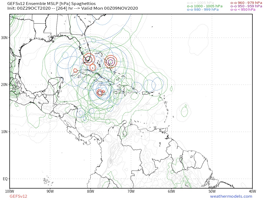
Interestingly, the minority of members that do not show significant interaction with Central America indicate steady 
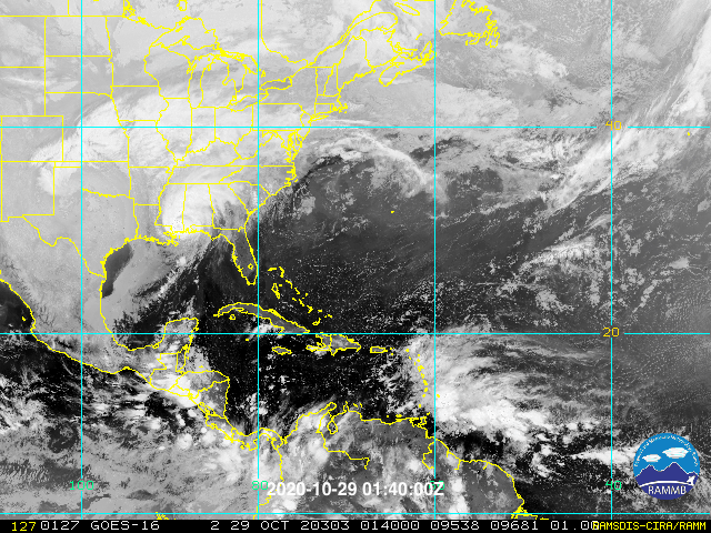
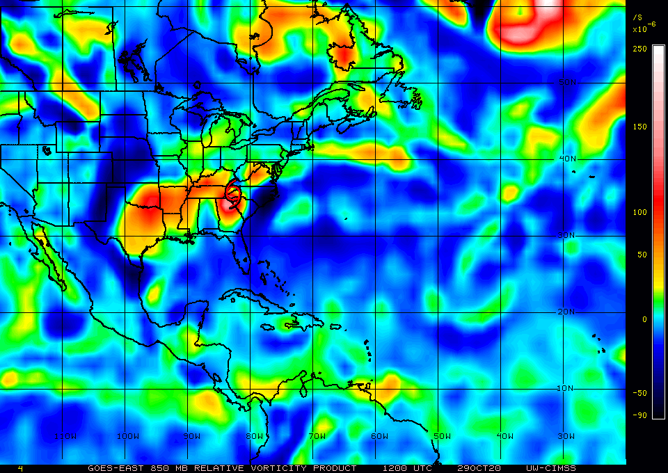
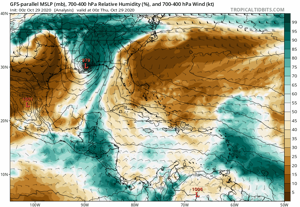
intensification as the potential system tracks north-northeastward toward westernmost Cuba, the Keys, and possibly South Florida. Perhaps early November will behave more like early to mid October in regard to the track of this system, just as the peak of this season has clearly been delayed or “backloaded.” If this system somehow stalls offshore and does not do a “Mitch 2.0,” then I am concerned that this could be yet another powerful hurricane over the western Caribbean, à la the 1924/‘32 Cuba hurricanes, Michelle ‘01, and/or Paloma ‘08, at least in terms of potential intensity. Probably the most disconcerting possible outcome would be a drifting, stalling, or even looping motion over the western Caribbean, in the vicinity of the Gulf of Honduras, remaining just offshore/north of Central America, while undergoing significant intensification and eventually tracking NNE toward Pinar del Río, Cuba, and the southeastern Gulf of Mexico, on a track that would clearly and unambiguously threaten the southernmost Florida peninsula and the Keys. Maybe a combination of ‘24’s track and ‘32’s intensity, with a bit of 1846 Havana/Key West thrown in for good measure. Maybe 2020 will save the worst for last and throw a robust Cat-5, Michael-style but offset to the southeast, into the I-4 corridor, from Tampa Bay to Greater Orlando and Cape Canaveral.
0 likes   
CVW / MiamiensisWx / Shell Mound
The posts in this forum are NOT official forecasts and should not be used as such. They are just the opinion of the poster and may or may not be backed by sound meteorological data. They are NOT endorsed by any professional institution or STORM2K. For official information, please refer to products from the NHC and NWS.

TheStormExpert

Re: Area of disturbed weather entering the Caribbean

#397 Postby TheStormExpert » Thu Oct 29, 2020 9:11 am

gatorcane wrote:Para into Central America with a lot of dry air over the Gulf and Florida with strong High pressure as is typical for early November:

https://i.postimg.cc/t4pcgN70/gfsp-mid-RH-watl-fh0-168.gif

For once the para-GFS isn’t showing a crazy solution. :lol:
0 likes   

User avatar
SFLcane
S2K Supporter
S2K Supporter
Posts: 10163
Age: 47
Joined: Sat Jun 05, 2010 1:44 pm
Location: Lake Worth Florida

Re: Area of disturbed weather entering the Caribbean

#398 Postby SFLcane » Thu Oct 29, 2020 9:12 am

:double:

Image
0 likes   

Shell Mound
Category 5
Category 5
Posts: 2434
Age: 32
Joined: Thu Sep 07, 2017 3:39 pm
Location: St. Petersburg, FL → Scandinavia

Re: Area of disturbed weather entering the Caribbean

#399 Postby Shell Mound » Thu Oct 29, 2020 9:19 am

TheStormExpert wrote:
gatorcane wrote:Para into Central America with a lot of dry air over the Gulf and Florida with strong High pressure as is typical for early November:

https://i.postimg.cc/t4pcgN70/gfsp-mid-RH-watl-fh0-168.gif

For once the para-GFS isn’t showing a crazy solution. :lol:

Watch the models trend toward a FL-centric solution, given that most members are showing both a) TCG and b) CA impacts in the medium term. This is not the usual situation in which models are showing landfall(s) on FL in the very distant future. Consensus shows TCG and landfall in the medium term, not further out. The track may well be in line with that of early to mid October (meaning threats to peninsular FL) instead of early November (CA and/or Jamaica, eastern Cuba, the Bahamas...), given that this season has been delayed or “backloaded.” Note that both the EPS/G(E)FS, including the parallel GFS suite(s), indicate the potential for a rapidly intensifying system at the time of closest approach to CA. If the system were instead moving slowly offshore at that time, then the potential for a significantly stronger system would be exponentially higher. Only a very small margin of error would result in yet another late-season major hurricane, possibly a Cat-5 system. The members that do take this system northward toward western Cuba all show significant deepening.
4 likes   
CVW / MiamiensisWx / Shell Mound
The posts in this forum are NOT official forecasts and should not be used as such. They are just the opinion of the poster and may or may not be backed by sound meteorological data. They are NOT endorsed by any professional institution or STORM2K. For official information, please refer to products from the NHC and NWS.

tomatkins
Tropical Storm
Tropical Storm
Posts: 222
Joined: Wed Sep 05, 2018 2:11 pm

Re: Area of disturbed weather entering the Caribbean

#400 Postby tomatkins » Thu Oct 29, 2020 9:21 am


It would be quite 2020 for a Greek letter storm from the Atlantic to cross Central America in November and remain intact enough to keep its name into the Pacific.
1 likes   


Return to “Talkin' Tropics”

Who is online

Users browsing this forum: Stormybajan and 37 guests