Texas Winter 2020-2021

Winter Weather Discussion

Moderator: S2k Moderators

Forum rules

The posts in this forum are NOT official forecast and should not be used as such. They are just the opinion of the poster and may or may not be backed by sound meteorological data. They are NOT endorsed by any professional institution or STORM2K.

Help Support Storm2K
Message
Author
Brent
S2K Supporter
S2K Supporter
Posts: 38095
Age: 37
Joined: Sun May 16, 2004 10:30 pm
Location: Tulsa Oklahoma
Contact:

Re: Texas Winter 2020-2021

#1501 Postby Brent » Sat Jan 09, 2021 11:42 am

TheProfessor wrote:
bubba hotep wrote:Latest update from FWD, it sounds like the are just going with "meh, any snow will be melting with no road impacts so no advisories"

https://pbs.twimg.com/media/ErTZBelXEAMRaiL?format=jpg&name=large


Personally I think they may be a bit too low with their totals from about Hillsboro to just north of Temple. I wouldn't be surprised to see 4-6" in that area if 8-1 ratios occur. If they get 10-1 then it would be even higher.


Why do they have such lower amounts between Gatesville and Fairfield anyway? It doesn't make sense if that's the low track it would seem there would be one large heavy bullseye
0 likes   
#neversummer

User avatar
bubba hotep
S2K Supporter
S2K Supporter
Posts: 5837
Joined: Wed Dec 28, 2016 1:00 am
Location: Collin County Texas

Re: Texas Winter 2020-2021

#1502 Postby bubba hotep » Sat Jan 09, 2021 11:44 am

TheProfessor wrote:
Ntxw wrote:
TheProfessor wrote:
Snow ratios are very important to talk about. Now the NWS probably isn't looking at Kuchera (I've seen a Wilmington, OH forecaster laugh at that for some reason even though it's just reading the models sampled sounding and converting that into snow ratios.) but Kuchera on both the GFS and 0z CMC shows very poor ratios for the Metroplex, especially the northern Metro. Even in the jackpot areas the CMC and GFS are showing 7/8-1 ratios. It's not until after the event around 12z Monday when the better snow ratios occur. I wouldn't call this a failure mode per say, but it does make the 10-1 maps misleading.


10:1 maps in my opinion are only good for highlighting potential coverage and how much can come out of the sky, nothing about actual accumulation. There are so many other factors in play, but one thing I will say is this so unusual in that the air above is much colder than our typical events in North Texas with such a set up. It's usually borderline at 850mb so ratios may be higher liquid-dendritic growth. Even 2010 we were barely cold enough above. 500mb temps here is -25 to -27C.


850s are cold, but not cold enough to be in the DGZ. I've been going through some Skew-ts and the DGZs are pretty shallow on both global and mesoscale models. In some cases the DGZ is also a bit dry (CMC). Now assuming some of the models are too warm at the surface, then a good estimate for snow ratios would be nearby areas where the models have surface temps near freezing and similar DGZs. It would not surprise me if most of DFW saw snow ratios of 6-1 to 8-1. The higher snow ratios will be to that south closer to the low where there are better dynamics. DFW really needs that low further north to get in on the good dynamics. If I had to issue a widespread forecast for DFW I'd say 1-3" of snow with locally higher accumulations to the south. If the models happen to be too dry, then it's possible that gets bumped up to 3-6" so we'll see what upper air analysis shows us on Sunday.


Forecasting snow is no easy challenge and forecast bust (both high and low) are often times the norm, outside of slam dunk setups. You can drive yourself mad looking at everything trying to figure out a call :double:
6 likes   
Winter time post are almost exclusively focused on the DFW area.

User avatar
Ntxw
Storm2k Moderator
Storm2k Moderator
Posts: 22788
Joined: Wed Oct 21, 2009 6:34 pm
Location: DFW, Texas

Re: Texas Winter 2020-2021

#1503 Postby Ntxw » Sat Jan 09, 2021 11:47 am

bubba hotep wrote:Forecasting snow is no easy challenge and forecast bust (both high and low) are often times the norm, outside of slam dunk setups. You can drive yourself mad looking at everything trying to figure out a call :double:


What do you mean this has been a slam dunk forecast :wink:.

Seriously, we've looked at this for over a week and some models, if you correct for bias, has shown potential. We've seen oh so many fade away but this one has held up well considering what we usually work with. It's never going to get any easier than this.
6 likes   
The above post and any post by Ntxw is NOT an official forecast and should not be used as such. It is just the opinion of the poster and may or may not be backed by sound meteorological data. It is NOT endorsed by any professional institution including Storm2k. For official information, please refer to NWS products.

  Help support Storm2K!
Help Support Storm2K

User avatar
bubba hotep
S2K Supporter
S2K Supporter
Posts: 5837
Joined: Wed Dec 28, 2016 1:00 am
Location: Collin County Texas

Re: Texas Winter 2020-2021

#1504 Postby bubba hotep » Sat Jan 09, 2021 11:48 am

12z SPC HREF is still running but does seem to be much more enthusiastic than 00z. I know that SPC loves the HREF for svr wx outlooks but I'm not sure how well it performs with winter wx.
4 likes   
Winter time post are almost exclusively focused on the DFW area.

User avatar
Haris
Category 5
Category 5
Posts: 1810
Joined: Mon Nov 27, 2017 8:19 pm
Location: ( Bee Cave) West Austin, Texas

Re: Texas Winter 2020-2021

#1505 Postby Haris » Sat Jan 09, 2021 11:49 am

Image

Wow
5 likes   
Weather geek and a storm spotter in West Austin. Not a degreed meteorologist. Big snow fan. Love rain and cold! Despise heat!

User avatar
TropicalTundra
S2K Supporter
S2K Supporter
Posts: 703
Joined: Wed Oct 16, 2019 12:56 pm
Location: Temple, Texas

Re: Texas Winter 2020-2021

#1506 Postby TropicalTundra » Sat Jan 09, 2021 11:52 am

Haris wrote:Image

Wow


I’m right on the 13 inch bullseye :lol:
0 likes   
Summer's for hibernation, Winter’s my vacation

Don't use my posts as forecast, I'm a complete meteorology noob! I just like cold weather, alright?

All observations I post are for Temple, Texas unless otherwise stated.

Brent
S2K Supporter
S2K Supporter
Posts: 38095
Age: 37
Joined: Sun May 16, 2004 10:30 pm
Location: Tulsa Oklahoma
Contact:

Re: Texas Winter 2020-2021

#1507 Postby Brent » Sat Jan 09, 2021 11:54 am

bubba hotep wrote:
TheProfessor wrote:
Ntxw wrote:
10:1 maps in my opinion are only good for highlighting potential coverage and how much can come out of the sky, nothing about actual accumulation. There are so many other factors in play, but one thing I will say is this so unusual in that the air above is much colder than our typical events in North Texas with such a set up. It's usually borderline at 850mb so ratios may be higher liquid-dendritic growth. Even 2010 we were barely cold enough above. 500mb temps here is -25 to -27C.


850s are cold, but not cold enough to be in the DGZ. I've been going through some Skew-ts and the DGZs are pretty shallow on both global and mesoscale models. In some cases the DGZ is also a bit dry (CMC). Now assuming some of the models are too warm at the surface, then a good estimate for snow ratios would be nearby areas where the models have surface temps near freezing and similar DGZs. It would not surprise me if most of DFW saw snow ratios of 6-1 to 8-1. The higher snow ratios will be to that south closer to the low where there are better dynamics. DFW really needs that low further north to get in on the good dynamics. If I had to issue a widespread forecast for DFW I'd say 1-3" of snow with locally higher accumulations to the south. If the models happen to be too dry, then it's possible that gets bumped up to 3-6" so we'll see what upper air analysis shows us on Sunday.


Forecasting snow is no easy challenge and forecast bust (both high and low) are often times the norm, outside of slam dunk setups. You can drive yourself mad looking at everything trying to figure out a call :double:


yeah I did that when i chased to Abilene... spent so much time looking at every model trying to figure out the heavier snow bands

Didnt do any good it was a nice snowfall but about half what I expected :lol: :lol:
3 likes   
#neversummer

Ralph's Weather
S2K Supporter
S2K Supporter
Posts: 3269
Age: 38
Joined: Fri Dec 13, 2013 11:55 am
Location: Lindale, TX
Contact:

Re: Texas Winter 2020-2021

#1508 Postby Ralph's Weather » Sat Jan 09, 2021 11:59 am


Even if you multiply by .75 to account for lower ratios it's still very impressive. Though as has been said ratios under the ULL may be closer to 10:1.
2 likes   
Follow on Facebook at Ralph's Weather.

User avatar
Ntxw
Storm2k Moderator
Storm2k Moderator
Posts: 22788
Joined: Wed Oct 21, 2009 6:34 pm
Location: DFW, Texas

Re: Texas Winter 2020-2021

#1509 Postby Ntxw » Sat Jan 09, 2021 12:02 pm

Satellite IR view. Storm is rounding the 4 corners and some snow in Colorado. Panhandle and South Plains juiced up.

Image
7 likes   
The above post and any post by Ntxw is NOT an official forecast and should not be used as such. It is just the opinion of the poster and may or may not be backed by sound meteorological data. It is NOT endorsed by any professional institution including Storm2k. For official information, please refer to NWS products.


  Help support Storm2K!

Help Support Storm2K


User avatar
EnnisTx
S2K Supporter
S2K Supporter
Posts: 896
Joined: Sat Dec 26, 2015 4:06 pm
Location: Albany, Texas
Contact:

Re: Texas Winter 2020-2021

#1510 Postby EnnisTx » Sat Jan 09, 2021 12:16 pm

Ntxw wrote:Satellite IR view. Storm is rounding the 4 corners and some snow in Colorado. Panhandle and South Plains juiced up.

https://i.imgur.com/U2Z3i4x.gif


She's ramping up and headed for the Lone Star State. Let's all hope she "Messes" with Texas! :yesno:
7 likes   

User avatar
Ntxw
Storm2k Moderator
Storm2k Moderator
Posts: 22788
Joined: Wed Oct 21, 2009 6:34 pm
Location: DFW, Texas

Re: Texas Winter 2020-2021

#1511 Postby Ntxw » Sat Jan 09, 2021 12:20 pm

FYI a little off topic models have some cold air moving down in about a week. No snow on them right now, but there is some energy and given the blocking we have seen this year and the how the Southern Plains have been a good target, who knows what could happen? I mean Oklahoma saw back to back systems about a week apart and Abilene will be on that list too.
9 likes   
The above post and any post by Ntxw is NOT an official forecast and should not be used as such. It is just the opinion of the poster and may or may not be backed by sound meteorological data. It is NOT endorsed by any professional institution including Storm2k. For official information, please refer to NWS products.


  Help support Storm2K!

Help Support Storm2K


rwfromkansas
Category 5
Category 5
Posts: 2627
Joined: Sat Aug 27, 2005 12:47 am
Location: North Fort Worth

Re: Texas Winter 2020-2021

#1512 Postby rwfromkansas » Sat Jan 09, 2021 12:41 pm

I kind of hate this period when it’s the anxious waiting. Gonna pull out the alcohol today for a margarita tonight that usually collects dust. Not much use for models now that it’s close to now casting.
Last edited by rwfromkansas on Sat Jan 09, 2021 12:55 pm, edited 1 time in total.
5 likes   

User avatar
EnnisTx
S2K Supporter
S2K Supporter
Posts: 896
Joined: Sat Dec 26, 2015 4:06 pm
Location: Albany, Texas
Contact:

Re: Texas Winter 2020-2021

#1513 Postby EnnisTx » Sat Jan 09, 2021 12:46 pm

Probably get scolded for posting this, but......

Let's not forget what makes this crazy model watching and discussion/-removed- all possible. Thanks to all that participate and make it all possible, especially the Pro Mets. and all us want to be'


Thanks for donating $60.00 USD to
storm2kdkj@gmail.com
7 likes   

User avatar
TropicalTundra
S2K Supporter
S2K Supporter
Posts: 703
Joined: Wed Oct 16, 2019 12:56 pm
Location: Temple, Texas

Re: Texas Winter 2020-2021

#1514 Postby TropicalTundra » Sat Jan 09, 2021 12:52 pm

Image

At this point TWC app is just teasing me :spam:
4 likes   
Summer's for hibernation, Winter’s my vacation

Don't use my posts as forecast, I'm a complete meteorology noob! I just like cold weather, alright?

All observations I post are for Temple, Texas unless otherwise stated.

User avatar
Haris
Category 5
Category 5
Posts: 1810
Joined: Mon Nov 27, 2017 8:19 pm
Location: ( Bee Cave) West Austin, Texas

Re: Texas Winter 2020-2021

#1515 Postby Haris » Sat Jan 09, 2021 1:01 pm

Image

As we await the storm on this last day, it is still hard to believe we made it this close with this type of a look. What an image! Noreaster of the south type look!
9 likes   
Weather geek and a storm spotter in West Austin. Not a degreed meteorologist. Big snow fan. Love rain and cold! Despise heat!

User avatar
TexasF6
S2K Supporter
S2K Supporter
Posts: 816
Joined: Mon Aug 09, 2004 9:33 pm
Location: Austin, TX

Re: Texas Winter 2020-2021

#1516 Postby TexasF6 » Sat Jan 09, 2021 1:05 pm


This. Is. BEAUTIFUL!!!!!!!!!!!!!!! Yes Yes Yasssssssssssssss!!!!!!!!!!!!!!!!!!!

#ChampTheChargerTime #GreyGooseSwilling? #KnockOnWood
4 likes   

Brent
S2K Supporter
S2K Supporter
Posts: 38095
Age: 37
Joined: Sun May 16, 2004 10:30 pm
Location: Tulsa Oklahoma
Contact:

Re: Texas Winter 2020-2021

#1517 Postby Brent » Sat Jan 09, 2021 1:07 pm

Haris wrote:[url]https://i.ibb.co/LnKtK8D/ecmwf-deterministic-tx-instant-ptype-0312400.png [/url]

As we await the storm on this last day, it is still hard to believe we made it this close with this type of a look. What an image! Noreaster of the south type look!


What a beauty we don't get these very often that's for sure
2 likes   
#neversummer

User avatar
bubba hotep
S2K Supporter
S2K Supporter
Posts: 5837
Joined: Wed Dec 28, 2016 1:00 am
Location: Collin County Texas

Re: Texas Winter 2020-2021

#1518 Postby bubba hotep » Sat Jan 09, 2021 1:11 pm

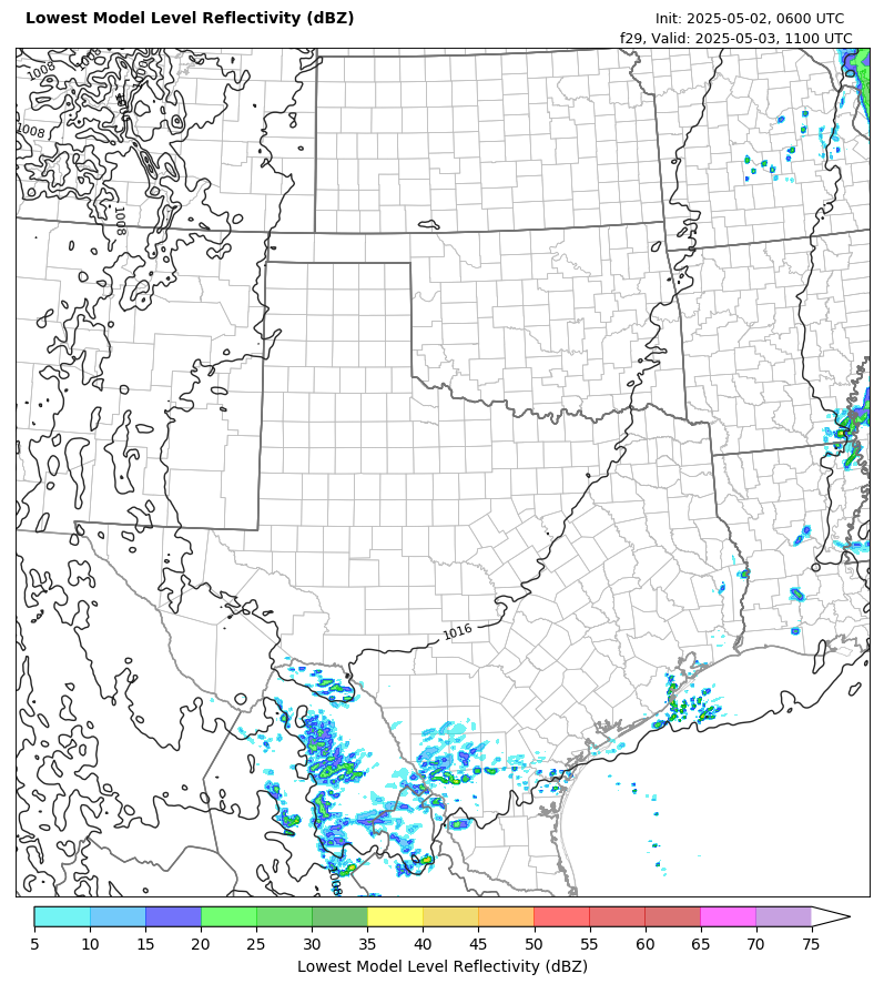
Texas Tech WRF showing a band of heavy snow moving across DFW with the sounding showing surface temp near 32F. Also, the dry layer was eroded well before this band moves in.

Image
5 likes   
Winter time post are almost exclusively focused on the DFW area.

User avatar
Ntxw
Storm2k Moderator
Storm2k Moderator
Posts: 22788
Joined: Wed Oct 21, 2009 6:34 pm
Location: DFW, Texas

Re: Texas Winter 2020-2021

#1519 Postby Ntxw » Sat Jan 09, 2021 1:15 pm

bubba hotep wrote:Texas Tech WRF showing a band of heavy snow moving across DFW with the sounding showing surface temp near 32F. Also, the dry layer was eroded well before this band moves in.

http://www.atmo.ttu.edu/bancell/real_time_WRF/current_run/d02_det_sfc_dbz_f29.png


This initial band that comes through in the first wave tomorrow morning is the one to watch as you mentioned above. It could be piece that breaks the forecast quickly.
4 likes   
The above post and any post by Ntxw is NOT an official forecast and should not be used as such. It is just the opinion of the poster and may or may not be backed by sound meteorological data. It is NOT endorsed by any professional institution including Storm2k. For official information, please refer to NWS products.


  Help support Storm2K!

Help Support Storm2K


Brent
S2K Supporter
S2K Supporter
Posts: 38095
Age: 37
Joined: Sun May 16, 2004 10:30 pm
Location: Tulsa Oklahoma
Contact:

Re: Texas Winter 2020-2021

#1520 Postby Brent » Sat Jan 09, 2021 1:17 pm

bubba hotep wrote:Texas Tech WRF showing a band of heavy snow moving across DFW with the sounding showing surface temp near 32F. Also, the dry layer was eroded well before this band moves in.

http://www.atmo.ttu.edu/bancell/real_time_WRF/current_run/d02_det_sfc_dbz_f29.png


How does that change to rain later :spam: lower rates?

That sounds eerily like February 2010 tbh
3 likes   
#neversummer


Return to “Winter Weather”

Who is online

Users browsing this forum: No registered users and 4 guests