

12z GFS similar to 6z but no crossover.
Moderator: S2k Moderators


cycloneye wrote:GFS is alone on development among the operational ones.


Yellow Evan wrote:https://i.imgur.com/grj4SjP.png
https://i.imgur.com/aplFXXC.png
12z GFS similar to 6z but no crossover.
Kingarabian wrote:Yellow Evan wrote:https://i.imgur.com/grj4SjP.png
https://i.imgur.com/aplFXXC.png
12z GFS similar to 6z but no crossover.
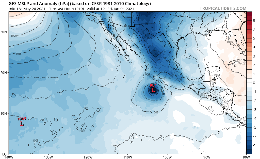
Aside from the EPAC-GOM crossover, this is probably what climo favors. More realistic compared to the runs from it and other models, that kept showing a deep TC over the open EPAC waters.

Yellow Evan wrote:https://www.tropicaltidbits.com/analysis/models/gfs/2021052618/gfs_mslpa_epac_16.png
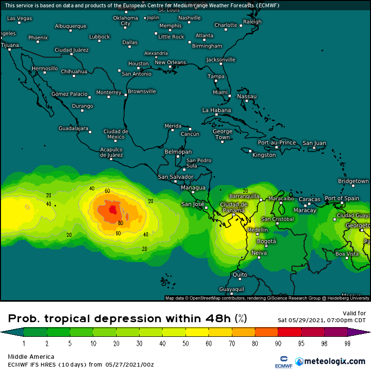
18z GFs through 90 hour. Will upload to imgur but said site is not working atm.

aspen wrote:12z GFS has both AOIs develop into pathetically weak tropical storms.

Users browsing this forum: ouragans and 118 guests


