2021 Global Model Runs Discussion (Out thru day 16)
Moderator: S2k Moderators
Forum rules

The posts in this forum are NOT official forecasts and should not be used as such. They are just the opinion of the poster and may or may not be backed by sound meteorological data. They are NOT endorsed by any professional institution or STORM2K. For official information, please refer to products from the National Hurricane Center and National Weather Service.
-
hurricane2025
- Category 1

- Posts: 254
- Joined: Thu Apr 08, 2021 10:36 am
Re: 2021 Global Model Runs Discussion (Out thru day 16)
One thing to remember this year we have airlines busy!! Last year we didn’t due to Covid so we couldn’t get as much data model wise, our commercial planes collect temps pressure dew points and it's all fed into the models, like mobile weather stations.
2 likes
-
Ivanhater

- Storm2k Moderator

- Posts: 11221
- Age: 39
- Joined: Fri Jul 01, 2005 8:25 am
- Location: Pensacola
Re: 2021 Global Model Runs Discussion (Out thru day 16)
12Z Euro shifts east

Sent from my LM-G900TM using Tapatalk
Sent from my LM-G900TM using Tapatalk
0 likes
Michael

Re: 2021 Global Model Runs Discussion (Out thru day 16)
18z GFS similar to 12z Euro but splits the energy with a piece going east and one going west. Models starting to pick up on a trough coming down into the northern gulf which would probably shear the system to death as it approaches from the south. Still way out there. though.
0 likes
-
Kingarabian

- S2K Supporter

- Posts: 16366
- Joined: Sat Aug 08, 2009 3:06 am
- Location: Honolulu, Hawaii
Re: 2021 Global Model Runs Discussion (Out thru day 16)
Shot at sub tropical develop in about a week:
NEW TROPICAL CYCLONE FORECAST TO DEVELOP AFTER 132 HOURS
FORECAST POSITION AT T+132 : 36.0N 73.9W
LEAD CENTRAL MAXIMUM WIND
VERIFYING TIME TIME POSITION PRESSURE (MB) SPEED (KNOTS)
-------------- ---- -------- ------------- -------------
1200UTC 16.06.2021 132 36.0N 73.9W 1001 36
0000UTC 17.06.2021 144 40.3N 67.3W 996 41
FORECAST POSITION AT T+132 : 36.0N 73.9W
LEAD CENTRAL MAXIMUM WIND
VERIFYING TIME TIME POSITION PRESSURE (MB) SPEED (KNOTS)
-------------- ---- -------- ------------- -------------
1200UTC 16.06.2021 132 36.0N 73.9W 1001 36
0000UTC 17.06.2021 144 40.3N 67.3W 996 41
0 likes
RIP Kobe Bryant

Re: 2021 Global Model Runs Discussion (Out thru day 16)
Is it me or are the models showing quite a few strong tropical waves for this time of year in the MDR?
1 likes
The above post is not official and should not be used as such. It is the opinion of the poster and may or may not be backed by sound meteorological data. It is not endorsed by any professional institution or storm2k.org. For official information, please refer to the NHC and NWS products.
-
Aric Dunn
- Category 5

- Posts: 21238
- Age: 43
- Joined: Sun Sep 19, 2004 9:58 pm
- Location: Ready for the Chase.
- Contact:
Re: 2021 Global Model Runs Discussion (Out thru day 16)
Maybe a thread for the system off SC needs to be added.... rapid spin up is possible.. as it heads NE Still partially attached to a weak trough. but a little convection that should be coming soon would take care of that..
1 likes
Note: If I make a post that is brief. Please refer back to previous posts for the analysis or reasoning. I do not re-write/qoute what my initial post said each time.
If there is nothing before... then just ask
Space & Atmospheric Physicist, Embry-Riddle Aeronautical University,
I believe the sky is falling...
If there is nothing before... then just ask
Space & Atmospheric Physicist, Embry-Riddle Aeronautical University,
I believe the sky is falling...
-
Aric Dunn
- Category 5
- Posts: 21238
- Age: 43
- Joined: Sun Sep 19, 2004 9:58 pm
- Location: Ready for the Chase.
- Contact:
Re: 2021 Global Model Runs Discussion (Out thru day 16)
Also need to watch the Tear Drop in the NE gulf as it crosses Florida and into the Atlantic overnight and into tomorrow.
0 likes
Note: If I make a post that is brief. Please refer back to previous posts for the analysis or reasoning. I do not re-write/qoute what my initial post said each time.
If there is nothing before... then just ask
Space & Atmospheric Physicist, Embry-Riddle Aeronautical University,
I believe the sky is falling...
If there is nothing before... then just ask
Space & Atmospheric Physicist, Embry-Riddle Aeronautical University,
I believe the sky is falling...
-
StPeteMike

- Category 2

- Posts: 655
- Joined: Thu Jun 07, 2018 11:26 pm
Re: 2021 Global Model Runs Discussion (Out thru day 16)
Was going to say Aric, the system off the SC coast should be monitored as models had hinted of something shaping up there. And as we have seen before, storms there can materialize without much model support and out of the blue.
4 likes
The above post is not official and should not be used as such. It is the opinion of the poster and may or may not be backed by sound meteorological data. It is not endorsed by any professional institution or storm2k.org. For official information, please refer to the NHC and NWS products.
-
JW-_-
Re: 2021 Global Model Runs Discussion (Out thru day 16)
The MDR is looking intriguing atm on the models. Early td potential?


2 likes
-
Shell Mound
- Category 5
- Posts: 2432
- Age: 33
- Joined: Thu Sep 07, 2017 3:39 pm
- Location: St. Petersburg, FL → Scandinavia
Re: 2021 Global Model Runs Discussion (Out thru day 16)
JW-_- wrote:The MDR is looking intriguing atm on the models. Early td potential?
https://i.imgur.com/sDn8FTM.png
https://i.imgur.com/McT5l4M.png
Numerous 00Z GEFS members show TS Claudette forming over the eastern MDR in two to three days, surpassing Bret (‘17) as the earliest TC in the MDR on record.
1 likes
CVW / MiamiensisWx / Shell Mound
The posts in this forum are NOT official forecasts and should not be used as such. They are just the opinion of the poster and may or may not be backed by sound meteorological data. They are NOT endorsed by any professional institution or STORM2K. For official information, please refer to products from the NHC and NWS.
-
Aric Dunn
- Category 5
- Posts: 21238
- Age: 43
- Joined: Sun Sep 19, 2004 9:58 pm
- Location: Ready for the Chase.
- Contact:
Re: 2021 Global Model Runs Discussion (Out thru day 16)
Also still need to watch the Tear drop that crossed Florida yesterday on the heals of soon to be Bill.
Could see another quick spin up.. chances are lower than with what spawned Bill.
But the conditions are there.
Could see another quick spin up.. chances are lower than with what spawned Bill.
But the conditions are there.
1 likes
Note: If I make a post that is brief. Please refer back to previous posts for the analysis or reasoning. I do not re-write/qoute what my initial post said each time.
If there is nothing before... then just ask
Space & Atmospheric Physicist, Embry-Riddle Aeronautical University,
I believe the sky is falling...
If there is nothing before... then just ask
Space & Atmospheric Physicist, Embry-Riddle Aeronautical University,
I believe the sky is falling...

Re: 2021 Global Model Runs Discussion (Out thru day 16)
Aric Dunn wrote:Also need to watch the Tear Drop in the NE gulf as it crosses Florida and into the Atlantic overnight and into tomorrow.
What do you think about the tropical wave that the GFS thinks could become an extremely early MDR TC?
0 likes
Irene '11 Sandy '12 Hermine '16 5/15/2018 Derecho Fay '20 Isaias '20 Elsa '21 Henri '21 Ida '21
I am only a meteorology enthusiast who knows a decent amount about tropical cyclones. Look to the professional mets, the NHC, or your local weather office for the best information.
I am only a meteorology enthusiast who knows a decent amount about tropical cyclones. Look to the professional mets, the NHC, or your local weather office for the best information.
-
Aric Dunn
- Category 5
- Posts: 21238
- Age: 43
- Joined: Sun Sep 19, 2004 9:58 pm
- Location: Ready for the Chase.
- Contact:
Re: 2021 Global Model Runs Discussion (Out thru day 16)
aspen wrote:Aric Dunn wrote:Also need to watch the Tear Drop in the NE gulf as it crosses Florida and into the Atlantic overnight and into tomorrow.
What do you think about the tropical wave that the GFS thinks could become an extremely early MDR TC?
It is very impressive.. one more decent convective burst and development is highly likely..
0 likes
Note: If I make a post that is brief. Please refer back to previous posts for the analysis or reasoning. I do not re-write/qoute what my initial post said each time.
If there is nothing before... then just ask
Space & Atmospheric Physicist, Embry-Riddle Aeronautical University,
I believe the sky is falling...
If there is nothing before... then just ask
Space & Atmospheric Physicist, Embry-Riddle Aeronautical University,
I believe the sky is falling...
-
SFLcane

- S2K Supporter
- Posts: 10281
- Age: 48
- Joined: Sat Jun 05, 2010 1:44 pm
- Location: Lake Worth Florida
Re: 2021 Global Model Runs Discussion (Out thru day 16)
2 capeverde TC’s for June…Now that would be something!

9 likes
Re: 2021 Global Model Runs Discussion (Out thru day 16)
Does anyone know why the HWRF isn’t updating? 92L hasn’t had any model runs in over 48 hours, and it still shows the 06z run for 93L from yesterday.
0 likes
Irene '11 Sandy '12 Hermine '16 5/15/2018 Derecho Fay '20 Isaias '20 Elsa '21 Henri '21 Ida '21
I am only a meteorology enthusiast who knows a decent amount about tropical cyclones. Look to the professional mets, the NHC, or your local weather office for the best information.
I am only a meteorology enthusiast who knows a decent amount about tropical cyclones. Look to the professional mets, the NHC, or your local weather office for the best information.
-
Shell Mound
- Category 5
- Posts: 2432
- Age: 33
- Joined: Thu Sep 07, 2017 3:39 pm
- Location: St. Petersburg, FL → Scandinavia
Re: 2021 Global Model Runs Discussion (Out thru day 16)
SFLcane wrote:2 capeverde TC’s for June…Now that would be something!
https://i.imgur.com/sTcPCvZ.gif
This is clearly going to bust, given the GFS’s usual bias. The latest runs no longer develop 94L, for instance, showing an open tropical wave instead.
0 likes
CVW / MiamiensisWx / Shell Mound
The posts in this forum are NOT official forecasts and should not be used as such. They are just the opinion of the poster and may or may not be backed by sound meteorological data. They are NOT endorsed by any professional institution or STORM2K. For official information, please refer to products from the NHC and NWS.
-
Kingarabian
- S2K Supporter
- Posts: 16366
- Joined: Sat Aug 08, 2009 3:06 am
- Location: Honolulu, Hawaii
Re: 2021 Global Model Runs Discussion (Out thru day 16)
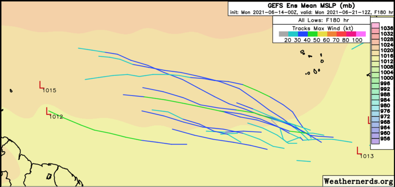
Super long range (300-384hours out) 00z GFS and EPS show another CAG with potential for a system in the WCarribean/BOC/EPAC.
3 likes
RIP Kobe Bryant
-
StPeteMike
- Category 2
- Posts: 655
- Joined: Thu Jun 07, 2018 11:26 pm
Re: 2021 Global Model Runs Discussion (Out thru day 16)
I don’t see anything really coming from the W Caribbean or GOM within the next 2 weeks. Though the models sorta saw this system we have now far out, I feel like these long range models are showing their bias than forecasting anything serious.
0 likes
The above post is not official and should not be used as such. It is the opinion of the poster and may or may not be backed by sound meteorological data. It is not endorsed by any professional institution or storm2k.org. For official information, please refer to the NHC and NWS products.
-
Kingarabian
- S2K Supporter
- Posts: 16366
- Joined: Sat Aug 08, 2009 3:06 am
- Location: Honolulu, Hawaii
Re: 2021 Global Model Runs Discussion (Out thru day 16)
StPeteMike wrote:I don’t see anything really coming from the W Caribbean or GOM within the next 2 weeks. Though the models sorta saw this system we have now far out, I feel like these long range models are showing their bias than forecasting anything serious.
GFS has a noticeable large area of convection rotating near Costa Rica and Panama. Looks to be aided by an AEW:

It eventually moves NW though continues to remain inland:

CMC also shows sort of the same thing but with a couple of better defined vorts.

So this is leading to some members from different ensembles showing closed of low pressure areas in the Pacific or Atlantic sides. Probably not exactly a CAG but something just as messy. The models have been showing this setup for a little while now so the trend/signal is there.
0 likes
RIP Kobe Bryant
-
StPeteMike
- Category 2
- Posts: 655
- Joined: Thu Jun 07, 2018 11:26 pm
Re: 2021 Global Model Runs Discussion (Out thru day 16)
We might get another early MDR invest around the 25/26, the GFS has been teasing a TD/TS forming around where 94L formed earlier this week. Even if nothing spawns from it, these strong waves should worry some about what August and the rest of the season will deliver.
1 likes
The above post is not official and should not be used as such. It is the opinion of the poster and may or may not be backed by sound meteorological data. It is not endorsed by any professional institution or storm2k.org. For official information, please refer to the NHC and NWS products.
Who is online
Users browsing this forum: StPeteMike and 236 guests