https://twitter.com/WxPatel/status/1411188334702084101
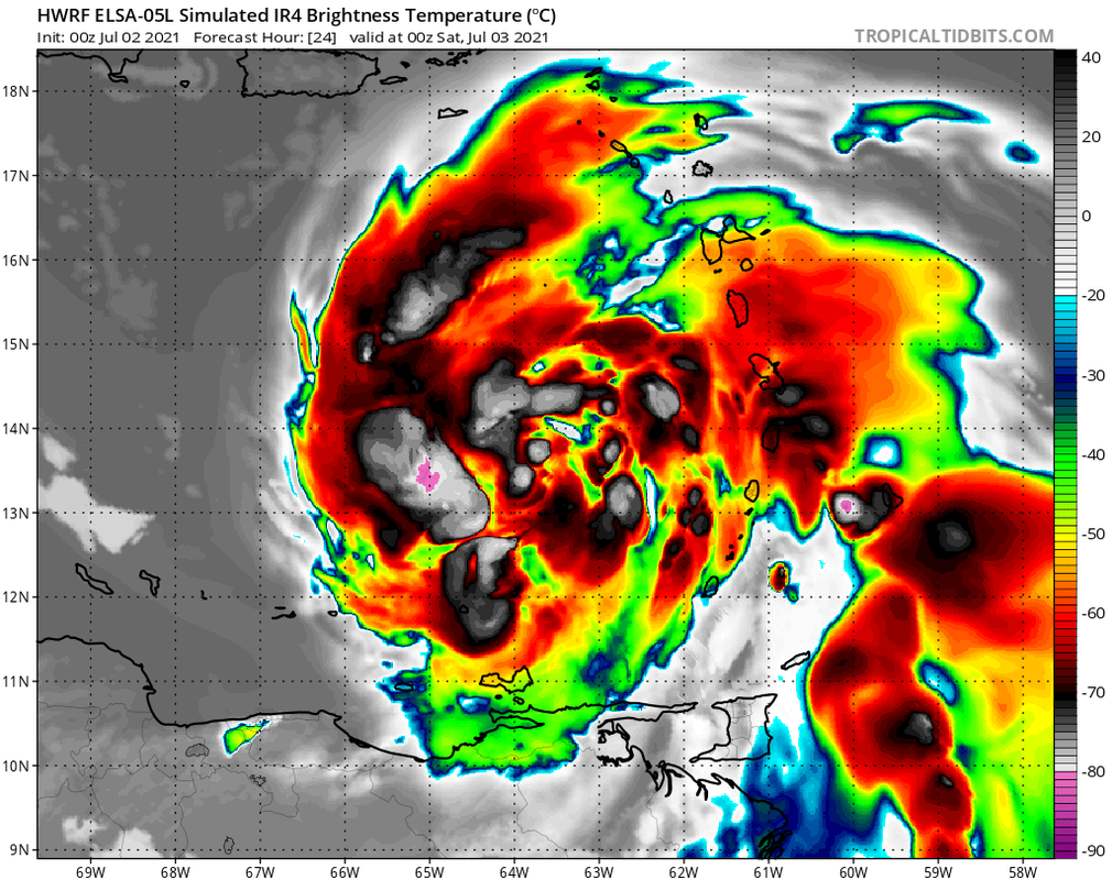
The 00Z HWRF shows Elsa deepening to 991 mb within the next hour, with a CDO forming directly over the LLC. Without an ULL to the W, this is doubtful.
Moderator: S2k Moderators


Shell Mound wrote:AutoPenalti wrote:Looks ragged on IR, but it HWRF did showcase this.
Not exactly:
https://i.postimg.cc/t4F2K1fh/Elsa2021-1.jpg
https://i.postimg.cc/gkCgtyMz/Elsa2021-3.png
Nevertheless, yesterday’s 00Z HWRF was showing a MSLP of 1000 mb by early Saturday, yet ended up five mb too high.


cane5 wrote:2am in and the cone is keeping South Fla in the picture and the keys even more in the picture. But so is Tampa.
Shell Mound wrote:https://i.postimg.cc/qqqx7wL3/Elsa2021-6.png
https://i.postimg.cc/X7ZgS2XM/Elsa2021-7.jpg
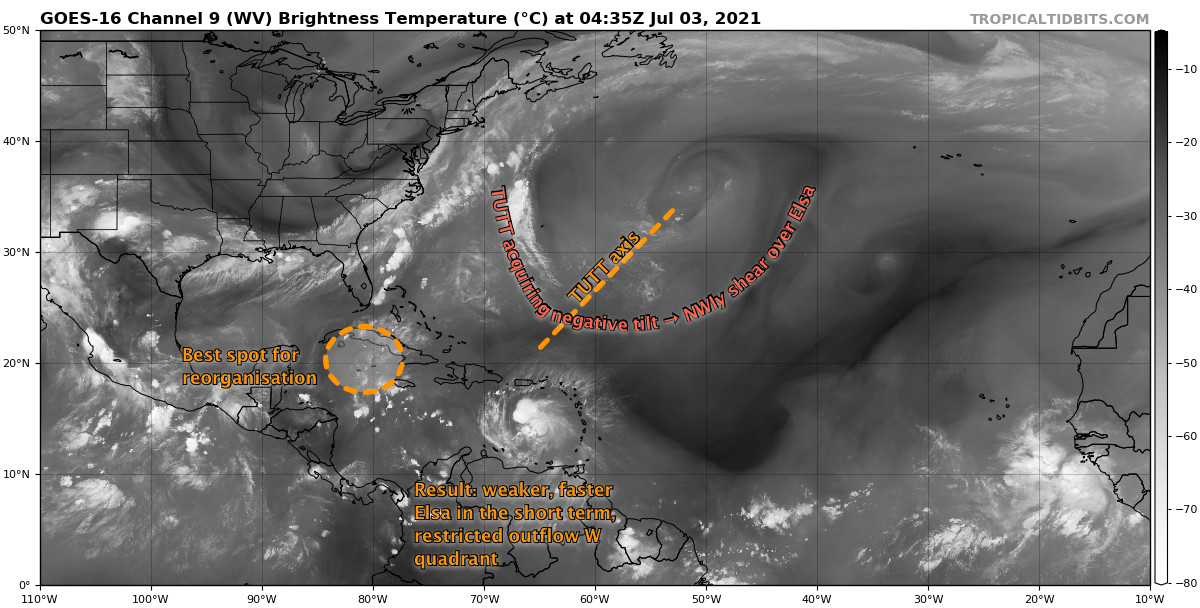
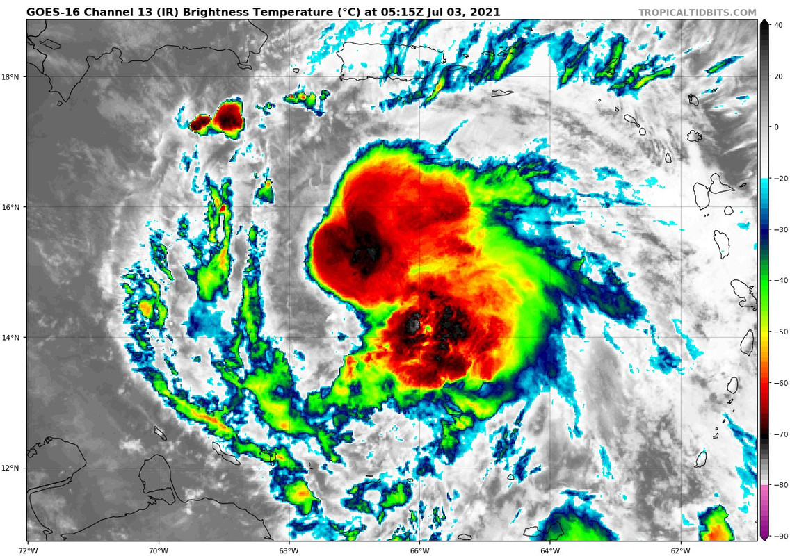
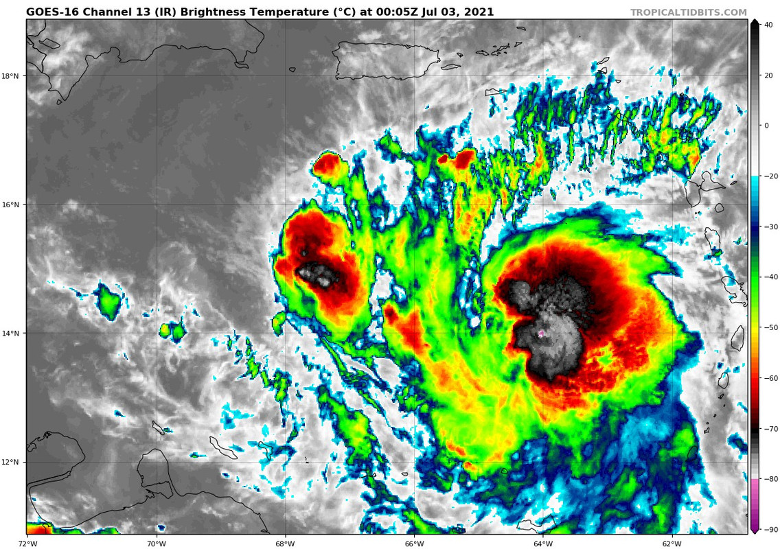
Given the lack of an ULL to its W, Elsa will struggle to redevelop its western outflow-channel. The 00Z HWRF shows deepening to 991 mb within the hour and also depicts a vertically stacked, rapidly reorganising Elsa. Based on current trends for once the HWRF may be too bullish, given the northwesterly shear imparted by the TUTT over the central North Atlantic, along with the ongoing rapid forward translation of the system, to not mention the recent decoupling of the LLC and MLC. Interestingly, there is decent agreement among the GFS, CMC, EC, and HWRF in regard to a landfall on Haiti’s Tiburon Peninsula, despite variations in the projected intensity. The weaker solutions are roughly in the same position as the stronger at that time. Based on shortwave IR I see two centres: one near 15.8°N 67.7°W and another (the old LLC) near 15°N 67.5°W. Based on current organisation I think Elsa has weakened to a moderate or strong TS.
ConvergenceZone wrote:Shell Mound wrote:https://i.postimg.cc/qqqx7wL3/Elsa2021-6.png
https://i.postimg.cc/X7ZgS2XM/Elsa2021-7.jpg
Given the lack of an ULL to its W, Elsa will struggle to redevelop its western outflow-channel. The 00Z HWRF shows deepening to 991 mb within the hour and also depicts a vertically stacked, rapidly reorganising Elsa. Based on current trends for once the HWRF may be too bullish, given the northwesterly shear imparted by the TUTT over the central North Atlantic, along with the ongoing rapid forward translation of the system, to not mention the recent decoupling of the LLC and MLC. Interestingly, there is decent agreement among the GFS, CMC, EC, and HWRF in regard to a landfall on Haiti’s Tiburon Peninsula, despite variations in the projected intensity. The weaker solutions are roughly in the same position as the stronger at that time. Based on shortwave IR I see two centres: one near 15.8°N 67.7°W and another (the old LLC) near 15°N 67.5°W. Based on current organisation I think Elsa has weakened to a moderate or strong TS.
Meteorologist Wxman did say that he thought it was a tropical storm and not a hurricane, so he very well could have been right....

Jr0d wrote:We have a tower firing over the center now....this maybe the start of the morning intensification the HWRF was hinting at....or it could be a temporary byrst of activity.
I'll be up until at least the 5am advisory.
Shell Mound wrote:https://twitter.com/philklotzbach/status/1410991508233326592
Users browsing this forum: No registered users and 22 guests


