aspen wrote:I’m starting to think that 2021 actually has a shot of exhausting the name list and potentially getting into the auxiliary list too. While this season is not going to keep up with the pace of 2020 (that suppressive CCKW will probably keep anything from developing until the last third of July), we’re still at a VERY strong start with 5 named storms already. If we see a minimum of 1 storm for the rest of July, 3 in August, 5 in September, 2 in October, and 1 in November, 2021 will finish with 17 storms. However, other hyperactive years had way more in August or September. 2004, 2005, 2010, 2012, and 2020 all had 6-10 systems form in either of those months, and with a favorable CCKW entering the Atlantic starting in late July, it’s possible this August is also active. I also won’t rule out significant late season activity like in 2010, 2018, and 2020 to boost the numbers further.
It would take 1 more July storm, 4 in August (like 2017), 7 in September, 3 in October (like in 2018), and 1 in November (like 2016) to get us to 21 named storms. If any month in ASO becomes even more active — something that is impossible to confidently pin down at this point — then we’ll be in the auxiliary list. Doesn’t have the same ring as “going Greek”, but oh well.
Imagine if this year we did not ditch the Greek alphabet, went over 22 NSs (which would have been something many would not have ever imagined of, with two consecutive seasons going into that rare territory), and then had another bad Hurricane Delta or Eta (this is just a hypothetical possibility and not a prediction). That would have been very interesting to say the least.
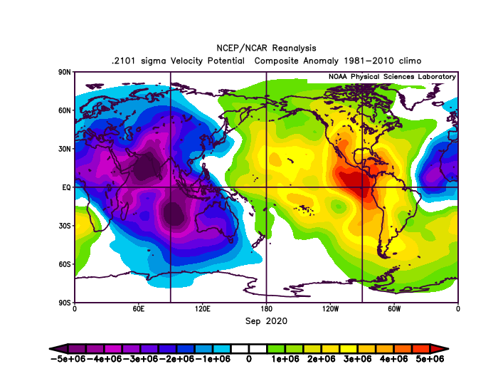
Also, I would like to point out this tweet from Ben Noll from several days ago that may be very useful now that we are almost done tracking Elsa.
https://twitter.com/BenNollWeather/status/1410612909609304064
If anything, this could mean (assuming it verifies) that we could expect activity to ramp up again by the end of this month. And that early August velocity signature is simply nerve-wracking, with rising motion over the West Coast of Africa, I think theoretically speaking this could actually moisten where tropical waves exit the continent and facilitate the process of a TC actually forming near the Cabo Verde islands.