DestinHurricane wrote:From CSU:
In general, early season Atlantic hurricane activity has very little correlation with
overall Atlantic hurricane activity. However, when this activity occurs in the tropics
(south of 23.5°N), that is typically a harbinger of a very active season. Hurricane Elsa
formed in the tropical Atlantic and then tracked into the eastern Caribbean (10-20°N, 75-
60°W) at hurricane strength. Since 1900, only six other years have had eastern Caribbean
hurricanes prior to 1 August: 1926, 1933, 1961, 1996, 2005 and 2020. All six of those
years were classified as hyperactive Atlantic hurricane seasons using the NOAA Atlantic
hurricane season definition (>=160 ACE).
While I do think 2021 will be an above average season, maybe even hyperactive especially now that Cool-Neutral or La Nina looks likely during the peak months. I disagree that Elsa is a sign of an active season. All of the years they mentioned, 1926, 1933, 1961, 1996, 2005 and 2020, had long lived hurricanes in the eastern Caribbean. Elsa was able to jump to hurricane for a few hours before it weakened back down, unlike the aforementioned seasons' E Carib hurricanes. The fact that Elsa was not able to maintain hurricane intensity through the Eastern Caribbean due to wind shear doesn't necessarily point to an inactive season, I just don't think it means the season will be hyperactive (though it may be, just wont be because of Elsa). Elsa did not find very favorable conditions in the eastern Caribbean, which is expected in july, even in an above average season. Some of the most active seasons such as 2017 don't have hurricanes in the e Caribbean in July.
Your point regarding Elsa's weaker life-span is worth consideration, however I think you're missing the bigger picture. Take a look past the major hurricanes of 2005 or 1933. These were two record setting years but both seasons also had their share of "weak-sister" Tropical Storms too. I think a better view of the background state for those years (aside from how many storms) would be consideration of the length of their storm tracks. Reason being that a season of primarily short tracks would suggest TUTTS, Upper level shear, cool SST'S, regions affected by SAL or perhaps diminished relative humidity through one or more levels of the atmosphere. Any combination of these conditions can quite effectively cut down a Tropical Storm to little more then an open wave. I found Elsa's long track from the Eastern Atlantic MDR to be potentially telling.
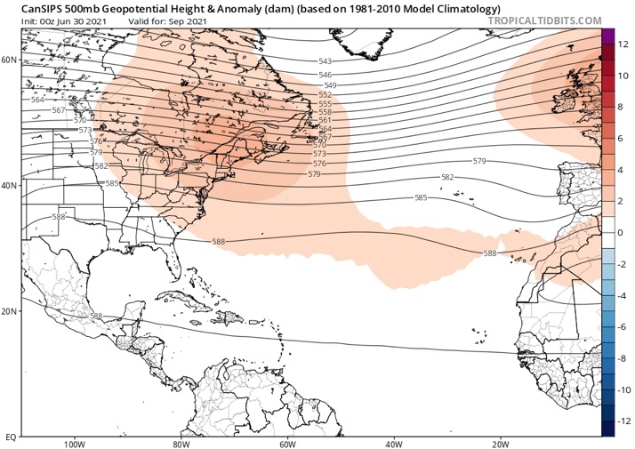
I don't think 2021 will be the Alien Apocalypse year 2005 was, but I think the present steering (generally) in place along with an increasingly favorable background state will positively result in additional threats to Florida, Bahamas, N. Gulf and the Eastern Seaboard. That's not to suggest other regions won't be threatened. Take a moment and compare tracks and Tropical cyclone origins for 1933 and 2005, and then consider our semi permanent Atlantic ridge pattern seemingly in place now. I believe this (along with Elsa's track) offers a few clues to how this season will probably play out.


