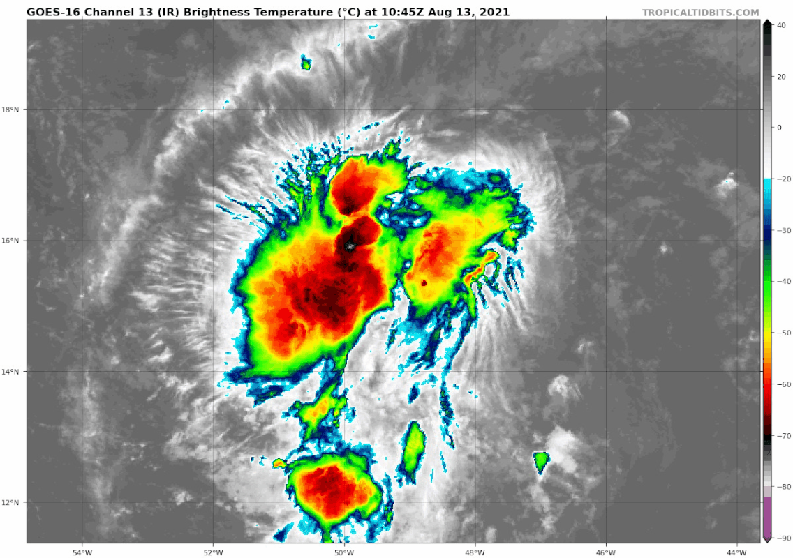
Satellite-derived wind data suggested that the northern area was pretty close to closing off a circulation this morning, but there’s still a bit of rotation in both the low- and mid-levels down south.
Based on that wind data from this morning and satellite trends this afternoon, I think if we see a circulation close off in this wave it will be up north. This will have some important implications from a track perspective, and by association for the intensity forecast. ...
What’s most likely at this point is probably a track very similar to PTC6 and Elsa through the northern Lesser Antilles before heading towards Hispaniola. ...
It’s also possible that the system tracks farther north through the SW Atlantic. While there’s plenty of warm water here, preliminary indications show the potential for more wind shear which would hamper its ability to intensify.
Source
https://twitter.com/AndyHazelton/status/1426162729275076614