

Moderator: S2k Moderators

skyline385 wrote:Bocadude85 wrote:kevin wrote:Just for a historical reference / statistics, only 10 hurricanes made landfall in the US while originating from the east (I took passing east of Cuba as 'east', Matthew is kind of an edge case) in October, November or December since 1851. Of this subset only 2 passed north of the Caribbean while forming roughly in the MDR (basically the potential set-up for 98L): the 1898 and 1893 hurricanes. It seems to indicate that a US landfall from such a set-up is extremely rare so for now I'm not worrying about that aspect too much (yet). The entire list, in chronological order:
Year / Name / Month / Landfalling state / Wind speed @LF (kt) / Pressure @LF (mb) / Cat@LF
2016 / Matthew / Oct / South Carolina / 75 / 967 / 1
2012 / Sandy* / Oct / New Jersey / 70 / 945 / 1
1966 / Inez / Oct / Florida / 75 / 984 / 1
1954 / Hazel / Oct / South and North Carolina / 115 / 938 / 4
1941 / Unnamed / Oct / Florida / 85 / ?? / 2
1935 / Unnamed / Nov / Florida / 85 / 973 / 2
1913 / Unnamed / Oct / South Carolina / 65 / ?? / 1
1898 / Unnamed / Oct / Georgia / 115 / 938 / 4
1893 / Unnamed / Oct / South Carolina / 105 / 955 / 3
1869 / Unnamed / Oct / Maine / 90 / ?? / 2
* = extra-tropical at landfall
Here are the two 'worst-case scenarios' (1898 and 1893):
1898 Georgia hurricane
https://i.imgur.com/y6QSMcJ.png
1893 Great Charleston Hurricane
https://i.imgur.com/vQ7I94i.png
Shouldn’t hurricane Kate from 1985 be on this list?
He forgot Irma of all storms too lol, probably the worst case of a Cape Verde system
EDIT: I see he had October, November or December only, however we still have 10 days left in September...


supercane4867 wrote:a lot of folks are gonna freak out once they wake up in the morning

Deshaunrob17 wrote:Bruh it's Irma all over again. Gfs with the northern solution and Euro with the southern solution. It will be a painful set of days watching these models.


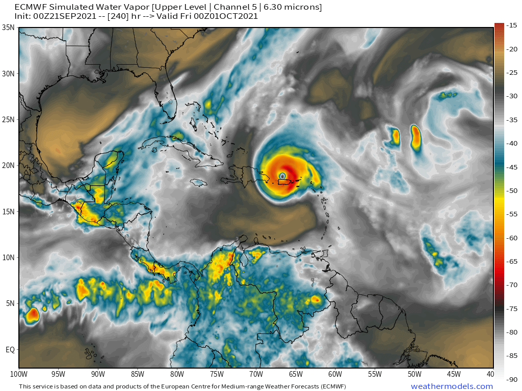
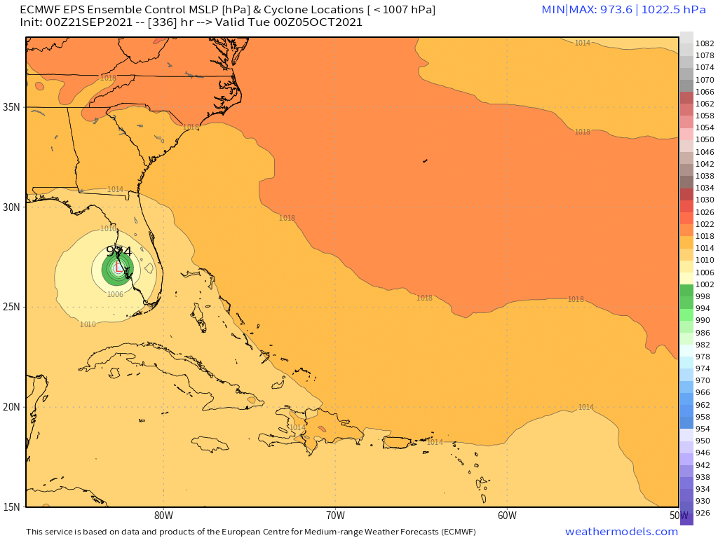
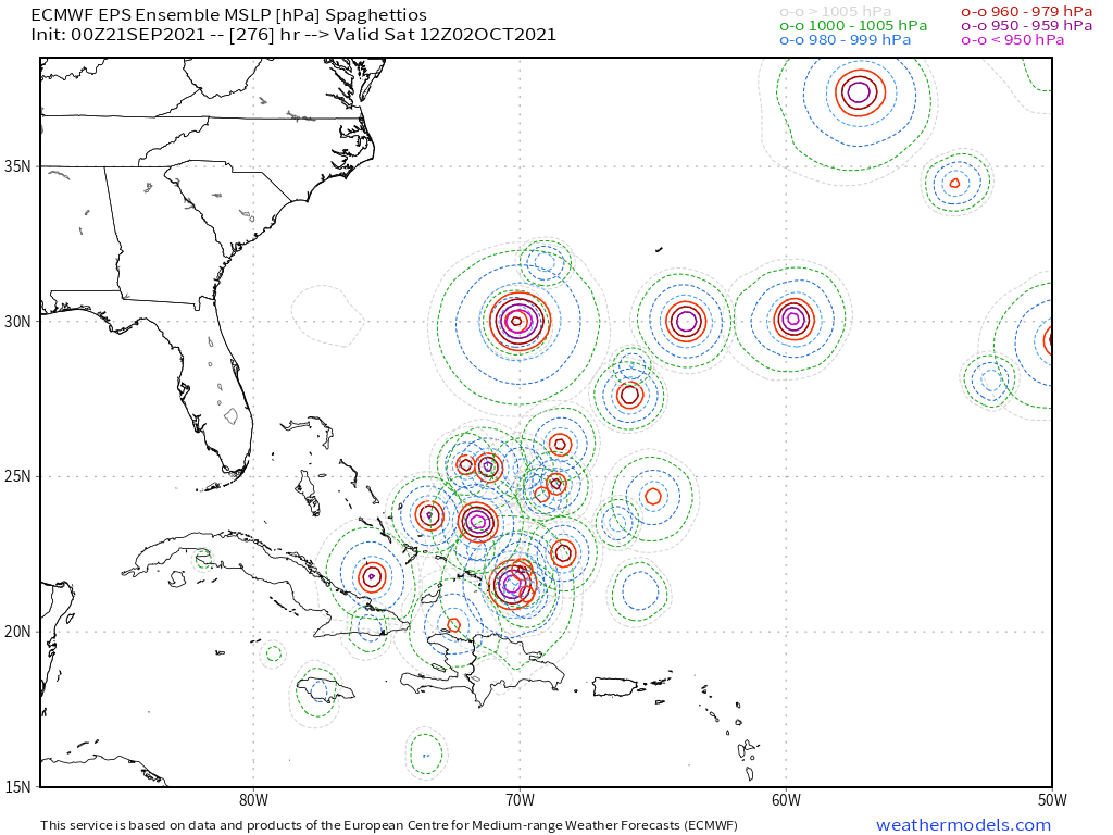
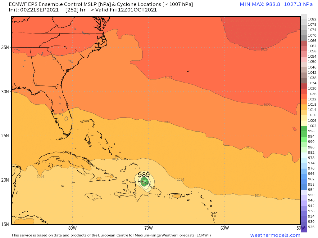
SFLcane wrote:Ok euro
https://i.postimg.cc/0QRs5JzR/4354-A263-69-E5-49-C3-800-D-15-D849-D21-FE4.png
https://i.postimg.cc/NFQvmq8d/95-E2-E827-DF52-4504-B999-E0753-F02-BD8-E.png
https://i.postimg.cc/DZrKSyGW/B9-D034-AC-EDD0-4-B5-A-92-DB-3394582-A659-F.png
https://i.postimg.cc/QCSGq40h/F59-E9-DB7-6-AD4-4-F52-8-B16-D6-FAC9-DC9-B37.png

Teban54 wrote:Lol, GFS basically stalls 98L from 258 hrs through 318 hrs at the same intensity. Looks like a front tries to pick it up but fails.
Update: Moving west slowly again, gets dangerously close to Bermuda but ultimately misses it just to the east while recurving. Keep in mind this is fantasy range.
Users browsing this forum: No registered users and 36 guests


