


Area Forecast Discussion...UPDATED
National Weather Service Austin/San Antonio TX
1156 AM CDT Thu Jul 14 2022
...New UPDATE...
.UPDATE...
Issued at 1144 AM CDT Thu Jul 14 2022
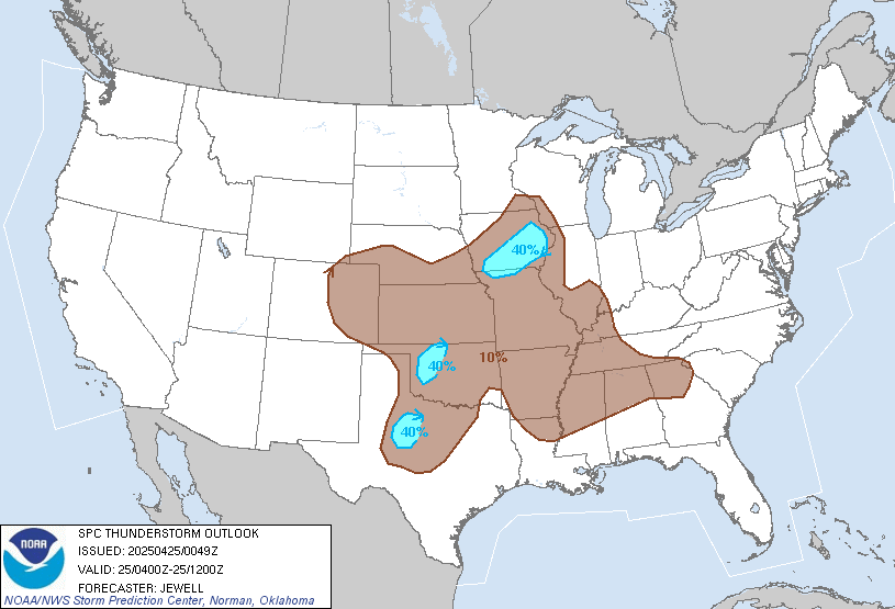
A cluster of storms is ongoing across northeast Texas in association
with a mid-level trough. The cluster is forecast to continue to push
southwestward this afternoon to affect areas of the Hill Country and
along of Interstate 35 including the cities of Austin and San
Antonio. Some storms will be capable of producing heavy downpours and
strong wind gusts of 40 to 50 mph. Can`t rule out a few severe
storms rolling into our area this afternoon and therefore the
reasoning of the Storm Prediction Center to upgrade most of South
Central Texas into marginal risk of severe thunderstorms for the new
Day 1 Convective Outlook.


 .
.


