Low Pressure in the Central Atlantic (Is Invest 91L)

This is the general tropical discussion area. Anyone can take their shot at predicting a storms path.

Moderator: S2k Moderators

Forum rules

The posts in this forum are NOT official forecasts and should not be used as such. They are just the opinion of the poster and may or may not be backed by sound meteorological data. They are NOT endorsed by any professional institution or STORM2K. For official information, please refer to products from the National Hurricane Center and National Weather Service.

Help Support Storm2K
Message
Author
User avatar
AtlanticWind
S2K Supporter
S2K Supporter
Posts: 1885
Age: 66
Joined: Sun Aug 08, 2004 9:57 pm
Location: Plantation,Fla

Re: Tropical Wave SW of the Cabo Verde Islands

#361 Postby AtlanticWind » Sat Aug 27, 2022 1:14 am

skyline385 wrote:0Z ECMWF starts off very strong but then suddenly seems to weaken around 60 hours into a broad circulation :?:

Looks about the same at 72 hours to me
0 likes   

User avatar
skyline385
Category 5
Category 5
Posts: 2728
Age: 34
Joined: Wed Aug 26, 2020 11:15 pm
Location: Houston TX

Tropical Wave SW of the Cabo Verde Islands

#362 Postby skyline385 » Sat Aug 27, 2022 1:19 am

Isaias flashbacks lol

Image

AtlanticWind wrote:
skyline385 wrote:0Z ECMWF starts off very strong but then suddenly seems to weaken around 60 hours into a broad circulation :?:

Looks about the same at 72 hours to me


Compare the vorticity plots, you will see the difference. This run is very broad and elongated almost like the trough never consolidated fully.
0 likes   

User avatar
AtlanticWind
S2K Supporter
S2K Supporter
Posts: 1885
Age: 66
Joined: Sun Aug 08, 2004 9:57 pm
Location: Plantation,Fla

Re: Tropical Wave SW of the Cabo Verde Islands

#363 Postby AtlanticWind » Sat Aug 27, 2022 1:25 am

Models backing off?

It really is an odd season to this point.
0 likes   

User avatar
AtlanticWind
S2K Supporter
S2K Supporter
Posts: 1885
Age: 66
Joined: Sun Aug 08, 2004 9:57 pm
Location: Plantation,Fla

Re: Tropical Wave SW of the Cabo Verde Islands

#364 Postby AtlanticWind » Sat Aug 27, 2022 1:31 am

Euro strengthens it at 144 hours , GFS was weakening it about this point I believe
0 likes   

User avatar
skyline385
Category 5
Category 5
Posts: 2728
Age: 34
Joined: Wed Aug 26, 2020 11:15 pm
Location: Houston TX

Tropical Wave SW of the Cabo Verde Islands

#365 Postby skyline385 » Sat Aug 27, 2022 1:45 am

AtlanticWind wrote:Models backing off?

It really is an odd season to this point.

Don’t think so, we have to wait for the trough to sort itself out before the models have an accurate idea.
Last edited by skyline385 on Sat Aug 27, 2022 2:14 am, edited 1 time in total.
0 likes   

User avatar
AtlanticWind
S2K Supporter
S2K Supporter
Posts: 1885
Age: 66
Joined: Sun Aug 08, 2004 9:57 pm
Location: Plantation,Fla

Re: Tropical Wave SW of the Cabo Verde Islands

#366 Postby AtlanticWind » Sat Aug 27, 2022 1:47 am

Euro still showing what appears to be a hurricane approaching florida
1 likes   

User avatar
skyline385
Category 5
Category 5
Posts: 2728
Age: 34
Joined: Wed Aug 26, 2020 11:15 pm
Location: Houston TX

Re: Tropical Wave SW of the Cabo Verde Islands

#367 Postby skyline385 » Sat Aug 27, 2022 2:10 am

0Z ECMWF, seems to slow down in the last frame getting blocked by the ridge building over Florida

Image
Image
1 likes   

User avatar
AJC3
Admin
Admin
Posts: 3998
Age: 61
Joined: Tue Aug 31, 2004 7:04 pm
Location: West Melbourne, Florida
Contact:

Re: Tropical Wave SW of the Cabo Verde Islands

#368 Postby AJC3 » Sat Aug 27, 2022 2:14 am

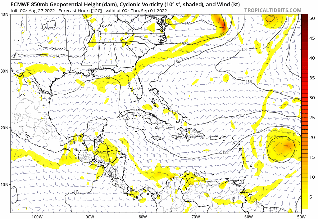
AtlanticWind wrote:Euro still showing what appears to be a hurricane approaching florida


The 00Z op run stalls it out just east of Eleuthera at day 10. Looks like the ridge to its north erodes east of 75W, but remains strong from 75W westward into the mid Atlantic and SE CONUS. Of course, too early to dwell on specifics, but the GFS is definitely trending toward the ECM, albeit about a full day slower as far as the islands are concerned. Looks like there's a decent chance for a wave/disturbance/TC to be moving close to the northern LA in about 6-7 days. As always, it'll sort itself out over the next week whether or not this becomes a significant concern/threat for the U.S.

edit: taking a second look at both runs, eyeballing the position of the surface-h850MB centers out at day 10, they're only about...maybe 80 miles apart, so the GFS does catch up from days 7-10. Go figure...
3 likes   

User avatar
skyline385
Category 5
Category 5
Posts: 2728
Age: 34
Joined: Wed Aug 26, 2020 11:15 pm
Location: Houston TX

Re: Tropical Wave SW of the Cabo Verde Islands

#369 Postby skyline385 » Sat Aug 27, 2022 2:36 am

0Z EPS has quite a few members sneak into the Gulf as the ridge builds up over the east coast while others recurve near the Bahamas

Image
3 likes   

MHC Tracking
Tropical Storm
Tropical Storm
Posts: 195
Joined: Mon Mar 15, 2021 10:05 am

Re: Tropical Wave SW of the Cabo Verde Islands

#370 Postby MHC Tracking » Sat Aug 27, 2022 2:54 am

Seems 00z GFS TUTTs the wave into oblivion before it can get going. Later period of organization rendered impossible by shear from the GOMEX fantasy's outflow.
Image
0 likes   

Keldeo1997
Category 2
Category 2
Posts: 637
Joined: Fri Oct 11, 2019 11:35 pm

Re: Tropical Wave SW of the Cabo Verde Islands

#371 Postby Keldeo1997 » Sat Aug 27, 2022 3:08 am

Image :double: :double:
1 likes   

User avatar
CFLHurricane
Category 1
Category 1
Posts: 346
Joined: Thu Mar 27, 2014 5:56 pm
Location: Floriduh

Re: Tropical Wave SW of the Cabo Verde Islands

#372 Postby CFLHurricane » Sat Aug 27, 2022 4:55 am


I’ll believe when I see it. The models have been too much of a tease this year.
3 likes   
I'm not a meteorologist, but I did stay at a motel 8.

Keldeo1997
Category 2
Category 2
Posts: 637
Joined: Fri Oct 11, 2019 11:35 pm

Re: Tropical Wave SW of the Cabo Verde Islands

#373 Postby Keldeo1997 » Sat Aug 27, 2022 5:31 am

Image

Image
0 likes   

User avatar
aspen
Category 5
Category 5
Posts: 8812
Joined: Sat Oct 12, 2019 7:10 pm
Location: Connecticut, USA

Re: Tropical Wave SW of the Cabo Verde Islands

#374 Postby aspen » Sat Aug 27, 2022 6:13 am

06z GFS, 00z Euro, 00z CMC, and 06z ICON all develop this and make it at least a moderate TS. The CMC is the only model that doesn’t bring it to Category 2 or higher intensity, but the fact that it actually shows development is something.

06z GFS and 00z Euro are a little slower than yesterday’s runs and don’t have TS Danielle until after August 31st, while the ICON is faster and makes it a TS before the end of the month.
2 likes   
Irene '11 Sandy '12 Hermine '16 5/15/2018 Derecho Fay '20 Isaias '20 Elsa '21 Henri '21 Ida '21

I am only a meteorology enthusiast who knows a decent amount about tropical cyclones. Look to the professional mets, the NHC, or your local weather office for the best information.

User avatar
gatorcane
S2K Supporter
S2K Supporter
Posts: 23689
Age: 47
Joined: Sun Mar 13, 2005 3:54 pm
Location: Boca Raton, FL

Re: Tropical Wave SW of the Cabo Verde Islands

#375 Postby gatorcane » Sat Aug 27, 2022 6:41 am

Overnight runs are even more concerning for the northern Lesser Antilles, Bahamas, and Florida. The GFS has shifted way west (with development) as I thought it would while the Euro stalls it just east of the Bahamas by day 10 with plenty of model shifting to come. Long way to go here but not buying the GFS recurve still.

Yikes 00Z ECMWF :eek:

Image
3 likes   

User avatar
wxman57
Moderator-Pro Met
Moderator-Pro Met
Posts: 22951
Age: 67
Joined: Sat Jun 21, 2003 8:06 pm
Location: Houston, TX (southwest)

Re: Tropical Wave SW of the Cabo Verde Islands

#376 Postby wxman57 » Sat Aug 27, 2022 6:51 am

I think this feature has a much better chance of developing than anything in the western Caribbean. Note that the NHC is jumping its "X" westward to be more in line with the lead disturbance?
10 likes   

User avatar
tropicwatch
Category 5
Category 5
Posts: 3364
Age: 61
Joined: Sat Jun 02, 2007 10:01 am
Location: Panama City Florida
Contact:

Re: Tropical Wave SW of the Cabo Verde Islands

#377 Postby tropicwatch » Sat Aug 27, 2022 7:29 am

wxman57 wrote:I think this feature has a much better chance of developing than anything in the western Caribbean. Note that the NHC is jumping its "X" westward to be more in line with the lead disturbance?


Saw that this morning. Maybe the name of this thread should be adjusted.
2 likes   
Tropicwatch


Agnes 72', Eloise 75, Elena 85', Kate 85', Charley 86', Florence 88', Beryl 94', Dean 95', Erin 95', Opal 95', Earl 98', Georges 98', Ivan 2004', Arlene 2005', Dennis 2005', Ida 2009' Debby 2012' Irma 2017' Michael 2018'

User avatar
cycloneye
Admin
Admin
Posts: 143879
Age: 68
Joined: Thu Oct 10, 2002 10:54 am
Location: San Juan, Puerto Rico

Re: Tropical Wave SW of the Cabo Verde Islands

#378 Postby cycloneye » Sat Aug 27, 2022 7:52 am

tropicwatch wrote:
wxman57 wrote:I think this feature has a much better chance of developing than anything in the western Caribbean. Note that the NHC is jumping its "X" westward to be more in line with the lead disturbance?


Saw that this morning. Maybe the name of this thread should be adjusted.


Edited the title.
2 likes   
Visit the Caribbean-Central America Weather Thread where you can find at first post web cams,radars
and observations from Caribbean basin members Click Here

User avatar
aspen
Category 5
Category 5
Posts: 8812
Joined: Sat Oct 12, 2019 7:10 pm
Location: Connecticut, USA

Re: Tropical Wave SW of the Cabo Verde Islands

#379 Postby aspen » Sat Aug 27, 2022 7:56 am

wxman57 wrote:I think this feature has a much better chance of developing than anything in the western Caribbean. Note that the NHC is jumping its "X" westward to be more in line with the lead disturbance?

The “X” is centered to the east of the main convective blob because that is offset from the center of vorticity. At the 850mb and 700mb levels, it’s at roughly 36-37W, although there’s an offset to 39-40W at the 500mb and 200mb levels. However, the disturbance is now one singular area of vorticity instead of being two connected but distinguishable areas, an important step towards this finally developing. It’s also a little more convectively active than the GFS has forecast for this time. Now all that convection just needs to center itself over the vort center and consolidate.
2 likes   
Irene '11 Sandy '12 Hermine '16 5/15/2018 Derecho Fay '20 Isaias '20 Elsa '21 Henri '21 Ida '21

I am only a meteorology enthusiast who knows a decent amount about tropical cyclones. Look to the professional mets, the NHC, or your local weather office for the best information.

tolakram
Admin
Admin
Posts: 19990
Age: 61
Joined: Sun Aug 27, 2006 8:23 pm
Location: Florence, KY (name is Mark)

Re: Low Pressure in the Central Atlantic

#380 Postby tolakram » Sat Aug 27, 2022 8:01 am

I feel like this will be an invest very soon.

UKMET 6Z (only goes to 60 hours)

60 hours
Image
2 likes   
M a r k
- - - - -
Join us in chat: Storm2K Chatroom Invite. Android and IOS apps also available.

The posts in this forum are NOT official forecasts and should not be used as such. Posts are NOT endorsed by any professional institution or STORM2K.org. For official information and forecasts, please refer to NHC and NWS products.


Return to “Talkin' Tropics”

Who is online

Users browsing this forum: Google Adsense [Bot], StormWeather and 208 guests