toad strangler wrote:LarryWx wrote:gatorcane wrote:Those Euro ensembles don’t make much sense for September. Looks like more of an October track. My bet is still something like what the TVCN shows, i.e less of a northeast turn and more north across the EGOM or East-Central GOM.
I agree with you about late Sept climo not favoring the NE tracks across the S half of FL. But that's an Octoberlike upper trough coming into the E US days 4-6 before lifting out. Notice that the faster members are mainly the ones that turn NE across S FL. So, it appears that a big key will be speed of 98L. If it goes faster, it will have a better chance to get caught by the upper trough and move NE over the S half of FL. But, if not fast enough, it very likely won't and would instead likely hit the N Gulf coast anywhere from the FL Big Bend westward to LA.
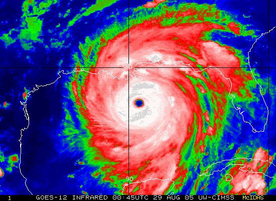
Charley happened in the first half of August. gator brought that one up earlier and since its 18 years might have not realized how early in the season that was to have this "October" climo track to it. Point being, TC's don't read climo textbooks before planning their trip

Anomalies happen all the time. hmmm
Indeed, mean climo is important to keep in mind but one needs to keep in mind that climo is in reality a mix of many possibilities with tracks on both sides of the mean climo. When folks refer to climo, they're often referring to either the mean or mode track during a period of the calendar. But climo doesn't say that it necessarily has to go near that track to behave per climo. Both the mode and mean for storms with genesis during 9/21-30 (we're looking at progged genesis smack dab in the middle of 9/21-30 making using that period as a good one to use) that later reach the NW Caribbean is clearly not a NE track across the S half of FL. Rather, it is a track toward the FL Panhandle. But if one looks at the history of these tracks, they will see many tracks on both sides of that Panhandle track:
https://www.nhc.noaa.gov/climo/images/sep_21_30.png On this map one can see that for those that travel over the NW Caribbean that there are many tracks that go anywhere from the E 2/3 of LA all of the way to those that even barely miss S FL to the SE over the NW Bahamas. So, using climo to say that 98L should follow the mean track from the NW Caribbean to the FL Panhandle just because it will have genesis near the middle of 9/21-30 is not using climo the best way imho. Climo says that at or near the FL Panhandle is the highest chance but it doesn't say it is anywhere near the only chance.
Aside: The map for geneses that occur OCT 1-10 and that are then either already in or later get to the NW Caribbean have a mean track that is further SE than the 9/21-30 geneses tracks with an increased chance for a NE crossing over the S half of FL though even that map has tracks on both sides of that and with the mean near the FL Big Bend:
https://www.nhc.noaa.gov/climo/images/oct_1_10.png If we look at the 10/11-20 map, it has an even further SE mean track near far S FL with many tracks from the NW Caribbean going over the SE third of FL or NW Bahamas:
https://www.nhc.noaa.gov/climo/images/oct_11_20.png


