

SteveM wrote:AlanSnyder35 wrote:zzzh wrote:https://i.imgur.com/crcNJEZ.png
https://i.imgur.com/Dw2A8uO.png
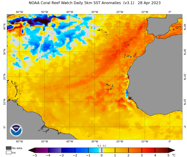
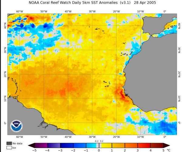
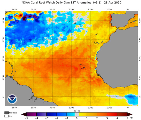
Atlantic MDR is currently warmer than 2020, 2017, near 2005/2010 level.
where it stops nobody freaking knows at this point. it truly is going to be a battle between Atlantic and Enso
I wouldn't look at it as a battle; a key reason El Nino inhibits Atlantic activity is due to wind shear. It doesn't matter how hot the water is there's too much shear.
Why does El Nino increase shear over the Atlantic? Because ocean and atmosphere are coupled. Rising branch in the East Pacific causes upper westerlies over the Atlantic.
Same idea here, warmer MDR/East Atlantic reduces shear because it creates upper easterlies over the Atlantic and reduces shear..


