Texas Spring 2023

U.S. & Caribbean Weather Discussions and Severe Weather Events

Moderator: S2k Moderators

Forum rules

The posts in this forum are NOT official forecast and should not be used as such. They are just the opinion of the poster and may or may not be backed by sound meteorological data. They are NOT endorsed by any professional institution or STORM2K.

Help Support Storm2K
Message
Author
User avatar
Iceresistance
Category 5
Category 5
Posts: 9279
Age: 21
Joined: Sat Oct 10, 2020 9:45 am
Location: Tecumseh, OK/Norman, OK

Re: Texas Spring 2023

#1221 Postby Iceresistance » Tue May 09, 2023 3:07 pm

Bhow wrote:Meso low 1 looks to be washing out around San Marcos followed by a new one near Uvalde. Been an odd radar presentation with all the spinning throughout the day in sctx.

Main circulation is SE of Houston
0 likes   
Bill 2015 & Beta 2020

Winter 2020-2021 :cold:

All observations are in Tecumseh, OK unless otherwise noted.

Winter posts are focused mainly for Oklahoma & Texas.

Take any of my forecasts with a grain of salt, refer to the NWS, SPC, and NHC for official information

Never say Never with weather! Because ANYTHING is possible!

User avatar
Edwards Limestone
S2K Supporter
S2K Supporter
Posts: 459
Age: 35
Joined: Tue Dec 28, 2021 11:05 am
Location: Smithson Valley, TX

Re: Texas Spring 2023

#1222 Postby Edwards Limestone » Tue May 09, 2023 4:19 pm

Looks like another minimum QPF day in Comal, Blanco and Hays as per usual (relative to coastal plains and western areas that have mostly seen widespread 2"+ totals). Just can't catch a break around here.

Good news is that 1) someone is getting rain somewhere (even here, despite the low totals) 2) it seems like there's much more to come this weekend/next week.

It's weird how the convection has seemed to "wash out" repeatedly over northern Bexar and Comal over the last 12 hours while absolutely drenching areas to the west and east of here. To a lesser extent, that's been the theme all spring in my local area.
I doubt that strong convection to our SW will make it here, just seems to keep drying out as it moves NE toward northern SA metro area.

Edit: Just as I complain- rain is coming down steadily now at my office in Hollywood Park (northern SA metro). Anti-jinx!
0 likes   
The above post is NOT an official forecast and should not be used as such. It is just the opinion of the poster and may or may not be backed by sound meteorological data. It is NOT endorsed by any professional institution including Storm2k. For official information, please refer to NWS products.

User avatar
bubba hotep
S2K Supporter
S2K Supporter
Posts: 5830
Joined: Wed Dec 28, 2016 1:00 am
Location: Collin County Texas

Re: Texas Spring 2023

#1223 Postby bubba hotep » Tue May 09, 2023 5:05 pm

Euro Weeklies say we carry this pattern well into June, with a large part of the state covered by the 6-8"+ mean :rain:
4 likes   
Winter time post are almost exclusively focused on the DFW area.

User avatar
Cpv17
Category 5
Category 5
Posts: 4915
Joined: Wed Dec 07, 2016 2:24 pm
Location: Wharton/El Campo, TX

Re: Texas Spring 2023

#1224 Postby Cpv17 » Tue May 09, 2023 5:09 pm

bubba hotep wrote:Euro Weeklies say we carry this pattern well into June, with a large part of the state covered by the 6-8"+ mean :rain:


By far the best news I’ve heard all day!
2 likes   

User avatar
Iceresistance
Category 5
Category 5
Posts: 9279
Age: 21
Joined: Sat Oct 10, 2020 9:45 am
Location: Tecumseh, OK/Norman, OK

Re: Texas Spring 2023

#1225 Postby Iceresistance » Tue May 09, 2023 9:37 pm

Surprise broken line just to my north
1 likes   
Bill 2015 & Beta 2020

Winter 2020-2021 :cold:

All observations are in Tecumseh, OK unless otherwise noted.

Winter posts are focused mainly for Oklahoma & Texas.

Take any of my forecasts with a grain of salt, refer to the NWS, SPC, and NHC for official information

Never say Never with weather! Because ANYTHING is possible!

Brent
S2K Supporter
S2K Supporter
Posts: 37988
Age: 36
Joined: Sun May 16, 2004 10:30 pm
Location: Tulsa Oklahoma
Contact:

Re: Texas Spring 2023

#1226 Postby Brent » Tue May 09, 2023 10:09 pm

Iceresistance wrote:Surprise broken line just to my north


We apparently gusted to 59 mph here :eek: also the temperature dropped to 67 which is a big improvement over the last few nights at this hour
1 likes   
#neversummer

User avatar
Cpv17
Category 5
Category 5
Posts: 4915
Joined: Wed Dec 07, 2016 2:24 pm
Location: Wharton/El Campo, TX

Re: Texas Spring 2023

#1227 Postby Cpv17 » Tue May 09, 2023 10:46 pm

Brent wrote:
Iceresistance wrote:Surprise broken line just to my north


We apparently gusted to 59 mph here :eek: also the temperature dropped to 67 which is a big improvement over the last few nights at this hour


Before you know it those 60° dew points are gonna be all the way up to Canada.
0 likes   

Brent
S2K Supporter
S2K Supporter
Posts: 37988
Age: 36
Joined: Sun May 16, 2004 10:30 pm
Location: Tulsa Oklahoma
Contact:

Re: Texas Spring 2023

#1228 Postby Brent » Tue May 09, 2023 11:29 pm

Cpv17 wrote:
Brent wrote:
Iceresistance wrote:Surprise broken line just to my north


We apparently gusted to 59 mph here :eek: also the temperature dropped to 67 which is a big improvement over the last few nights at this hour


Before you know it those 60° dew points are gonna be all the way up to Canada.


Yeah the last few days have made me not hyped about it :spam: I mean we had chilly rain all day Thursday and flipped to hot and humid by the end of Friday
0 likes   
#neversummer

User avatar
ElectricStorm
Category 5
Category 5
Posts: 5017
Age: 24
Joined: Tue Aug 13, 2019 11:23 pm
Location: Skiatook, OK / Norman, OK

Re: Texas Spring 2023

#1229 Postby ElectricStorm » Wed May 10, 2023 1:18 am

Personally getting more concerned for Thursday in OK/KS. IMO starting to look like a classic May tornado event setting up. There could be some capping concerns, and maybe some cloud cover, but I'm not really sure either of those will be much of an issue. Day 2 outlook maintains the slight risk for now, but I'm fully expecting an upgrade to enhanced at some point. Probably will see a 30% hail area and potentially a 10% tornado area added later. Not sure we'll see anything higher than that but it can't be ruled out. Looking like a dangerous day.

Would love a good storm, but 2/26 and 4/19 provided more than enough tornado action around here, we certainly don't need anymore of that.
0 likes   
I am in no way a professional. Take what I say with a grain of salt as I could be totally wrong. Please refer to the NHC, NWS, or SPC for official information.

Boomer Sooner!

User avatar
Edwards Limestone
S2K Supporter
S2K Supporter
Posts: 459
Age: 35
Joined: Tue Dec 28, 2021 11:05 am
Location: Smithson Valley, TX

Re: Texas Spring 2023

#1230 Postby Edwards Limestone » Wed May 10, 2023 9:10 am

Image

Image

Image
Last edited by Edwards Limestone on Wed May 10, 2023 10:09 am, edited 1 time in total.
2 likes   
The above post is NOT an official forecast and should not be used as such. It is just the opinion of the poster and may or may not be backed by sound meteorological data. It is NOT endorsed by any professional institution including Storm2k. For official information, please refer to NWS products.

rwfromkansas
Category 5
Category 5
Posts: 2531
Joined: Sat Aug 27, 2005 12:47 am
Location: North Fort Worth

Re: Texas Spring 2023

#1231 Postby rwfromkansas » Wed May 10, 2023 9:46 am

Back in my home state, I saw Wichita KS got almost an inch of rain yesterday, which is more than they received in over two months!

They have had a bad drought going on up there.

For Texas, I prefer the precip placement on the GFS for DFW, but at least both Euro and GFS both show decent rains state-wide. For some, drought-busting rains!
1 likes   

User avatar
Ntxw
Storm2k Moderator
Storm2k Moderator
Posts: 22730
Joined: Wed Oct 21, 2009 6:34 pm
Location: DFW, Texas

Re: Texas Spring 2023

#1232 Postby Ntxw » Wed May 10, 2023 10:00 am

Last year around this time we were kicking off an early season heatwave that would roll all the way through mid August...

I remember getting some flack for being a heat monger, but as is with the data. :lol: Glad we're not going through that again.
6 likes   
The above post and any post by Ntxw is NOT an official forecast and should not be used as such. It is just the opinion of the poster and may or may not be backed by sound meteorological data. It is NOT endorsed by any professional institution including Storm2k. For official information, please refer to NWS products.

  Help support Storm2K!
Help Support Storm2K

User avatar
Haris
Category 5
Category 5
Posts: 1810
Joined: Mon Nov 27, 2017 8:19 pm
Location: ( Bee Cave) West Austin, Texas

Re: Texas Spring 2023

#1233 Postby Haris » Wed May 10, 2023 11:17 am

1 likes   
Weather geek and a storm spotter in West Austin. Not a degreed meteorologist. Big snow fan. Love rain and cold! Despise heat!

gpsnowman
S2K Supporter
S2K Supporter
Posts: 3157
Joined: Fri Jan 07, 2011 10:35 am
Location: Grand Prairie Tx

Re: Texas Spring 2023

#1234 Postby gpsnowman » Wed May 10, 2023 11:59 am

About to get wet here. Got darker all of a sudden and some light rain is falling. Nice and cool outside also. On a side note, the drop down advertisements on the forum are driving me nuts!! :D
0 likes   

User avatar
Iceresistance
Category 5
Category 5
Posts: 9279
Age: 21
Joined: Sat Oct 10, 2020 9:45 am
Location: Tecumseh, OK/Norman, OK

Re: Texas Spring 2023

#1235 Postby Iceresistance » Wed May 10, 2023 12:46 pm

gpsnowman wrote:About to get wet here. Got darker all of a sudden and some light rain is falling. Nice and cool outside also. On a side note, the drop down advertisements on the forum are driving me nuts!! :D

Well, I have an adblocker and I don't have that issue! :D

But either way, Thursday could be dangerous. Enhanced risk for OKC that is tornado and hail driven.
0 likes   
Bill 2015 & Beta 2020

Winter 2020-2021 :cold:

All observations are in Tecumseh, OK unless otherwise noted.

Winter posts are focused mainly for Oklahoma & Texas.

Take any of my forecasts with a grain of salt, refer to the NWS, SPC, and NHC for official information

Never say Never with weather! Because ANYTHING is possible!

User avatar
Edwards Limestone
S2K Supporter
S2K Supporter
Posts: 459
Age: 35
Joined: Tue Dec 28, 2021 11:05 am
Location: Smithson Valley, TX

Re: Texas Spring 2023

#1236 Postby Edwards Limestone » Wed May 10, 2023 1:17 pm

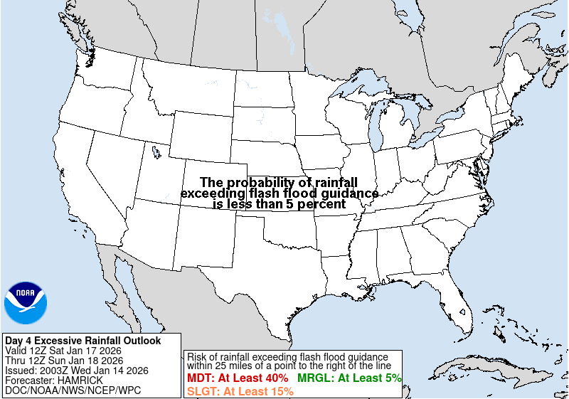
Image

https://www.wpc.ncep.noaa.gov/#

Excessive Rainfall Discussion
NWS Weather Prediction Center College Park MD
330 AM EDT Wed May 10 2023

Day 3
Valid 12Z Fri May 12 2023 - 12Z Sat May 13 2023

...THERE IS A MODERATE RISK OF EXCESSIVE RAINFALL FOR PORTIONS OF
SOUTH-CENTRAL TEXAS...

TX...
An upper low is expected to move out of northern Mexico into TX to
the west of the track of the system crossing the state at this
time, strongly increasing low-level inflow up the Rio Grande and
into portions of the Escarpment towards 60 kts at 850 hPa.
Precipitable water values rise to 1.75-2", while CAPE should be
3000 J/kg or so. Convection with heavy rainfall is expected
Friday evening which should continue overnight. Conceptually, the
initial convective area should take roughly four hours to move --
any veering in the 850 hPa inflow is modest and towards Saturday
12z. Given the available moisture, 2.5-3" an hour totals cannot
be ruled out while the convection is stationary -- especially if
mesocyclones form -- which could pile up totals quickly. An
equally big concern would be if convection formed out ahead of the
developing complex -- particularly along the Escarpment -- once a
cold pool formed leading to cell mergers as the advancing
organized convection moves in to any preceding thunderstorm
activity. Other problems would be if a warm advection band formed
to its east-southeast which should be the eventual direction of
propagation parallel to the 1000-500 hPa thickness gradient or if
convection starts training on its western flank -- it's unclear
whether that would be in Mexico or South-Central TX closer to the
Rio Grande Valley. Some of the model guidance indicate that local
amounts in the 10" (00z Canadian Global, 00z NAM12, and 09/12z
ECMWF) or even 20" (Canadian Regional) range are possible should
the worst case scenarios play out. For now, an upgrade to a
Moderate Risk is being made which appears to be a conservative
move. Further elevation in the risk level is possible in later
cycles should the guidance get less dispersive while continuing to
show such significant heavy rainfall potential. The new Moderate
Risk area was coordinated with the CRP/Corpus Christi, EWX/New
Braunfels TX, and SJT/San Angelo TX forecast offices.
Image

Image
2 likes   
The above post is NOT an official forecast and should not be used as such. It is just the opinion of the poster and may or may not be backed by sound meteorological data. It is NOT endorsed by any professional institution including Storm2k. For official information, please refer to NWS products.

User avatar
Iceresistance
Category 5
Category 5
Posts: 9279
Age: 21
Joined: Sat Oct 10, 2020 9:45 am
Location: Tecumseh, OK/Norman, OK

Re: Texas Spring 2023

#1237 Postby Iceresistance » Wed May 10, 2023 3:01 pm

Popcorn showers and storms like June and July...
0 likes   
Bill 2015 & Beta 2020

Winter 2020-2021 :cold:

All observations are in Tecumseh, OK unless otherwise noted.

Winter posts are focused mainly for Oklahoma & Texas.

Take any of my forecasts with a grain of salt, refer to the NWS, SPC, and NHC for official information

Never say Never with weather! Because ANYTHING is possible!

User avatar
Cpv17
Category 5
Category 5
Posts: 4915
Joined: Wed Dec 07, 2016 2:24 pm
Location: Wharton/El Campo, TX

Re: Texas Spring 2023

#1238 Postby Cpv17 » Wed May 10, 2023 3:06 pm

Edwards Limestone wrote:https://www.wpc.ncep.noaa.gov/qpf/99ewbg.gif

https://www.wpc.ncep.noaa.gov/#

Excessive Rainfall Discussion
NWS Weather Prediction Center College Park MD
330 AM EDT Wed May 10 2023

Day 3
Valid 12Z Fri May 12 2023 - 12Z Sat May 13 2023

...THERE IS A MODERATE RISK OF EXCESSIVE RAINFALL FOR PORTIONS OF
SOUTH-CENTRAL TEXAS...

TX...
An upper low is expected to move out of northern Mexico into TX to
the west of the track of the system crossing the state at this
time, strongly increasing low-level inflow up the Rio Grande and
into portions of the Escarpment towards 60 kts at 850 hPa.
Precipitable water values rise to 1.75-2", while CAPE should be
3000 J/kg or so. Convection with heavy rainfall is expected
Friday evening which should continue overnight. Conceptually, the
initial convective area should take roughly four hours to move --
any veering in the 850 hPa inflow is modest and towards Saturday
12z. Given the available moisture, 2.5-3" an hour totals cannot
be ruled out while the convection is stationary -- especially if
mesocyclones form -- which could pile up totals quickly. An
equally big concern would be if convection formed out ahead of the
developing complex -- particularly along the Escarpment -- once a
cold pool formed leading to cell mergers as the advancing
organized convection moves in to any preceding thunderstorm
activity. Other problems would be if a warm advection band formed
to its east-southeast which should be the eventual direction of
propagation parallel to the 1000-500 hPa thickness gradient or if
convection starts training on its western flank -- it's unclear
whether that would be in Mexico or South-Central TX closer to the
Rio Grande Valley. Some of the model guidance indicate that local
amounts in the 10" (00z Canadian Global, 00z NAM12, and 09/12z
ECMWF) or even 20" (Canadian Regional) range are possible should
the worst case scenarios play out. For now, an upgrade to a
Moderate Risk is being made which appears to be a conservative
move. Further elevation in the risk level is possible in later
cycles should the guidance get less dispersive while continuing to
show such significant heavy rainfall potential. The new Moderate
Risk area was coordinated with the CRP/Corpus Christi, EWX/New
Braunfels TX, and SJT/San Angelo TX forecast offices.


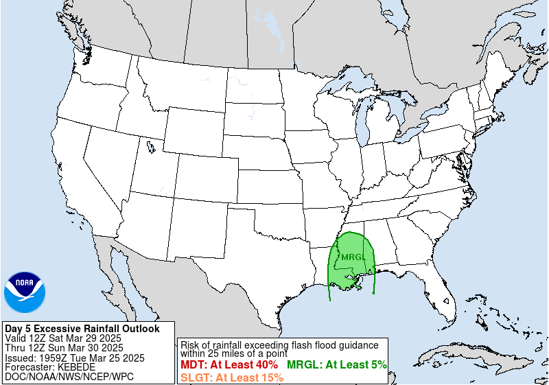
https://www.wpc.ncep.noaa.gov/qpf/ero_d45/images/d4wbg.gif

https://www.wpc.ncep.noaa.gov/qpf/ero_d45/images/d5wbg.gif


This could get pretty bad. Feast or famine at its finest.
1 likes   

User avatar
Texas Snowman
Storm2k Moderator
Storm2k Moderator
Posts: 6151
Joined: Fri Jan 25, 2008 11:29 am
Location: Denison, Texas

Re: Texas Spring 2023

#1239 Postby Texas Snowman » Wed May 10, 2023 3:33 pm

Lakes like Falcon and O.H. Ivie are about to get a food drink of H2O…

 https://twitter.com/chasetxwx/status/1656388269074939905


2 likes   
The above post and any post by Texas Snowman is NOT an official forecast and should not be used as such. It is just the opinion of the poster and may or may not be backed by sound meteorological data. It is NOT endorsed by any professional institution including storm2k.org. For official information, please refer to NWS products.

User avatar
opticsguy
S2K Supporter
S2K Supporter
Posts: 227
Joined: Wed Jan 05, 2011 9:27 pm
Location: McKinney, TX

Re: Texas Spring 2023

#1240 Postby opticsguy » Wed May 10, 2023 8:44 pm

Looking at last year, DFW was in a heat wave of 95-100F weather that started around May 1, and except for about an inch of rain late in May, no rain at all until Labor Day. I still haven't used my A/C here in McKinney
1 likes   


Return to “USA & Caribbean Weather”

Who is online

Users browsing this forum: rwfromkansas, TomballEd, txtwister78 and 33 guests