2023 EPAC Season

This is the general tropical discussion area. Anyone can take their shot at predicting a storms path.

Moderator: S2k Moderators

Forum rules

The posts in this forum are NOT official forecasts and should not be used as such. They are just the opinion of the poster and may or may not be backed by sound meteorological data. They are NOT endorsed by any professional institution or STORM2K. For official information, please refer to products from the National Hurricane Center and National Weather Service.

Help Support Storm2K
Message
Author
User avatar
Kingarabian
S2K Supporter
S2K Supporter
Posts: 15980
Joined: Sat Aug 08, 2009 3:06 am
Location: Honolulu, Hawaii

Re: 2023 EPAC Season

#241 Postby Kingarabian » Wed Jul 05, 2023 10:36 pm

Yellow Evan wrote:https://media.discordapp.net/attachments/733552978572869632/1126278051072839690/image0.jpg

https://media.discordapp.net/attachments/733552978572869632/1126275166373171230/gfs_midRH_epac_24.png

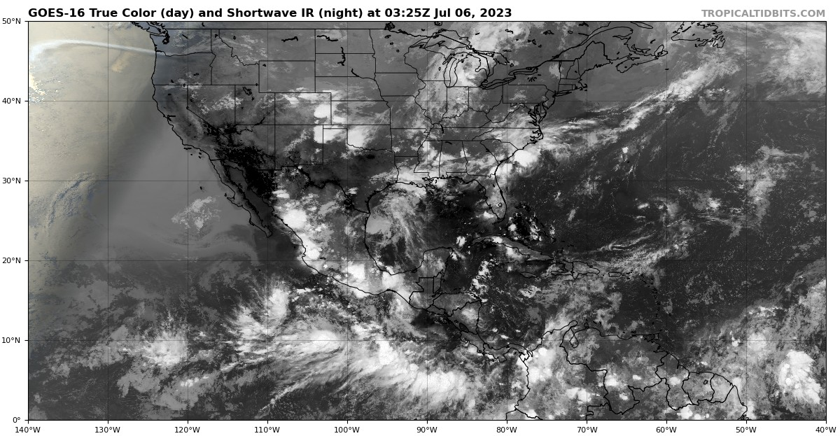
18z GFS continues to have the best UL environment I’ve seen in this basin this year. However, it is trending towards a larger system, though embedded within an excellent moisture envelope.

System that large probably caps intensity.

Euro has a normal sized cane which probably means MH before it reaches unfavorable conditions.
Last edited by Kingarabian on Wed Jul 05, 2023 10:40 pm, edited 1 time in total.
0 likes   
RIP Kobe Bryant

User avatar
Kingarabian
S2K Supporter
S2K Supporter
Posts: 15980
Joined: Sat Aug 08, 2009 3:06 am
Location: Honolulu, Hawaii

Re: 2023 EPAC Season

#242 Postby Kingarabian » Wed Jul 05, 2023 10:36 pm

Image

Ready for 94E.
0 likes   
RIP Kobe Bryant

User avatar
cycloneye
Admin
Admin
Posts: 145300
Age: 68
Joined: Thu Oct 10, 2002 10:54 am
Location: San Juan, Puerto Rico

Re: 2023 EPAC Season

#243 Postby cycloneye » Thu Jul 06, 2023 6:53 am

Tropical Weather Outlook
NWS National Hurricane Center Miami FL
500 AM PDT Thu Jul 6 2023

For the eastern North Pacific...east of 140 degrees west longitude:

1. Offshore of Southwestern Mexico:
A broad area of low pressure located several hundred miles south of
southwestern Mexico is producing disorganized showers and
thunderstorms. Environmental conditions are forecast to be
conducive for gradual development of this system, and a tropical
depression will likely form over weekend while it moves
generally west-northwestward, away from the coast of mainland
Mexico.
* Formation chance through 48 hours...medium...60 percent.
* Formation chance through 7 days...high...80 percent.

2. Offshore of Southern Mexico:
A broad area of low pressure could form a few hundred miles south
of the southern coast of Mexico early next week. Some gradual
development of this system is possible thereafter while it moves
generally westward to west-northwestward.
* Formation chance through 48 hours...low...near 0 percent.
* Formation chance through 7 days...medium...40 percent.

Forecaster Roberts
0 likes   
Visit the Caribbean-Central America Weather Thread where you can find at first post web cams,radars
and observations from Caribbean basin members Click Here

User avatar
cycloneye
Admin
Admin
Posts: 145300
Age: 68
Joined: Thu Oct 10, 2002 10:54 am
Location: San Juan, Puerto Rico

Re: 2023 EPAC Season

#244 Postby cycloneye » Thu Jul 06, 2023 12:59 pm

11 AM PDT:

Offshore of Southern Mexico:
A broad area of low pressure could form a few hundred miles south
of the southern coast of Mexico early next week. Some gradual
development of this system is possible thereafter while it moves
generally westward to west-northwestward.
* Formation chance through 48 hours...low...near 0 percent.
* Formation chance through 7 days...medium...50 percent.
0 likes   
Visit the Caribbean-Central America Weather Thread where you can find at first post web cams,radars
and observations from Caribbean basin members Click Here

User avatar
Kingarabian
S2K Supporter
S2K Supporter
Posts: 15980
Joined: Sat Aug 08, 2009 3:06 am
Location: Honolulu, Hawaii

Re: 2023 EPAC Season

#245 Postby Kingarabian » Thu Jul 06, 2023 2:06 pm

It is El Nino out there in the far eastern Pacific so something should become a strong major hurricane eventually. But models are now tracking future 94E more NW vs WNW and bring it over unfavorable conditions sooner. Also looks to be large which isn't going to help it ramp up fast.
Last edited by Kingarabian on Thu Jul 06, 2023 2:07 pm, edited 2 times in total.
0 likes   
RIP Kobe Bryant

User avatar
cycloneye
Admin
Admin
Posts: 145300
Age: 68
Joined: Thu Oct 10, 2002 10:54 am
Location: San Juan, Puerto Rico

Re: 2023 EPAC Season

#246 Postby cycloneye » Thu Jul 06, 2023 2:07 pm

Kingarabian wrote:https://i.postimg.cc/kXB12KVN/image.png

Ready for 94E.


Agreed. Future 94E has good potential to be a fairly strong hurricane and be close to cat 3. Let's see what happens.
0 likes   
Visit the Caribbean-Central America Weather Thread where you can find at first post web cams,radars
and observations from Caribbean basin members Click Here

User avatar
cycloneye
Admin
Admin
Posts: 145300
Age: 68
Joined: Thu Oct 10, 2002 10:54 am
Location: San Juan, Puerto Rico

Re: 2023 EPAC Season

#247 Postby cycloneye » Thu Jul 06, 2023 10:08 pm

Kingarabian wrote:It is El Nino out there in the far eastern Pacific so something should become a strong major hurricane eventually. But models are now tracking future 94E more NW vs WNW and bring it over unfavorable conditions sooner. Also looks to be large which isn't going to help it ramp up fast.


I still see Euro a bit more south in the track than GFS. If it takes the Euro route, it may be a photogenic hurricane like Marie 2014.

Image
1 likes   
Visit the Caribbean-Central America Weather Thread where you can find at first post web cams,radars
and observations from Caribbean basin members Click Here

User avatar
cycloneye
Admin
Admin
Posts: 145300
Age: 68
Joined: Thu Oct 10, 2002 10:54 am
Location: San Juan, Puerto Rico

Re: 2023 EPAC Season

#248 Postby cycloneye » Fri Jul 07, 2023 6:53 am

5 AM PDT TWO.

Offshore of Southern Mexico:
An elongated trough of low pressure located well south-southeast
of southeastern Mexico is producing disorganized showers and
thunderstorms. Environmental conditions are expected to be
conducive for gradual development of this system during the next
several days, and a tropical depression is likely to form early next
week. The system is forecast to move westward to west-northwestward
parallel to, but well offshore, of the coast of southern Mexico.
* Formation chance through 48 hours...low...10 percent.
* Formation chance through 7 days...high...70 percent.
0 likes   
Visit the Caribbean-Central America Weather Thread where you can find at first post web cams,radars
and observations from Caribbean basin members Click Here

User avatar
cycloneye
Admin
Admin
Posts: 145300
Age: 68
Joined: Thu Oct 10, 2002 10:54 am
Location: San Juan, Puerto Rico

Re: 2023 EPAC Season

#249 Postby cycloneye » Fri Jul 07, 2023 12:32 pm

11 AM PDT TWO for future 94E.

Offshore of Southern Mexico:
A trough of low pressure located well south-southeast of
southeastern Mexico is producing disorganized showers and
thunderstorms. Environmental conditions are forecast to be
conducive for gradual development during the next several days,
and a tropical depression is likely to form early next week. The
system is expected to move westward to west-northwestward parallel
to, but well offshore, of the coast of southern Mexico.
* Formation chance through 48 hours...low...20 percent.
* Formation chance through 7 days...high...80 percent.
0 likes   
Visit the Caribbean-Central America Weather Thread where you can find at first post web cams,radars
and observations from Caribbean basin members Click Here

User avatar
cycloneye
Admin
Admin
Posts: 145300
Age: 68
Joined: Thu Oct 10, 2002 10:54 am
Location: San Juan, Puerto Rico

Re: 2023 EPAC Season

#250 Postby cycloneye » Fri Jul 07, 2023 1:30 pm

Euro continues to be in the southerrn track from GFS and if that happens, it may well be a strong hurricane as it has more time on warm waters. Stays strong as it moves beyond 120W.

Image
0 likes   
Visit the Caribbean-Central America Weather Thread where you can find at first post web cams,radars
and observations from Caribbean basin members Click Here

User avatar
Blown Away
S2K Supporter
S2K Supporter
Posts: 10145
Joined: Wed May 26, 2004 6:17 am

Re: 2023 EPAC Season

#251 Postby Blown Away » Fri Jul 07, 2023 1:35 pm

La Niña or El Niño, for the past 2 seasons the EPAC keeps pumping out hurricanes.
0 likes   
Hurricane Eye Experience: David 79, Irene 99, Frances 04, Jeanne 04, Wilma 05... EYE COMING MY WAY IN 2024…
Hurricane Brush Experience: Andrew 92, Erin 95, Floyd 99, Matthew 16, Irma 17, Ian 22, Nicole 22…

User avatar
Yellow Evan
Professional-Met
Professional-Met
Posts: 16143
Age: 27
Joined: Fri Jul 15, 2011 12:48 pm
Location: Henderson, Nevada/Honolulu, HI
Contact:

Re: 2023 EPAC Season

#252 Postby Yellow Evan » Fri Jul 07, 2023 1:40 pm

Upper environment around the system anticyclonic and generally aligned with storm motion and thermodynamics won’t become a negative factor for about a week. Outside of its broad size (more of an issue on the GFS than ECMWF), I don’t see what is stopping a major hurricane from forming next week
2 likes   

User avatar
cycloneye
Admin
Admin
Posts: 145300
Age: 68
Joined: Thu Oct 10, 2002 10:54 am
Location: San Juan, Puerto Rico

Re: 2023 EPAC Season

#253 Postby cycloneye » Fri Jul 07, 2023 1:59 pm

Kingarabian, you may have to watch where you are, future Dora if the Euro is right. It will weaken but still may have some effects if it makes it to the islands.

Image
2 likes   
Visit the Caribbean-Central America Weather Thread where you can find at first post web cams,radars
and observations from Caribbean basin members Click Here

User avatar
Kingarabian
S2K Supporter
S2K Supporter
Posts: 15980
Joined: Sat Aug 08, 2009 3:06 am
Location: Honolulu, Hawaii

Re: 2023 EPAC Season

#254 Postby Kingarabian » Fri Jul 07, 2023 5:36 pm

cycloneye wrote: Kingarabian, you may have to watch where you are, future Dora if the Euro is right. It will weaken but still may have some effects if it makes it to the islands.

https://i.imgur.com/EoycdiC.gif

It'll probably cut off the trade winds and could enhance some rainfall if it moves SW of the state.
1 likes   
RIP Kobe Bryant

User avatar
cycloneye
Admin
Admin
Posts: 145300
Age: 68
Joined: Thu Oct 10, 2002 10:54 am
Location: San Juan, Puerto Rico

Re: 2023 EPAC Season

#255 Postby cycloneye » Fri Jul 07, 2023 8:40 pm

 https://twitter.com/Yellow_Evan/status/1677490199012712450


Significant support of a potent hurricane out of this system by the ECMWF and EPS remains. They still show low wind shear and high divergence aloft. However, some GFS runs show a large, sprawling system with an asymmetric precipitation field within an environment of higher shear.
1 likes   
Visit the Caribbean-Central America Weather Thread where you can find at first post web cams,radars
and observations from Caribbean basin members Click Here

Astromanía
Category 2
Category 2
Posts: 779
Age: 26
Joined: Sat Aug 25, 2018 10:34 pm
Location: Monterrey, N.L, México

Re: 2023 EPAC Season

#256 Postby Astromanía » Sat Jul 08, 2023 5:06 am

Blown Away wrote:La Niña or El Niño, for the past 2 seasons the EPAC keeps pumping out hurricanes.

There has not been an epac season without at least one hurricane and there are just two seasons recorded in history without major hurricanes, EPAC it's the second most active basin in tbe world, we can often enjoy great activity here even if it's just for some time in the season
0 likes   

User avatar
cycloneye
Admin
Admin
Posts: 145300
Age: 68
Joined: Thu Oct 10, 2002 10:54 am
Location: San Juan, Puerto Rico

Re: 2023 EPAC Season

#257 Postby cycloneye » Sat Jul 08, 2023 6:34 am

I say this 5 AM PDT TWO is a small setback as they say early to middle portions of next week instead of early that has been the wording in past outlooks.

Offshore of Southern Mexico:
A trough of low pressure a few hundred miles south-southeast of
southern Mexico is producing disorganized showers and thunderstorms.
Environmental conditions are expected to be conducive for gradual
development during the next several days, and a tropical depression
is likely to form during the early to middle portions of next week.
The system is expected to move westward to west-northwestward
parallel to, but well offshore of the coast of southern and
southwestern Mexico.
* Formation chance through 48 hours...low...20 percent.
* Formation chance through 7 days...high...80 percent.


Image
0 likes   
Visit the Caribbean-Central America Weather Thread where you can find at first post web cams,radars
and observations from Caribbean basin members Click Here

User avatar
Kingarabian
S2K Supporter
S2K Supporter
Posts: 15980
Joined: Sat Aug 08, 2009 3:06 am
Location: Honolulu, Hawaii

Re: 2023 EPAC Season

#258 Postby Kingarabian » Sat Jul 08, 2023 9:00 am

Kinda crazy but now only the Euro really develops the 20/80. Reason is because it tracks it almost due west or WNW where as the GFS and CMC have a more NW track. The latter eventually make it a TS before it crosses cooler waters.
2 likes   
RIP Kobe Bryant

User avatar
cycloneye
Admin
Admin
Posts: 145300
Age: 68
Joined: Thu Oct 10, 2002 10:54 am
Location: San Juan, Puerto Rico

Re: 2023 EPAC Season

#259 Postby cycloneye » Sat Jul 08, 2023 9:28 am

Is July 8, but I can say at this date, If 93E and the 20/80 one don't develop into quality systems, then,imo, this basin is underperforming with El Niño present. The ACE so far is below average as on this date, normally is at 18.4, but so far is at 11.5.
2 likes   
Visit the Caribbean-Central America Weather Thread where you can find at first post web cams,radars
and observations from Caribbean basin members Click Here

User avatar
cycloneye
Admin
Admin
Posts: 145300
Age: 68
Joined: Thu Oct 10, 2002 10:54 am
Location: San Juan, Puerto Rico

Re: 2023 EPAC Season

#260 Postby cycloneye » Sat Jul 08, 2023 6:38 pm

5 PM PDT TWO has no change.

Offshore of Southern Mexico:
A trough of low pressure a few hundred miles south of southern
Mexico is producing disorganized showers and thunderstorms.
Environmental conditions are expected to be conducive for gradual
development during the next several days, and a tropical depression
is likely to form during the early to middle portions of next week.
The system is expected to move westward to west-northwestward,
remaining well offshore of the coast of southern and southwestern
Mexico.
* Formation chance through 48 hours...low...20 percent.
* Formation chance through 7 days...high...80 percent.
0 likes   
Visit the Caribbean-Central America Weather Thread where you can find at first post web cams,radars
and observations from Caribbean basin members Click Here


Return to “Talkin' Tropics”

Who is online

Users browsing this forum: JaviT, Ulf and 23 guests