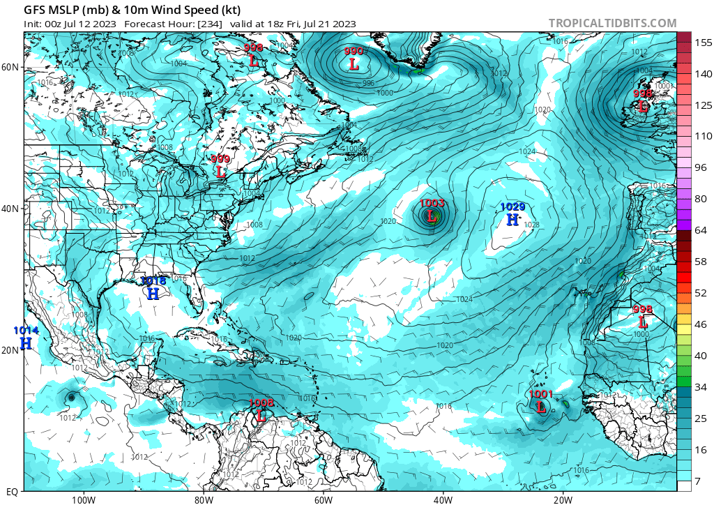
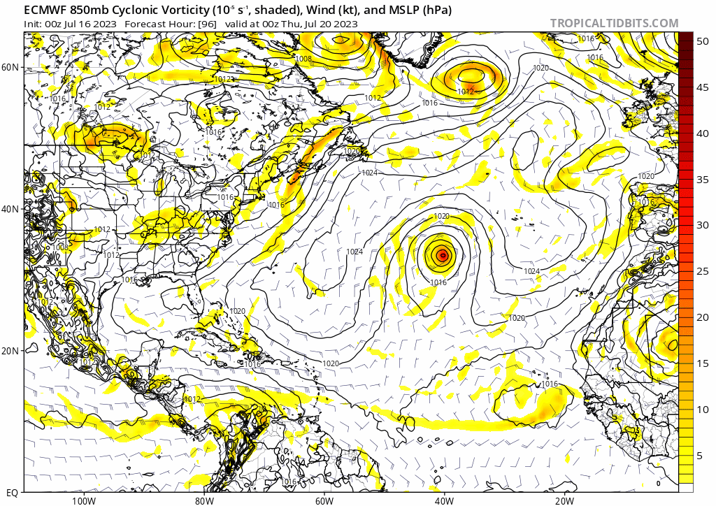
cycloneye wrote:12z Euro develops wave sw of CV islands 10 days from today.
https://i.imgur.com/qJDlrx0.gif
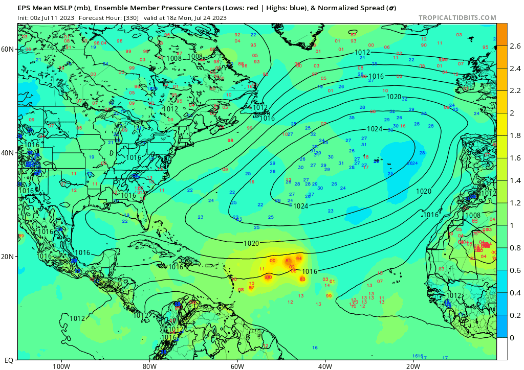
12z EPS....

Moderator: S2k Moderators


cycloneye wrote:12z Euro develops wave sw of CV islands 10 days from today.
https://i.imgur.com/qJDlrx0.gif


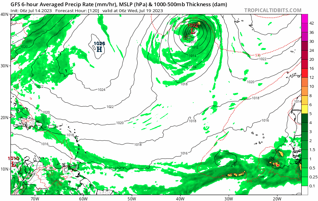
cycloneye wrote:00z Euro, has nothing in MDR.


Spacecoast wrote:Comparing the Euro ensemble medium range (51 members) to the updated extended range (101 members)......
0z Medium range EPS strike probability 7/25 (+288 hrs) n=51 members:
https://i.ibb.co/HGgcyw4/ec10.jpg
0z Extended range strike probability week of 7/25 (+288-456 hrs) n=101 members
https://i.ibb.co/47q8hT8/ec11.jpg
wrt spread, the two ensemble runs are similar, which seems to confirm that the additional members were added to increase density, rather than to increase the range of possible initial conditions.
If anything, the 'spread' looks narrower, with 101 members vs. 51 members, suggesting greater accuracy
0z EPS run also shows ~12% (6 of 51 members) between 40W-65W for 7/25....
https://i.ibb.co/P4wqpx5/ec12.jpg


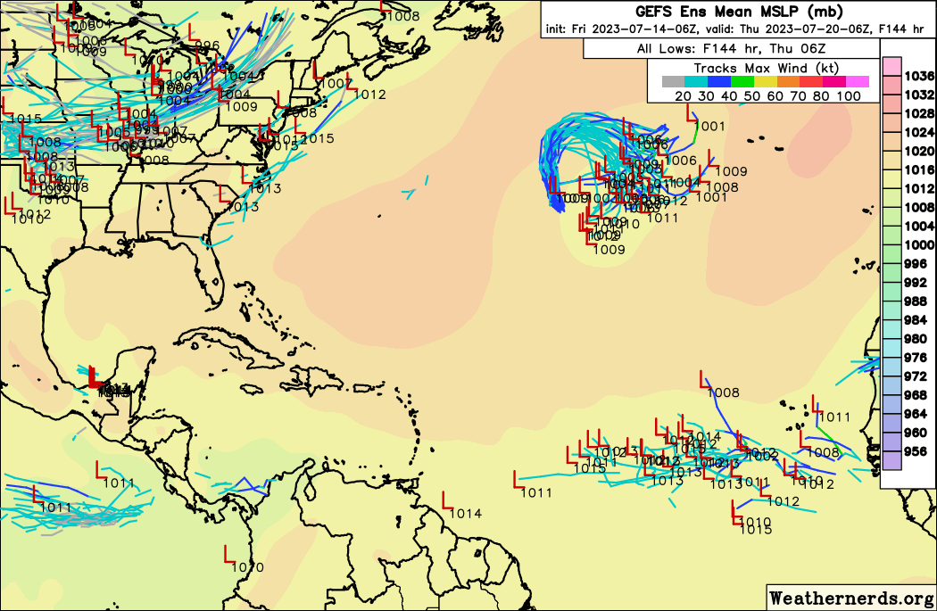
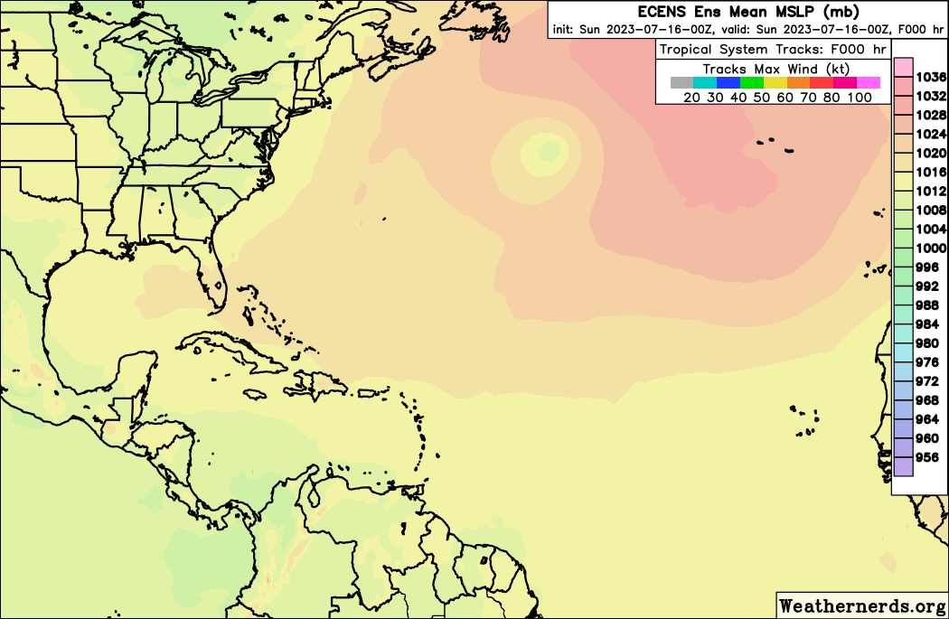
tiger_deF wrote:06z GFS is showing some brief potential development of our tropical wave of interest less than a week out.

gatorcane wrote:tiger_deF wrote:06z GFS is showing some brief potential development of our tropical wave of interest less than a week out.
The favored area for an Atlantic development this season should be about where the GFS is showing the wave, animation below -near or just west of the Cape Verde islands and out over the South-Central Atlantic where those above normal SSTs are. Conditions should not be as favorable near the islands, Caribbean, and Gulf due to the El Niño even during the peak months. 06Z run below as the low weakens nearing the islands:
https://i.postimg.cc/X7fwTbgv/gfs-mslp-pcpn-eatl-fh120-270.gif


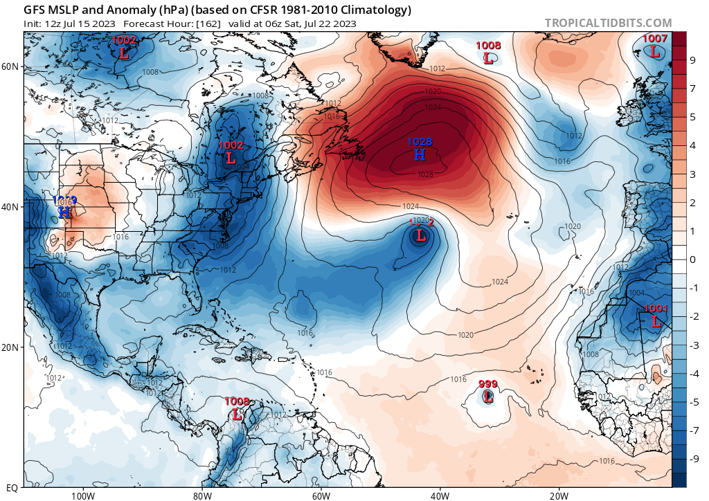
LarryWx wrote:
I count 3 (10%) of 12Z GEFS developing this into a TS+. All reach 70W.
LarryWx wrote:LarryWx wrote:
I count 3 (10%) of 12Z GEFS developing this into a TS+. All reach 70W.
I count a sizable increase from 3 on 12Z GEFS to ~7 (~23%) of 0Z 7/16 GEFS members with a TS+ from this with 3 of them going past 70W.
The same can be said of the 0Z EPS vs the last few days of runs with 7 (14%) TS+ members.
Kingarabian wrote:LarryWx wrote:LarryWx wrote:
I count 3 (10%) of 12Z GEFS developing this into a TS+. All reach 70W.
I count a sizable increase from 3 on 12Z GEFS to ~7 (~23%) of 0Z 7/16 GEFS members with a TS+ from this with 3 of them going past 70W.
The same can be said of the 0Z EPS vs the last few days of runs with 7 (14%) TS+ members.
Looks like it'll be enough for an NHC lemon in a few more days.


Users browsing this forum: NotSparta and 216 guests


