TS strike @12 days = ~9-12%

Hurricane strike possibility is back @11 days = ~8%


Still low probabilities overall.
Moderator: S2k Moderators


wxman57 wrote:Nothing to see here, folks. GFS is developing another spurious hurricane in the long range. Such development is quite unlikely. Enjoy the quiet over the next couple of weeks.
Spacecoast wrote:0z EPS probabilities..
TS strike @12 days = ~9-12%
https://i.ibb.co/4PPZvRX/ec30.jpg
Hurricane strike possibility is back @11 days = ~8%
https://i.ibb.co/LkdVbRM/ec28.jpg
https://i.ibb.co/bNfnCVz/ec29.jpg
Still low probabilities overall.
Teban54 wrote:Spacecoast wrote:0z EPS probabilities..
TS strike @12 days = ~9-12%
https://i.ibb.co/4PPZvRX/ec30.jpg
Hurricane strike possibility is back @11 days = ~8%
https://i.ibb.co/LkdVbRM/ec28.jpg
https://i.ibb.co/bNfnCVz/ec29.jpg
Still low probabilities overall.
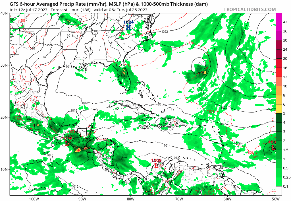
In addition to these members, it does seem that some other members kill the storm in the MDR, or bring it into the Caribbean where it dissipates. I'd say the chance of anything forming at all is probably higher than 10%.


wxman57 wrote:Nothing to see here, folks. GFS is developing another spurious hurricane in the long range. Such development is quite unlikely. Enjoy the quiet over the next couple of weeks.


Kingarabian wrote:wxman57 wrote:Nothing to see here, folks. GFS is developing another spurious hurricane in the long range. Such development is quite unlikely. Enjoy the quiet over the next couple of weeks.
I wouldn't write it off this early. It's on the Euro as well just of course not as strong. But it'll at the very least be lemon'd.

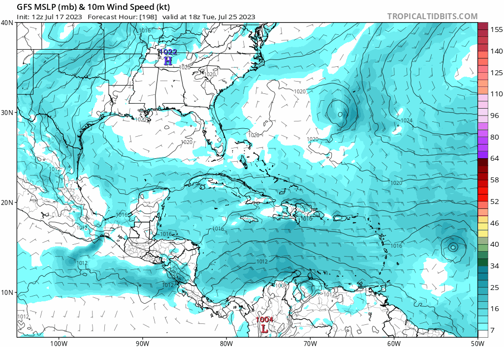
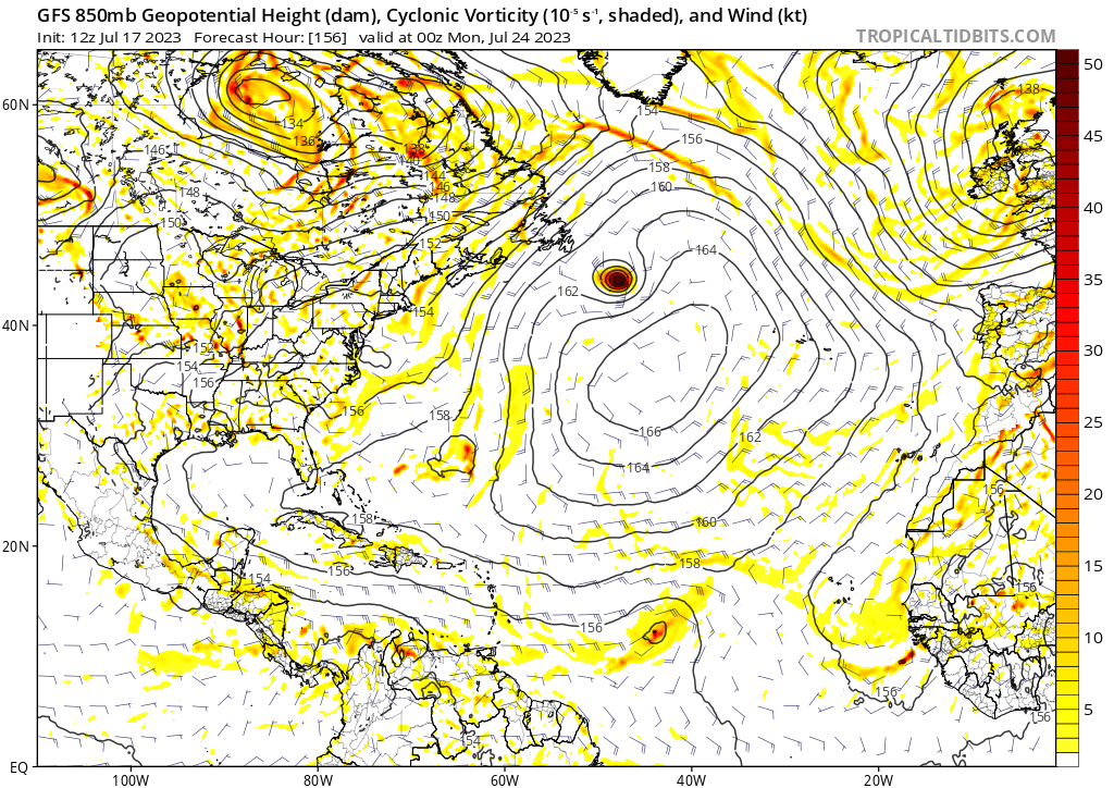
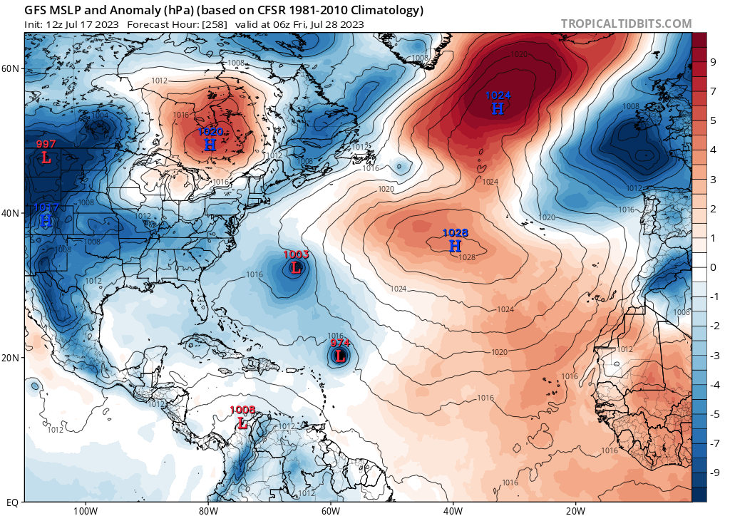
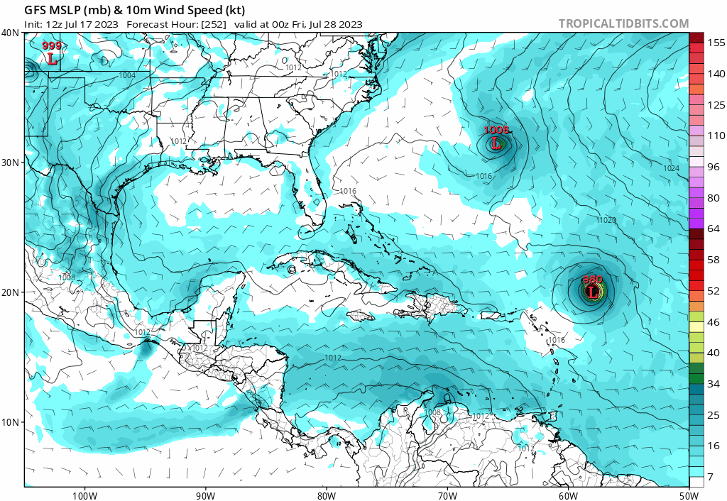
Kingarabian wrote:GFS begins development on two systems in about 6 days.
https://i.postimg.cc/y8fWz2BQ/image.png
https://i.postimg.cc/k4WnDH3d/image.png

LarryWx wrote:Kingarabian wrote:wxman57 wrote:Nothing to see here, folks. GFS is developing another spurious hurricane in the long range. Such development is quite unlikely. Enjoy the quiet over the next couple of weeks.
I wouldn't write it off this early. It's on the Euro as well just of course not as strong. But it'll at the very least be lemon'd.
Whereas it might be unlikely to become a hurricane and maybe even a TS at this early stage, it isn't just the typically overdone GFS with hurricanes. Seven (14%) of the 0Z EPS members are hurricanes, with 5-6 being MHs. So, I wouldn't make a heavy bet that this won't become a H or even a MH. Let's see what the 12Z Euro suite shows.

SFLcane wrote:LarryWx wrote:Kingarabian wrote:I wouldn't write it off this early. It's on the Euro as well just of course not as strong. But it'll at the very least be lemon'd.
Whereas it might be unlikely to become a hurricane and maybe even a TS at this early stage, it isn't just the typically overdone GFS with hurricanes. Seven (14%) of the 0Z EPS members are hurricanes, with 5-6 being MHs. So, I wouldn't make a heavy bet that this won't become a H or even a MH. Let's see what the 12Z Euro suite shows.
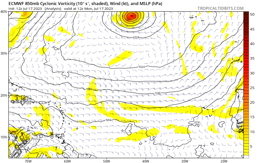
There is an actually trackable TW. Conditions look prime ahead and looks like those favorable climate models were correct after all we shall see.
https://twitter.com/andyhazelton/status/1680976201937047558?s=46&t=sStb56JhzYdUjITqDzKFmQ
Users browsing this forum: No registered users and 218 guests


