2023 Global Model Runs Discussion (Out thru day 16)
Moderator: S2k Moderators
Forum rules

The posts in this forum are NOT official forecasts and should not be used as such. They are just the opinion of the poster and may or may not be backed by sound meteorological data. They are NOT endorsed by any professional institution or STORM2K. For official information, please refer to products from the National Hurricane Center and National Weather Service.
-
Hurricane2022

- Category 5

- Posts: 2093
- Joined: Tue Aug 23, 2022 11:38 pm
- Location: Araçatuba, Brazil
Re: 2023 Global Model Runs Discussion (Out thru day 16)
2 likes
Sorry for the bad English sometimes...!
For reliable and detailed information for any meteorological phenomenon, please consult the National Hurricane Center, Joint Typhoon Warning Center , or your local Meteo Center.
--------
ECCE OMNIA NOVA FACIAM (Ap 21,5).
For reliable and detailed information for any meteorological phenomenon, please consult the National Hurricane Center, Joint Typhoon Warning Center , or your local Meteo Center.
--------
ECCE OMNIA NOVA FACIAM (Ap 21,5).
-
Blown Away

- S2K Supporter

- Posts: 10253
- Joined: Wed May 26, 2004 6:17 am
Re: 2023 Global Model Runs Discussion (Out thru day 16)
If all this long range modeling is correct about an active August, we should be seeing these storms in the long range GFS/Euro starting this week, not just in the ensembles. I see a lot of active TW’s in these models drying out.
1 likes
Hurricane Eye Experience: David 79, Irene 99, Frances 04, Jeanne 04, Wilma 05… Hurricane Brush Experience: Andrew 92, Erin 95, Floyd 99, Matthew 16, Irma 17, Ian 22, Nicole 22…
Re: 2023 Global Model Runs Discussion (Out thru day 16)
The Canadian has been the only global model consistently showing development since Monday (outside of some ensembles). I'm used to the GFS doing things like this, but not the Canadian.
2 likes
-
Blown Away
- S2K Supporter
- Posts: 10253
- Joined: Wed May 26, 2004 6:17 am
Re: 2023 Global Model Runs Discussion (Out thru day 16)
12z CMC
12z ECMWF
0 likes
Hurricane Eye Experience: David 79, Irene 99, Frances 04, Jeanne 04, Wilma 05… Hurricane Brush Experience: Andrew 92, Erin 95, Floyd 99, Matthew 16, Irma 17, Ian 22, Nicole 22…
-
lsuhurricane
- Category 1

- Posts: 270
- Joined: Tue Aug 15, 2017 2:53 pm
Re: 2023 Global Model Runs Discussion (Out thru day 16)
I think its fair to say that things are going to pickup around here very soon.....if you believe the Euro Ensembles.

0 likes
-
cycloneye

- Admin

- Posts: 149730
- Age: 69
- Joined: Thu Oct 10, 2002 10:54 am
- Location: San Juan, Puerto Rico
Re: 2023 Global Model Runs Discussion (Out thru day 16)
12z Euro ensembles are all over the place.

1 likes
Visit the Caribbean-Central America Weather Thread where you can find at first post web cams,radars
and observations from Caribbean basin members Click Here
and observations from Caribbean basin members Click Here
-
captainbarbossa19

- Professional-Met

- Posts: 1094
- Age: 27
- Joined: Wed Aug 21, 2019 11:09 pm
- Location: Beaumont, TX
Re: 2023 Global Model Runs Discussion (Out thru day 16)
It's probably due to uncertainty of ridge placement. Models seem to really struggle this time of year because the atmosphere is likely in or entering a transitional phase now as we approach peak season.
2 likes
-
jlauderdal
- S2K Supporter
- Posts: 7240
- Joined: Wed May 19, 2004 5:46 am
- Location: NE Fort Lauderdale
- Contact:
Re: RE: Re: 2023 Global Model Runs Discussion (Out thru day 16)
https://www.nbcmiami.com/weather/hurricane-season/what-should-we-expect-as-we-approach-the-peak-of-the-hurricane-season-john-morales/3083108/Blown Away wrote:If all this long range modeling is correct about an active August, we should be seeing these storms in the long range GFS/Euro starting this week, not just in the ensembles. I see a lot of active TW’s in these models drying out.
1 likes
-
USTropics
- Professional-Met
- Posts: 2741
- Joined: Sun Aug 12, 2007 3:45 am
- Location: Florida State University
Re: 2023 Global Model Runs Discussion (Out thru day 16)
captainbarbossa19 wrote:
It's probably due to uncertainty of ridge placement. Models seem to really struggle this time of year because the atmosphere is likely in or entering a transitional phase now as we approach peak season.
Just looking at the 12z ECMWF operational, ridge placement + evolution/propagation of these AEWs are causing the likely spread in ensembles. Enhanced monsoonal flow off of Africa and a transitioning UL environment is creating a sort of traffic jam for these waves, and operational models have a difficult time pegging which AEW (if any) will potentially dominate.
Here is an analysis of the current AEWs highlighted in separate colors:

Superimpose this on the 12z ECMWF operational run out to 4 days:

This gives a bit of a better picture of potential tracks the operational/ensembles are showing of these AEWs:

5 likes

Re: 2023 Global Model Runs Discussion (Out thru day 16)
USTropics wrote:captainbarbossa19 wrote:
It's probably due to uncertainty of ridge placement. Models seem to really struggle this time of year because the atmosphere is likely in or entering a transitional phase now as we approach peak season.
Just looking at the 12z ECMWF operational, ridge placement + evolution/propagation of these AEWs are causing the likely spread in ensembles. Enhanced monsoonal flow off of Africa and a transitioning UL environment is creating a sort of traffic jam for these waves, and operational models have a difficult time pegging which AEW (if any) will potentially dominate.
Here is an analysis of the current AEWs highlighted in separate colors:
https://i.imgur.com/8pffXuy.png
Superimpose this on the 12z ECMWF operational run out to 4 days:
https://i.imgur.com/Qt5auPL.gif
This gives a bit of a better picture of potential tracks the operational/ensembles are showing of these AEWs:
https://i.imgur.com/7vSjYbr.png
Do you think we may see a similar situation as 2020 where a supercharged WAM causes waves to have trouble consolidating in the MDR?
0 likes
TC naming lists: retirements and intensity
Most aggressive Advisory #1's in North Atlantic (cr. kevin for starting the list)
Most aggressive Advisory #1's in North Atlantic (cr. kevin for starting the list)
-
USTropics
- Professional-Met
- Posts: 2741
- Joined: Sun Aug 12, 2007 3:45 am
- Location: Florida State University
Re: 2023 Global Model Runs Discussion (Out thru day 16)
Teban54 wrote:USTropics wrote:captainbarbossa19 wrote:
It's probably due to uncertainty of ridge placement. Models seem to really struggle this time of year because the atmosphere is likely in or entering a transitional phase now as we approach peak season.
Just looking at the 12z ECMWF operational, ridge placement + evolution/propagation of these AEWs are causing the likely spread in ensembles. Enhanced monsoonal flow off of Africa and a transitioning UL environment is creating a sort of traffic jam for these waves, and operational models have a difficult time pegging which AEW (if any) will potentially dominate.
Here is an analysis of the current AEWs highlighted in separate colors:
https://i.imgur.com/8pffXuy.png
Superimpose this on the 12z ECMWF operational run out to 4 days:
https://i.imgur.com/Qt5auPL.gif
This gives a bit of a better picture of potential tracks the operational/ensembles are showing of these AEWs:
https://i.imgur.com/7vSjYbr.png
Do you think we may see a similar situation as 2020 where a supercharged WAM causes waves to have trouble consolidating in the MDR?
There will be times the monsoonal flow dominates (particularly when CCKW/MJO passages provides favorable parameters), but for the most part the WAM has been average this season. There are stark differences from 2020, where anomalous rising motion was concentrated over this region in July:

Compared to this season, anomalies have been focused towards the east in the WPAC/east of Australia:

Compare rainfall rate for July of both those years as well:

2023

2 likes

Re: 2023 Global Model Runs Discussion (Out thru day 16)
18z GFS actually shows a short-lived tropical storm forming from the tropical wave just off of Africa in 12-24 hours, which crosses the Atlantic and opens up into a wave.
0 likes

Re: 2023 Global Model Runs Discussion (Out thru day 16)
Why is there no lemon(at the very least) for the wave @11N 26W ??
This could easily be classified as a depression based on Satellite obs in my amateur opinion!
This could easily be classified as a depression based on Satellite obs in my amateur opinion!
0 likes
-
Blown Away
- S2K Supporter
- Posts: 10253
- Joined: Wed May 26, 2004 6:17 am
Re: 2023 Global Model Runs Discussion (Out thru day 16)
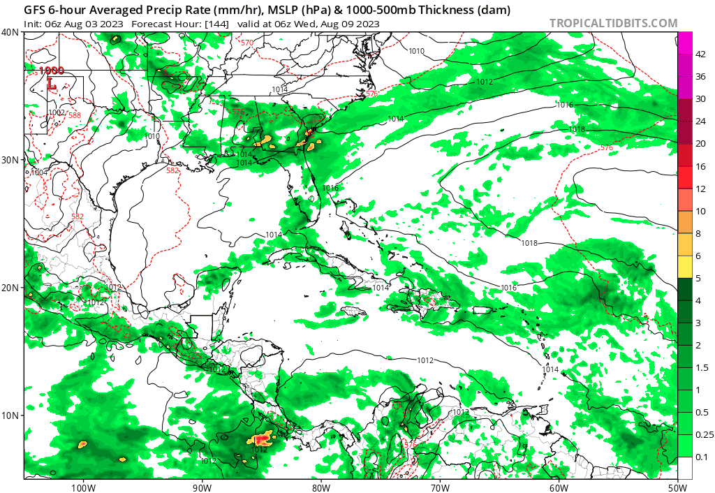
06z GFS

I think we should be seeing one of these in the MDR today...
0 likes
Hurricane Eye Experience: David 79, Irene 99, Frances 04, Jeanne 04, Wilma 05… Hurricane Brush Experience: Andrew 92, Erin 95, Floyd 99, Matthew 16, Irma 17, Ian 22, Nicole 22…
-
jlauderdal
- S2K Supporter
- Posts: 7240
- Joined: Wed May 19, 2004 5:46 am
- Location: NE Fort Lauderdale
- Contact:
Re: RE: Re: 2023 Global Model Runs Discussion (Out thru day 16)
Lets see what 57 saysBlown Away wrote:https://i.postimg.cc/cLgHF8GW/gfs-mslp-pcpn-watl-fh144-336.gif
06z GFS
https://i.postimg.cc/SKtjd7Jm/Lemon.jpg
I think we should be seeing one of these in the MDR today...
0 likes
Re: 2023 Global Model Runs Discussion (Out thru day 16)
Doubt we'll get anything with that system today, any models that do anything with it are beyond 7 days, and the ensembles have backed off quite a bit this morning. Subsidence is a huge damper here, strange to say in August, but it's what I think is happening with that wave (and what happened with 96L). If the thing persists for 24 hours or so, maybe then.
Last edited by BobHarlem on Thu Aug 03, 2023 7:39 am, edited 4 times in total.
0 likes

Re: 2023 Global Model Runs Discussion (Out thru day 16)
I believe it’s a lil too early to get mentioned.
0 likes
-
cycloneye
- Admin
- Posts: 149730
- Age: 69
- Joined: Thu Oct 10, 2002 10:54 am
- Location: San Juan, Puerto Rico
Re: 2023 Global Model Runs Discussion (Out thru day 16)
https://twitter.com/AndyHazelton/status/1687067690827923456
https://twitter.com/AndyHazelton/status/1687072574067425280
https://twitter.com/AndyHazelton/status/1687072574067425280
0 likes
Visit the Caribbean-Central America Weather Thread where you can find at first post web cams,radars
and observations from Caribbean basin members Click Here
and observations from Caribbean basin members Click Here
-
SFLcane

- S2K Supporter
- Posts: 10281
- Age: 48
- Joined: Sat Jun 05, 2010 1:44 pm
- Location: Lake Worth Florida
Re: 2023 Global Model Runs Discussion (Out thru day 16)
Blown Away wrote:[url]https://i.postimg.cc/cLgHF8GW/gfs-mslp-pcpn-watl-fh144-336.gif [/url]
06z GFS
[url]https://i.postimg.cc/SKtjd7Jm/Lemon.jpg [/url]
I think we should be seeing one of these in the MDR today...
Think we are a few days from that if it happens at all. Development chances are currently outside of the 5-7days window surely.
0 likes
Who is online
Users browsing this forum: jconsor, Yellow Evan and 84 guests