3090 wrote:UTSARoadrunner4 wrote:GCANE wrote:Now about 24nm north of forecast track. Was 20nm before.
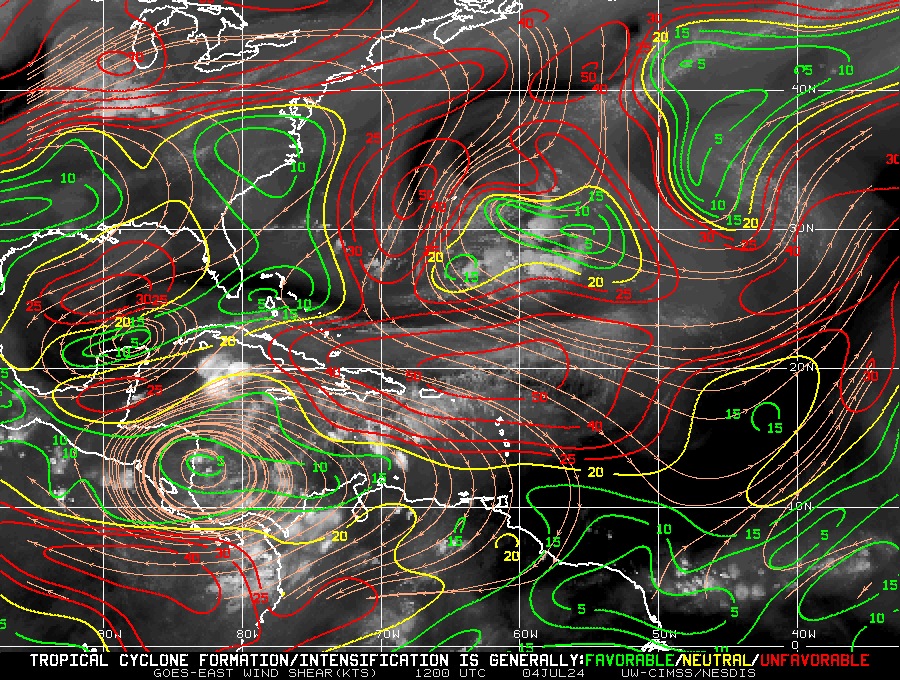
The GoM ULL has a firm grip on her. Clearly can see the Fuji interaction on WV.
Is the ULL just tugging to the north a bit or imparting shear on her as well?
The ULL will somewhat slingshot Beryl around and will also help ventilate Beryl if I am correct with previous similar occurences.
So, the ULL is forecast to impart shear once Beryl is in the GoM. For now it's not.
The ULL will be moving west as Beryl enters the GoM.
If it moves faster than current forecast, then shear wont be so bad.
This is the major factor of what Beryl will do in the GoM.