From Papin:
Thereafter, the
subtropical ridge north of Beryl that has been steering it for many
days now will become eroded in the western Gulf of Mexico from a
long-wave trough located over the Central U.S. In addition, an
upper-level low seen retrograding westward in the Gulf of Mexico
could also impart more poleward steering in the western Gulf of
Mexico. How sharply Beryl turns poleward from 36-72 h will likely
depend on the storm's vertical depth, with a more vertically deep
system more likely to feel the ridge weakness and upper-level flow.
In fact, that scenario has been highlighted by the last few cycles
of the ECMWF ensembles which show stronger solutions on the north
side of the track envelope. The overall guidance this cycle has also
made a notable shift northward and is a bit slower than earlier, and
the NHC forecast track has been shifted in that direction, quite
close to the consensus aid TVCN. However, it is not quite as far
north as the latest ECMWF or GFS tracks, and further adjustments in
that direction may be necessary later today.
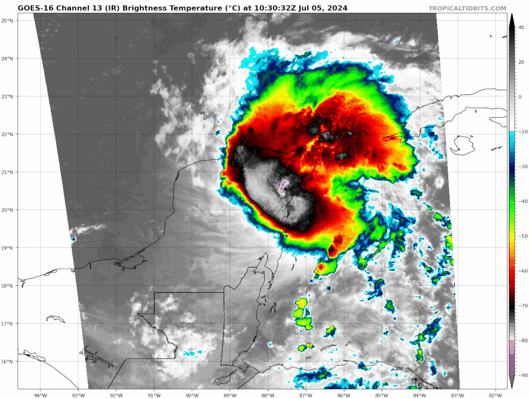
However, both the GFS- and ECMWF-based SHIPS guidance shows
shear dropping under 10 kt after 48 hours, while the storm traverses
29-30 C sea-surface temperatures. Such an environment should favor
strengthening, and the raw model output from the GFS and ECMWF
suggests significant deepening as Beryl approaches the coastline of
northeastern Mexico and south Texas. Somewhat surprisingly, the
hurricane-regional models are more subdued and suggest less
intensification this cycle, but these models have been oscillating
between stronger and weaker solutions. The latest NHC intensity
forecast will show a bit more intensification than the prior
advisory, which is on the high end of the intensity guidance, but
more in line with the expected favorable environment as Beryl
approaches landfall.