Let's get it. I got distracted watching D-Nice, Shelia E, BIg Boi and Method Man streaming on Essence.
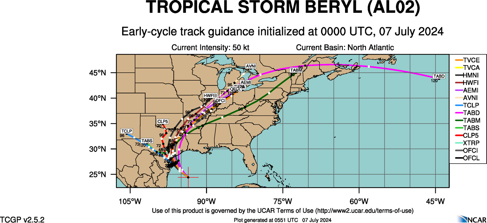
Only 00z model out that I can find is the HRRR. LIkes that Matagorda Bay landfall and straight up. Not that strong, but obviously the north, east and south of the system for most of Houston. That's not a model really to watch for the tropics. It's the rapid mesoscale that runs every hour. Still though, that's a party day if you're protected in Houston. You get the top of the storm, then like the east side of it maybe even for a bit of time and then the south or southeast part of the circulation which looks reasonably intact if not a hair above the pressure I think it's going to be. FV-3 next up or the NAMS.
https://www.tropicaltidbits.com/analysi ... 70700&fh=3


