2024 EPAC Season
Moderator: S2k Moderators
Forum rules

The posts in this forum are NOT official forecasts and should not be used as such. They are just the opinion of the poster and may or may not be backed by sound meteorological data. They are NOT endorsed by any professional institution or STORM2K. For official information, please refer to products from the National Hurricane Center and National Weather Service.
-
Hurricane2022

- Category 5

- Posts: 2016
- Joined: Tue Aug 23, 2022 11:38 pm
- Location: Araçatuba, Brazil
Re: 2024 EPAC Season
1914, here we go!
0 likes
Sorry for the bad English sometimes...!
For reliable and detailed information for any meteorological phenomenon, please consult the National Hurricane Center, Joint Typhoon Warning Center , or your local Meteo Center.
--------
ECCE OMNIA NOVA FACIAM (Ap 21,5).
For reliable and detailed information for any meteorological phenomenon, please consult the National Hurricane Center, Joint Typhoon Warning Center , or your local Meteo Center.
--------
ECCE OMNIA NOVA FACIAM (Ap 21,5).
-
cycloneye

- Admin

- Posts: 149261
- Age: 69
- Joined: Thu Oct 10, 2002 10:54 am
- Location: San Juan, Puerto Rico
Re: 2024 EPAC Season
Hurricane2022 wrote:1914, here we go!
You go that far to have zero named storms?
0 likes
Visit the Caribbean-Central America Weather Thread where you can find at first post web cams,radars
and observations from Caribbean basin members Click Here
and observations from Caribbean basin members Click Here
-
cycloneye
- Admin
- Posts: 149261
- Age: 69
- Joined: Thu Oct 10, 2002 10:54 am
- Location: San Juan, Puerto Rico
Re: 2024 EPAC Season
EPAC has a lemon. How strong it gets if it forms is the question.

Tropical Weather Outlook
NWS National Hurricane Center Miami FL
1100 AM PDT Thu Jul 11 2024
For the eastern North Pacific...east of 140 degrees west longitude:
1. Central East Pacific:
A tropical wave located near Central America is forecast to move
westward at 10 to 15 mph across the tropical East Pacific during
the next week. Conditions could become favorable for some slow
development of the wave next week as it approaches the central
portion of the basin.
* Formation chance through 48 hours...low...near 0 percent.
* Formation chance through 7 days...low...20 percent.
Forecaster D. Zelinsky
0 likes
Visit the Caribbean-Central America Weather Thread where you can find at first post web cams,radars
and observations from Caribbean basin members Click Here
and observations from Caribbean basin members Click Here
-
Hurricane2022
- Category 5
- Posts: 2016
- Joined: Tue Aug 23, 2022 11:38 pm
- Location: Araçatuba, Brazil
Re: 2024 EPAC Season
cycloneye wrote:Hurricane2022 wrote:1914, here we go!
You go that far to have zero named storms?
0 likes
Sorry for the bad English sometimes...!
For reliable and detailed information for any meteorological phenomenon, please consult the National Hurricane Center, Joint Typhoon Warning Center , or your local Meteo Center.
--------
ECCE OMNIA NOVA FACIAM (Ap 21,5).
For reliable and detailed information for any meteorological phenomenon, please consult the National Hurricane Center, Joint Typhoon Warning Center , or your local Meteo Center.
--------
ECCE OMNIA NOVA FACIAM (Ap 21,5).
-
cycloneye
- Admin
- Posts: 149261
- Age: 69
- Joined: Thu Oct 10, 2002 10:54 am
- Location: San Juan, Puerto Rico
Re: 2024 EPAC Season
Hurricane2022 wrote:cycloneye wrote:Hurricane2022 wrote:1914, here we go!
You go that far to have zero named storms?
At least Aletta formed, but with only 0.2 ACE.
0 likes
Visit the Caribbean-Central America Weather Thread where you can find at first post web cams,radars
and observations from Caribbean basin members Click Here
and observations from Caribbean basin members Click Here

Re: 2024 EPAC Season
cycloneye wrote:Hurricane2022 wrote:cycloneye wrote:
You go that far to have zero named storms?
At least Aletta formed, but with only 0.2 ACE.
For 2024 EPAC to tie 1914 ATL in storm counts, it still needs zero named storms from now onwards. So that's still a call for zero
2 likes
TC naming lists: retirements and intensity
Most aggressive Advisory #1's in North Atlantic (cr. kevin for starting the list)
Most aggressive Advisory #1's in North Atlantic (cr. kevin for starting the list)
-
cycloneye
- Admin
- Posts: 149261
- Age: 69
- Joined: Thu Oct 10, 2002 10:54 am
- Location: San Juan, Puerto Rico
Re: 2024 EPAC Season
Not a good sign for this basin when you have a downward percent less than 24 hours from the first NHC mention. It was at 20%.
Tropical Weather Outlook
NWS National Hurricane Center Miami FL
500 AM PDT Fri Jul 12 2024
For the eastern North Pacific...east of 140 degrees west longitude:
1. Central East Pacific:
A tropical wave over the far eastern Pacific is producing
disorganized showers and a few thunderstorms. The wave is expected
to move westward or west-northwestward at 15 mph during the next
few days. Environmental conditions are forecast to only be
marginally conducive and development, if any, should be slow to
occur when the wave moves into the central portion of the basin
next week.
* Formation chance through 48 hours...low...near 0 percent.
* Formation chance through 7 days...low...10 percent.
Forecaster Brown
0 likes
Visit the Caribbean-Central America Weather Thread where you can find at first post web cams,radars
and observations from Caribbean basin members Click Here
and observations from Caribbean basin members Click Here
-
Kingarabian

- S2K Supporter

- Posts: 16345
- Joined: Sat Aug 08, 2009 3:06 am
- Location: Honolulu, Hawaii
Re: 2024 EPAC Season
GFS considerably less bullish but the Euro and CMC show a very active MT setting up in the EPAC with 3-4 lows embedded.
0 likes
RIP Kobe Bryant
-
HurricaneRyan
- Category 3

- Posts: 846
- Age: 32
- Joined: Sun Dec 05, 2010 3:05 pm
Re: 2024 EPAC Season
Damn. And this is with the Atlantic going dormant again for a bit.
0 likes
Kay '22 Hilary '23
-
toad strangler

- S2K Supporter
- Posts: 4546
- Joined: Sun Jul 28, 2013 3:09 pm
- Location: Earth
- Contact:
Re: 2024 EPAC Season

3 likes
My Weather Station
https://www.wunderground.com/dashboard/pws/KFLPORTS603
https://www.wunderground.com/dashboard/pws/KFLPORTS603
-
cycloneye
- Admin
- Posts: 149261
- Age: 69
- Joined: Thu Oct 10, 2002 10:54 am
- Location: San Juan, Puerto Rico
Re: 2024 EPAC Season
EPAC better wake up soon, or will go to the record historic books.
https://x.com/cyclonicwx/status/1812145466747793435
https://x.com/cyclonicwx/status/1812145466747793435
1 likes
Visit the Caribbean-Central America Weather Thread where you can find at first post web cams,radars
and observations from Caribbean basin members Click Here
and observations from Caribbean basin members Click Here
-
Yellow Evan

- Professional-Met

- Posts: 16231
- Age: 27
- Joined: Fri Jul 15, 2011 12:48 pm
- Location: Henderson, Nevada/Honolulu, HI
- Contact:
Re: 2024 EPAC Season
Upper environment appears favorable so not sure why guidance the past 3-4 days has been so bearish. I expect overperformance.
2 likes
-
cycloneye
- Admin
- Posts: 149261
- Age: 69
- Joined: Thu Oct 10, 2002 10:54 am
- Location: San Juan, Puerto Rico
Re: 2024 EPAC Season
Tropical Weather Outlook
NWS National Hurricane Center Miami FL
500 PM PDT Sun Jul 14 2024
For the eastern North Pacific...east of 140 degrees west longitude:
1. Central and Western East Pacific:
A tropical wave located several hundred miles southwest of the
southern tip of the Baja California peninsula is producing a large
but disorganized area of showers and thunderstorms. Environmental
conditions could become more conducive for some development in a
day or two while it moves westward or west-northwestward at 10 to
15 mph across the central and western portion of the basin.
* Formation chance through 48 hours...low...10 percent.
* Formation chance through 7 days...low...30 percent.
Forecaster Blake
0 likes
Visit the Caribbean-Central America Weather Thread where you can find at first post web cams,radars
and observations from Caribbean basin members Click Here
and observations from Caribbean basin members Click Here
-
Kingarabian
- S2K Supporter
- Posts: 16345
- Joined: Sat Aug 08, 2009 3:06 am
- Location: Honolulu, Hawaii
-
cycloneye
- Admin
- Posts: 149261
- Age: 69
- Joined: Thu Oct 10, 2002 10:54 am
- Location: San Juan, Puerto Rico
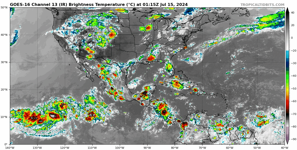
Re: 2024 EPAC Season
Tropical Weather Outlook
NWS National Hurricane Center Miami FL
500 AM PDT Mon Jul 15 2024
For the eastern North Pacific...east of 140 degrees west longitude:
1. Central and Western East Pacific:
A tropical wave located several hundred miles southwest of the
southern tip of the Baja California peninsula continues to produce a
large area of showers and thunderstorms. Environmental conditions
appear conducive for development in the next couple of days and a
tropical depression could form mid- to late-week as the system moves
west-northwestward at 10 to 15 mph across the central and western
portion of the basin.
* Formation chance through 48 hours...low...30 percent.
* Formation chance through 7 days...medium...40 percent.
Forecaster Kelly
0 likes
Visit the Caribbean-Central America Weather Thread where you can find at first post web cams,radars
and observations from Caribbean basin members Click Here
and observations from Caribbean basin members Click Here
-
Hurricane2022
- Category 5
- Posts: 2016
- Joined: Tue Aug 23, 2022 11:38 pm
- Location: Araçatuba, Brazil
Re: 2024 EPAC Season
cycloneye wrote:Tropical Weather Outlook
NWS National Hurricane Center Miami FL
500 AM PDT Mon Jul 15 2024
For the eastern North Pacific...east of 140 degrees west longitude:
1. Central and Western East Pacific:
A tropical wave located several hundred miles southwest of the
southern tip of the Baja California peninsula continues to produce a
large area of showers and thunderstorms. Environmental conditions
appear conducive for development in the next couple of days and a
tropical depression could form mid- to late-week as the system moves
west-northwestward at 10 to 15 mph across the central and western
portion of the basin.
* Formation chance through 48 hours...low...30 percent.
* Formation chance through 7 days...medium...40 percent.
Forecaster Kelly
Nooooo my 1914 prediction is already busting
0 likes
Sorry for the bad English sometimes...!
For reliable and detailed information for any meteorological phenomenon, please consult the National Hurricane Center, Joint Typhoon Warning Center , or your local Meteo Center.
--------
ECCE OMNIA NOVA FACIAM (Ap 21,5).
For reliable and detailed information for any meteorological phenomenon, please consult the National Hurricane Center, Joint Typhoon Warning Center , or your local Meteo Center.
--------
ECCE OMNIA NOVA FACIAM (Ap 21,5).
-
Kingarabian
- S2K Supporter
- Posts: 16345
- Joined: Sat Aug 08, 2009 3:06 am
- Location: Honolulu, Hawaii
Re: 2024 EPAC Season
Hurricane2022 wrote:cycloneye wrote:Tropical Weather Outlook
NWS National Hurricane Center Miami FL
500 AM PDT Mon Jul 15 2024
For the eastern North Pacific...east of 140 degrees west longitude:
1. Central and Western East Pacific:
A tropical wave located several hundred miles southwest of the
southern tip of the Baja California peninsula continues to produce a
large area of showers and thunderstorms. Environmental conditions
appear conducive for development in the next couple of days and a
tropical depression could form mid- to late-week as the system moves
west-northwestward at 10 to 15 mph across the central and western
portion of the basin.
* Formation chance through 48 hours...low...30 percent.
* Formation chance through 7 days...medium...40 percent.
Forecaster Kelly
Nooooo my 1914 prediction is already busting
There's still a chance.
0 likes
RIP Kobe Bryant
-
ScottNAtlanta

- Category 5
- Posts: 2535
- Joined: Sat May 25, 2013 3:11 pm
- Location: Atlanta, GA
Re: 2024 EPAC Season
I vote that we move all season cancel posts to this thread (seems more appropriate) 
8 likes
The posts in this forum are NOT official forecast and should not be used as such. They are just the opinion of the poster and may or may not be backed by sound meteorological data. They are NOT endorsed by any professional institution or storm2k.org. For official information, please refer to the NHC and NWS products.
-
Kingarabian
- S2K Supporter
- Posts: 16345
- Joined: Sat Aug 08, 2009 3:06 am
- Location: Honolulu, Hawaii
Re: 2024 EPAC Season
All the global models show 3-5 areas of vigorous vorticity across the EPAC. Nothing able to close off and get going. Maybe something off of Mexico in 10 days.
0 likes
RIP Kobe Bryant
-
cycloneye
- Admin
- Posts: 149261
- Age: 69
- Joined: Thu Oct 10, 2002 10:54 am
- Location: San Juan, Puerto Rico
Re: 2024 EPAC Season
0 likes
Visit the Caribbean-Central America Weather Thread where you can find at first post web cams,radars
and observations from Caribbean basin members Click Here
and observations from Caribbean basin members Click Here
Who is online
Users browsing this forum: kevin, mixedDanilo.E and 77 guests