
zzzh wrote:https://i.imgur.com/TSUwZZU.png
Just like that
August 29th. Katrina, Ida.
Moderator: S2k Moderators

toad strangler wrote:Steve wrote:jlauderdal wrote:13 weeks gets us into the first week of September, CSU calling for 23 NS and we have had 5. 18 storms in 13 weeks, not buying it, my 19 NS might be high but we will see. The math is the math. I would take my 19 down to 17 if I had a redo, less storms but same ACE.
Gonna take some simultaneous systems to get there. I'm not sure where we are as far as named storm days or hurricane days so far, but CSU called for 120 named storm days and 50 hurricane days. I'm assuming we're roughly 15-20 into NS and probably 5 or 6 into H days. If that assumption is close, there are 108 days until November 30th though we know that most of November won't feature activity (might be one or two ocean systems or in the Caribbean due to the La Nina). We would have 100 named storm days to go which is about a constant system between now and the end of the season adjusted by however many simultaneous storms there are to offset the days without any named storms.
I don't have an opinion one way or the other on this. There are times when bursts bring on 2, 3 or even 4 systems. But there are usually only a couple of these a season that even features those. So it's all a big ? to me until we hit 4-5 weeks from now and see what we are dealing with numbers wise.
As of 03:00 MT this morning .... climatology norm 1991 - 2020 in ()
18.5 NS days (11.9)
6.5 H days (2.2)
42.2 ACE (14.1 AVG)
4.5 MH days (0.4)


zzzh wrote:https://i.imgur.com/TSUwZZU.png
Just like that


skyline385 wrote:And there's the switch flip coming, just like every year
https://i.imgur.com/gQjTGAq.png

AnnularCane wrote:skyline385 wrote:And there's the switch flip coming, just like every year
https://i.imgur.com/gQjTGAq.png
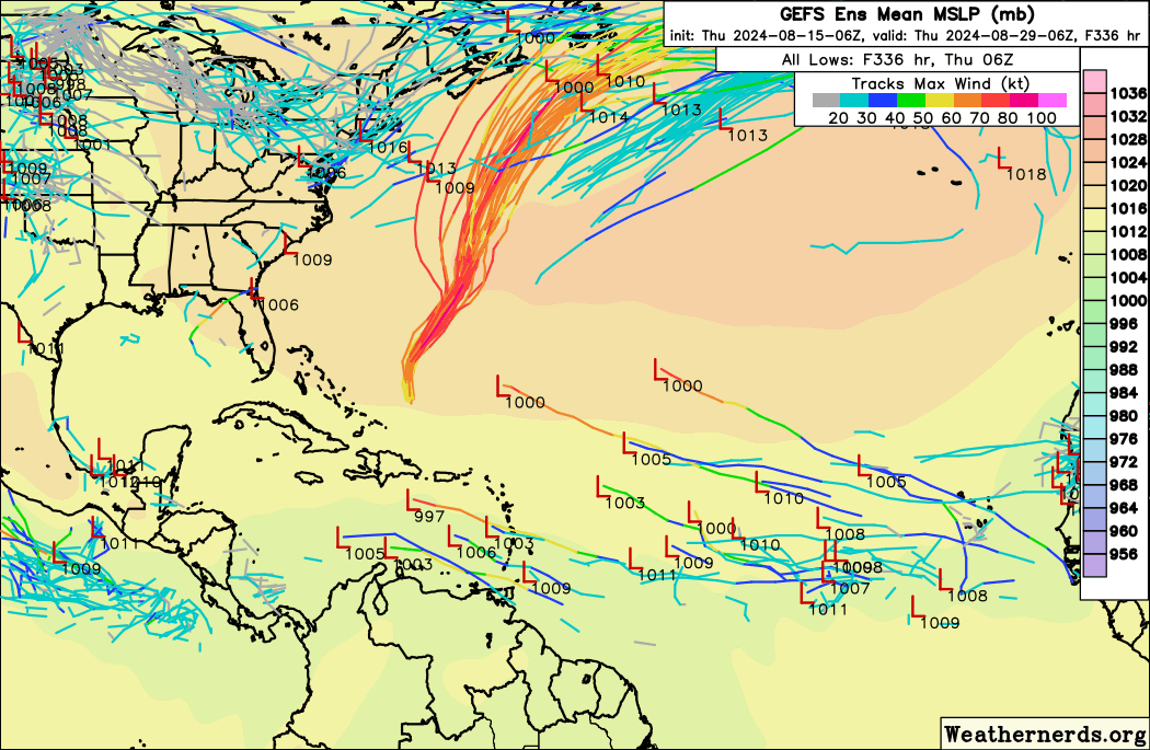
Are they really coming off that far north though? That doesn't look right.
chaser1 wrote:The general public (and fair extent of the media) simply do not understand the concept that Global Models do not have a memory. They are good at picking up strong signals and typically better forecasting with "all of the players on the field". The GFS had forever been solid in sniffing out genesis but with too many false negatives. That is why following the more subtle increase/decrease in the ensembles offers better hints toward an upswing in activity. Even still.... one day the ensembles see nothing, and next model run suddenly picks up the scent. Not much different from hunting dogs bred to hunt. Forecast models are our generations' Weather AI bloodhounds
20+ is certainly not off the table but I look at the math and the idea its difficult to get everything to align for a NS.Steve wrote:toad strangler wrote:Steve wrote:
Gonna take some simultaneous systems to get there. I'm not sure where we are as far as named storm days or hurricane days so far, but CSU called for 120 named storm days and 50 hurricane days. I'm assuming we're roughly 15-20 into NS and probably 5 or 6 into H days. If that assumption is close, there are 108 days until November 30th though we know that most of November won't feature activity (might be one or two ocean systems or in the Caribbean due to the La Nina). We would have 100 named storm days to go which is about a constant system between now and the end of the season adjusted by however many simultaneous storms there are to offset the days without any named storms.
I don't have an opinion one way or the other on this. There are times when bursts bring on 2, 3 or even 4 systems. But there are usually only a couple of these a season that even features those. So it's all a big ? to me until we hit 4-5 weeks from now and see what we are dealing with numbers wise.
As of 03:00 MT this morning .... climatology norm 1991 - 2020 in ()
18.5 NS days (11.9)
6.5 H days (2.2)
42.2 ACE (14.1 AVG)
4.5 MH days (0.4)
Thanks Toad. In other words we ain’t seen nothing yet. Also glad I was somewhat in the ranges and not just typing out of my ***.
MetroMike wrote:According to Yaakov Cantor on X he replied to me saying the EPS has a bias of moving waves too far north off the African coast in the long range forecasts. So that posted graphic from earlier shows said bias.


Hammy wrote:And there it is
https://i.imgur.com/GcB84rF.png
Probably wont be there on the next run, GFS is off and on with this until it gets closer, but we have a low center and a fairly tight, lower-latitude wave at the end of today's run, something that has been completely absent for weeks of model runs
It's the first sign the flip is near
skyline385 wrote:And there's the switch flip coming, just like every year
https://i.imgur.com/gQjTGAq.png

skyline385 wrote:skyline385 wrote:And there's the switch flip coming, just like every year
https://i.imgur.com/gQjTGAq.png
Similar support today
https://i.imgur.com/nLeXsgF.png

Teban54 wrote:skyline385 wrote:skyline385 wrote:And there's the switch flip coming, just like every year
https://i.imgur.com/gQjTGAq.png
Similar support today
https://i.imgur.com/nLeXsgF.png
Give how recurve-happy the EPS has been this year, already seeing members heading west through the Caribbean is
Users browsing this forum: No registered users and 155 guests


